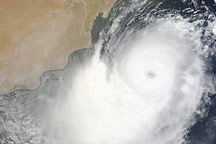
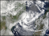
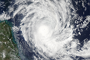
Acquired June 2, 2010, this natural-color image shows Tropical Cyclone Phet off the southeastern coast of Oman.
Published Jun 2, 2010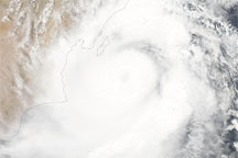
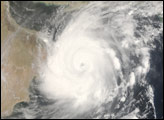
Acquired June 3, 2010, this natural-color image shows Tropical Cyclone Phet spanning most of the coastline of Oman.
Published Jun 3, 2010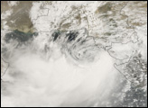
The storm became the third strongest on record for the Arabian Sea, but it was ripped apart by wind shear before reaching land.
Published Nov 2, 2014
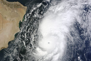
The storm reached the coast of the Arabian Peninsula with maximum winds between 120-130 kilometers per hour.
Published Sep 24, 2019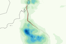
This color-coded image shows the storm track and rainfall amounts for Tropical Cyclone Phet from May 31 to June 6, 2010.
Published Jun 8, 2010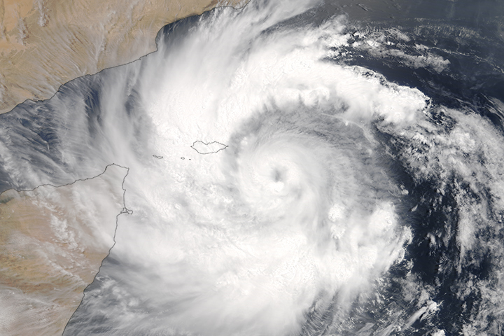
In the span of a week, the region has been hammered by back-to-back tropical cyclones.
Published May 23, 2018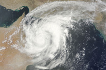
The swirling clouds of Cyclone Phet cover much of northern Oman and all of the Gulf of Oman in this photo-like satellite image from June 4, 2010.
Published Jun 5, 2010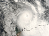
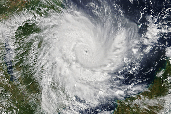
The tropical cyclone quickly intensified over 36 hours to arrive as a category 4 storm.
Published Apr 25, 2019Atmosphere Land Water Severe Storms Human Presence Remote Sensing
At the time of this image, the strengthening storm was headed for northeastern Queensland.
Published Mar 17, 2015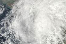
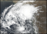
Acquired November 11, 2009, this true-color image shows Tropical Storm Phyan straddling the coastline of India, near the Pakistan border.
Published Nov 11, 2009