
Astronauts use the Sun’s reflection point to reveal features that are otherwise difficult or impossible to see.
Published Dec 1, 2014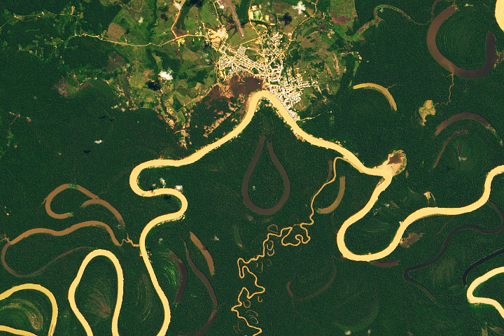
Heavy sediment loads play a role in making it one of the most sinuous rivers in the Amazon Basin.
Published Nov 13, 2019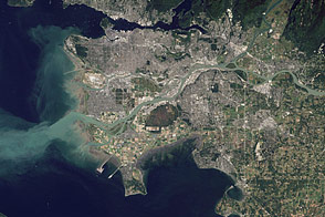
Flowing past the city of Vancouver, the Fraser River delivers a thick plume of sediment to the Strait of Georgia.
Published Mar 14, 2012
As they prepare for a satellite that will measure the height and areal extent of rivers in unprecedented detail, hydrologists have released a better map of North American river widths.
Published Jul 9, 2015
In the past few centuries, a river in northwestern Canada stopped wandering and assumed a more direct route to the sea.
Published Sep 4, 2012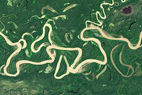
Lowland rivers that carry large volumes of sediment are on the move.
Published Dec 4, 2014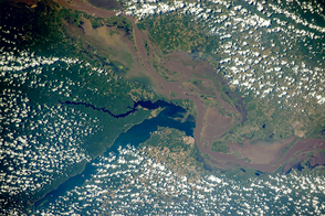
Two rivers meet near the port city of Santarém in the interior of Brazil.
Published Nov 2, 2015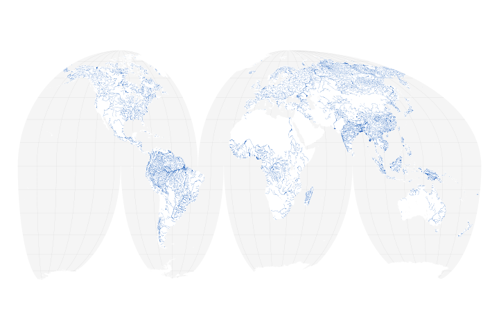
A new map of the world’s rivers and their widths shows that surface waterways are collectively wider and cover more area than previously thought.
Published Jul 18, 2018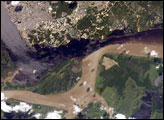
The largest river on the planet, the Amazon, forms from the confluence of the Solimões (the upper Amazon River) and the Negro at the Brazilian city of Manaus in central Amazonas. At the river confluence, the muddy, tan-colored waters of the Solimões meet the “black” water of the Negro River. The unique mixing zone where the waters meet extends downstream through the rainforest for hundreds of kilometers, and is a famous attraction for tourists from all over the world. The tourism contributes to substantial growth in the city of Manaus. Twenty years ago the large park near the city center (center) lay on the eastern outskirts of Manaus.
Published Feb 12, 2005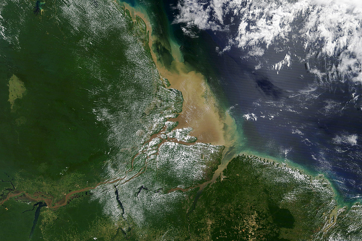
Most of the sediment that flows into the Atlantic Ocean from the mouth of the river comes from thousands of miles upstream.
Published Oct 2, 2020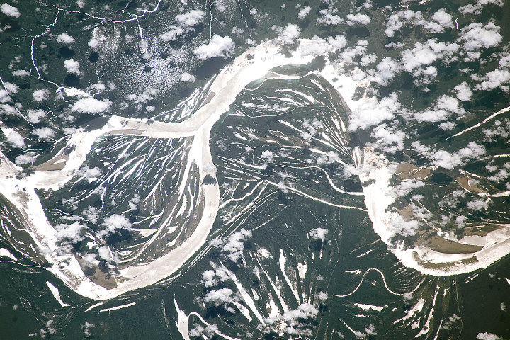
The largest river in the world is full of bends and meanders, a result of the water course snaking back and forth across the landscape over time.
Published Jul 2, 2018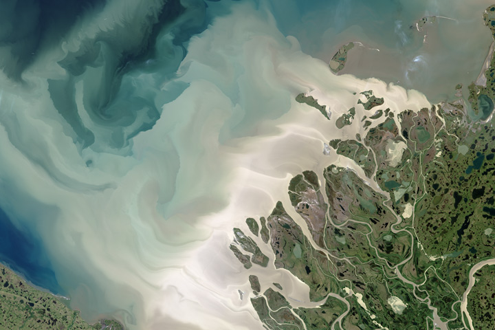
Canada’s largest and longest river delivers vast amounts of fresh water and sediment to the sea.
Published Aug 6, 2017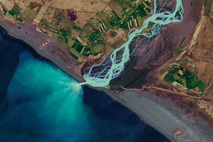
In a country rich with compelling geologic phenomena, even the rivers are connected to the landscape of fire and ice.
Published Aug 6, 2019
Sunlight highlights details around Rio Paraná, Rio Tiete, and Rio Paranapanema.
Published Dec 22, 2019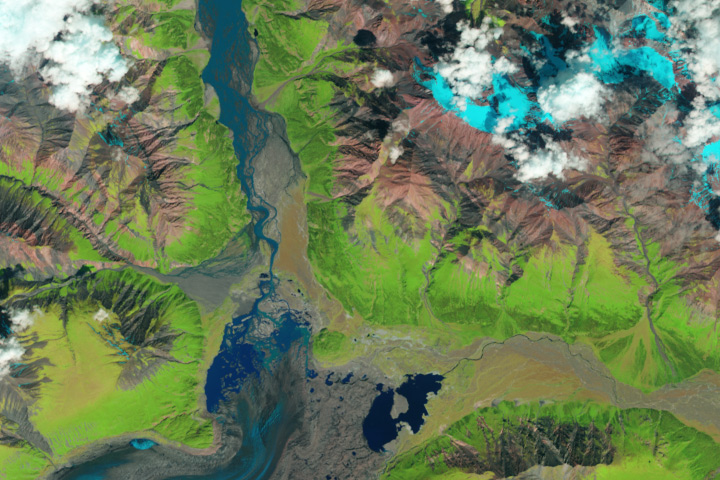
The Kaskawulsh River stole most of the water from the Slims River, dramatically reshaping the region’s drainage.
Published Apr 28, 2017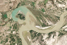
Between 1992 and 2009, a section of the lower Indus River changes course following the formation of an oxbow lake.
Published May 9, 2010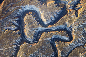
The Green River in eastern Utah once carved soft sediment into meanders on a floodplain. Then the land and mountains rose and the river dug deep, preserving those meanders in stone.
Published Mar 17, 2014
The setting sun glints off the Amazon River and numerous lakes in its floodplain in this astronaut photograph from August 19, 2008. Large areas of sunglint are common in oblique views. Sunglint images reveal great detail in surface water—in this case the marked difference between the smooth outline of the Amazon and the jagged shoreline of the Uatumã River.
Published Sep 8, 2008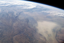
An astronaut photograph shot with a short focal length lens shows a wide swath of central Asia and the Earth’s limb in the distance.
Published Jan 5, 2009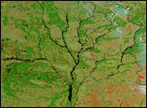
As the ground began to thaw and snow melted, the Dnieper River and its tributaries swelled with spring run-off. According to news reports, the rivers caused some damage as flood waters inundated small cities along their banks. The Moderate Resolution Imaging Spectroradiometer (MODIS) on the Aqua satellite captured this image of the river system on April 4, 2004. Four major rivers are shown running into the Dnieper, the large river that forms the trunk of this tree-like structure. On the far right is the Desna River, with the Seym River branching off of it. The center right branch is formed by the Sozh River and its tributaries. The center left branch is the Dnieper, and running into it from the top left is the Byarezina River. The far left branch is formed by the Prypyats River.
Published Apr 8, 2004
A new dataset reveals interesting patterns about where and why rivers define national borders.
Published Sep 17, 2020
Acquired April 2, 2011, and February 27, 2011, these natural-color images show rising waters on the Kuiseb River, which flowed all the way to the Atlantic Ocean for the first time in decades.
Published Apr 12, 2011
A satellite image offers inky evidence of the organic-rich freshwater that the Suwannee River delivers to the Gulf of Mexico.
Published Oct 27, 2018
This false-color image from April 1, 2002, shows numerous braided channels and oxbow lakes along the Songhua River in northeastern China, just upstream of the city of Harbin.
Published Dec 27, 2005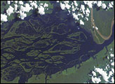
The wide, multi-island zone in the Rio Negro (Black River) shown in this astronaut photograph from September 2, 2006, is one of two, long “archipelagoes” upstream of the city of Manaus (not shown) in central Amazonia. Sixty kilometers of the total 120-kilemeter length of this archipelago appear in this image.
Published Dec 4, 2006