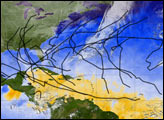
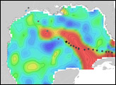
The 2005 Atlantic Hurricane season broke record after record: most named storms, lowest pressure measured in the Atlantic, longest-lived December hurricane, and the list goes on. This image provides a summary of the season, with the track of each named storm marked in black. In all, 30 tropical depressions, tropical storms, and hurricanes formed in 2005. Of these, 26 were named storms, a status given to tropical storms and hurricanes.
Published Dec 17, 2005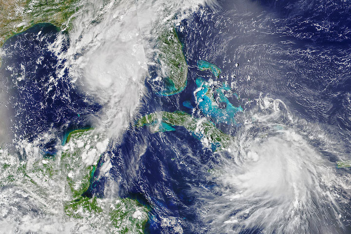
The 2020 Atlantic hurricane season continues to be unusually active.
Published Aug 24, 2020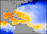
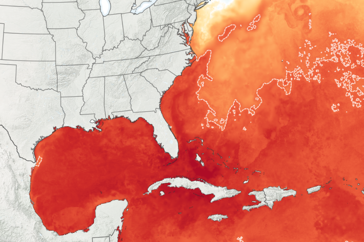
Abnormally warm ocean temperatures and a potential La Niña set the stage for an above-average Atlantic hurricane season.
Published Jul 17, 2020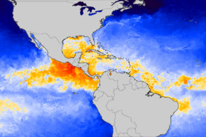
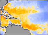
Tropical waters are warm, as usual, but not unusually so.
Published Jun 1, 2012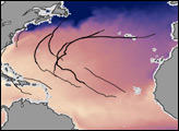
Warm sea surface temperatures help fuel hurricanes, and in 2006, those temperatures were cooler than expected. Why the difference between 2005 and 2006? William Lau of NASA Goddard Space Flight Center and Kyu-Myong Kim of University of Maryland-Baltimore County think the answer comes from the Sahara, namely dust.
Published Apr 18, 2007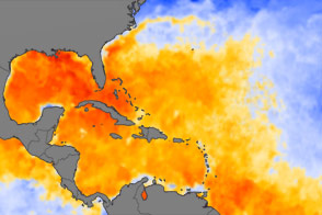
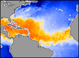
Plenty of warm-water fuel waits in the Atlantic Basin for Hurricane Irene and other tropical storms to build themselves up in August 2011.
Published Aug 25, 2011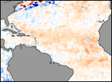
In early August, forecasters at the National Oceanic and Atmospheric Administration (NOAA) revised downward slightly their early-season predictions of the 2006 Atlantic hurricane season.
Published Aug 16, 2006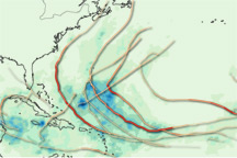
This map provides a summary of the very active 2010 Atlantic hurricane season, showing both the track each storm took and the rain it produced.
Published Dec 3, 2010