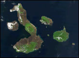
Charles Darwin’s book, The Voyage of the Beagle, cast a spotlight on the Galapagos, which he called “a little world within itself.”
Published Jan 1, 2017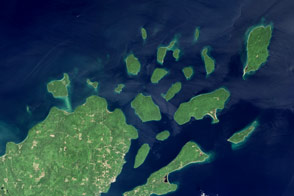
Lighthouses and sandstone formations draw visitors to the shores of Lake Superior.
Published Aug 28, 2016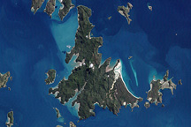
The Whitsunday Islands are a collection of some 74 islands sandwiched between the Australian mainland and the outer atolls of the Great Barrier Reef.
Published Jan 2, 2010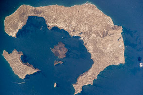
The islands of this tourist mecca are actually the rim of an old volcano.
Published Oct 17, 2016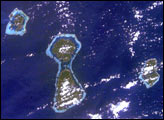
In one frame International Space Station astronauts were able to capture the evolution of fringing reefs to atolls. As with the Hawaiian Islands, these volcanic hot spot islands become progressively older to the northwest. As these islands move away from their magma sources they erode and subside.
Published Feb 16, 2003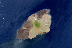
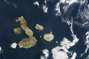
The island is a small but mighty example of compelling Galápagos biology.
Published Jul 21, 2012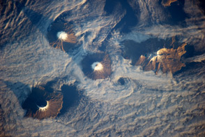
Four volcanoes double as islands in Alaska’s Aleutian chain.
Published Dec 16, 2013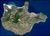
The Aeolian Islands formed from a chain of volcanoes in the Tyrrhenian Sea north of the island of Sicily. Geologists and volcanologists have studied the islands since the eighteenth century, and the United Nations Educational, Scientific, and Cultural Organization (UNESCO) declared them a World Heritage Site in 2000 because of their value to the study of volcanic processes.
Published Sep 1, 2008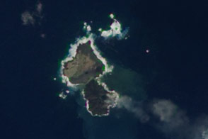
Volcanic activity may soon fuse a newly formed island to its neighbor Nishino-shima.
Published Dec 24, 2013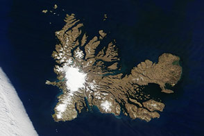
Penguins, seals, and scientists are among the residents of a remote archipelago in the southern Indian Ocean.
Published Dec 28, 2016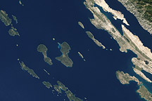
Acquired October 2, 2002, this natural-color image shows islands off the coast of Croatia, in the Adriatic Sea.
Published Apr 17, 2011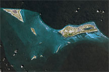
This approximately true-color image shows part of the Turks and Caicos Islands archipelago, observed September 18, 2001.
Published Apr 17, 2009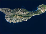
Eight small islands lie off California’s southern coast; on the map they appear situated roughly along a transect line that bypasses Los Angeles and stretches southeastward from Point Conception to San Diego.
Published Jan 27, 2003
Myths about these Australian islands seem to provide an ancient explanation for sea level rise.
Published Dec 27, 2019
The small Puerto Rican island is a natural reserve that has been nicknamed the “Galapagos of the Caribbean.”
Published Feb 28, 2016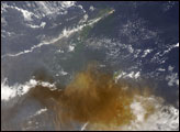
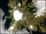
Located in the southern Indian Ocean roughly midway between Africa, Australia, and Antarctica, the Kerguelen Islands experience a fierce climate, with incessant, howling winds and rain or snow nearly every day. At a latitude of about 49 degrees South, the islands lie in the path of the “Furious Fifties,” a belt of westerly winds that whip around the Southern Hemisphere, mostly unimpeded by land.
Published Mar 6, 2007