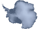
To the untrained eye, Antarctica may look like a giant piece of solid ice that rarely changes, but scientists studying the continent have long known better. The icy surface is dynamic, with glaciers and "streams" of ice flowing toward the ocean.
Published Apr 27, 2007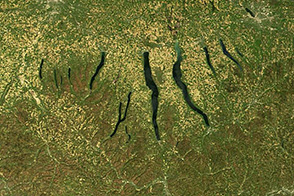
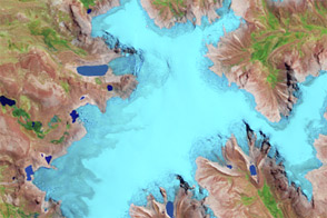
Huge sheets of ice carved out the U-shaped valleys that hold New York’s Finger Lakes. When they retreated north about 10,000 years ago, glaciers left deposits of gravel that dammed streams and caused the depressions to become lakes.
Published Nov 30, 2013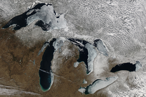
The extent of ice on North America's Great Lakes is past its annual peak, but remains above the average maximum extent.
Published Mar 18, 2015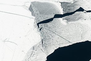
Ice cover surpassed 80 percent for the first time in 20 years.
Published Feb 21, 2014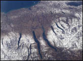
A late fall snowstorm frosted the hills of the Finger Lakes region of central New York in early December, 2004. Shapes of the snow-covered hills are accented by the low Sun angles, and contrast with the darker, finger-shaped lakes filling the region’s valleys. The steep, roughly parallel valleys and hills of the Finger Lakes region were shaped by advancing and retreating ice sheets that were as much as 2 miles deep during the last ice age (2 million years to about 10,000 years ago). River valleys were scoured into deep troughs; many are now filled with lakes. The two largest lakes, Seneca and Cayuga, are so deep that the base of their lakebeds are below sea level.
Published Dec 20, 2004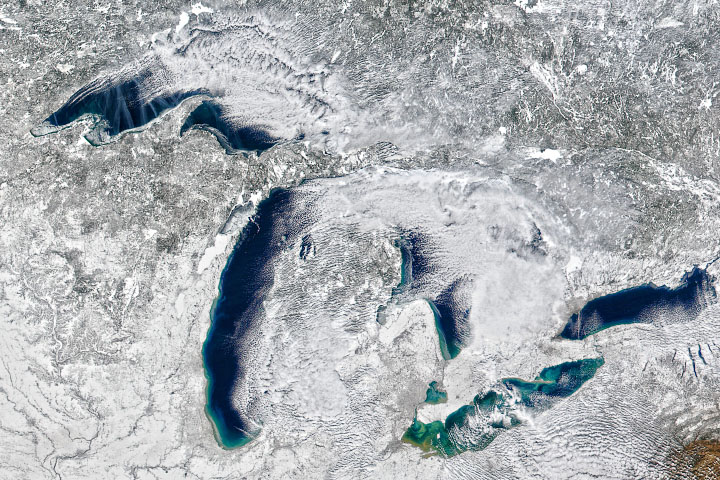
Warm air prevailed in the 2019-2020 winter season, preventing much ice from forming on the lakes.
Published Feb 20, 2020
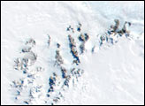
Across the rippling, crevassed whitescape of the East Antarctic Ice Sheet, two unusual shapes appear in this grayscale satellite image of the frozen continent.
Published Feb 4, 2006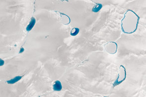
When it comes to the blue hue of meltwater lakes, darker means deeper; satellites can help scientists discover just how deep.
Published Sep 9, 2015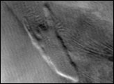
Throughout Antarctica, broad ribbons of ice known as ice streams shed large quantities of ice into the ocean.
Published Apr 24, 2007
Perched high in the Andes, Peru’s Quelccaya Ice Cap stores centuries of climate change history in its ice. Its melting edges tell a more immediate climate story.
Published May 8, 2013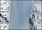
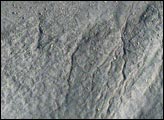
The Byrd Glacier plunges through a deep, 15-mile-wide valley in the Transatlantic Mountains to create a 100-mile-long, rock-floored ice stream.
Published Apr 1, 2007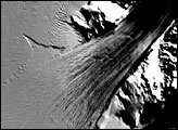
Named after American Antarctic explorer Richard E. Byrd, West Antarctica’s Byrd Glacier flows through a deep valley in the Transantarctic Mountains, covering a distance of 180 kilometers (112 miles) and descending more than 1,300 meters (4,300 feet) as it flows into the Ross Ice Shelf.
Published Jan 19, 2006