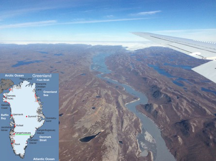
I have always wanted to visit Greenland, the “ground zero” for climate change. Its ice cap rises more than 3,200 meters (2 miles!) above sea level and it holds so much ice that if it all melted, the height of sea level would rise by 7 meters (23 feet). The landscape is stark and inhospitable for most plants and animals. Greenland’s location makes it very sensitive to climate change, and it has a dynamic geological history as a result. It is undergoing rapid change now, as shown in the chart below. Greenland is “ground zero” for climate change.
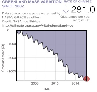
The loss of ice mass by the Greenland Ice Sheet from 2002 to 2015, measured by NASA’s Gravity Recovery and Climate Experiment (GRACE) and by the DC8 in NASA’s Operation IceBridge. Each gigaton of ice lost adds about 1 cubic kilometer of water to the oceans. The ice sheet has lost significant mass every year since measurements began in 2002.
For our flight to Greenland, the DC8 took off from Lajes air base in the Açores and headed directly to the ice sheet, traversing its length along the western edge. Our destination was the Canadian scientific base at Eureka (80o N), off the northern coast on Ellesmere Island’s Fosheim Peninsula. Instruments at this station record the total amount of greenhouse gases and pollutants between the Earth’s surface and the Sun. Our goal was to measure these gases at each altitude in the atmosphere, in order to check the accuracy of these data. We would then head south and land at Kangerlussuaq, on Greenland’s west coast.
The ice cap was mostly covered in clouds until we reached the northern part of Greenland. When we saw the ice surface, it showed many dark features, including melt ponds and dark hills, especially at the edge of the ice sheet.
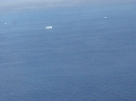
A lonely iceberg floats off the eastern coast of Ellesmere Island, Canada. Satellite data show that areas around Ellesmere Island that formerly retained floating ice all year round are now ice free, like the waters in this image.
While flying over Ellesmere Island, I snapped a photo that dramatically illustrates how dark surfaces put heat into the atmosphere. The picture shows currents of air being warmed by dark, ice-free rock, rising up along the slopes of small hills and producing the little cloud right at the top of each one. This is the way that heat absorbed by the rocky surface is distributed throughout the lowest layer of the atmosphere.
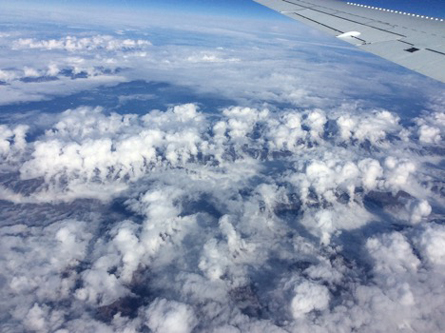
The rocky hills of Ellesmere Island absorb energy from sunlight and from heat radiated by the atmosphere (“longwave radiation”). This unusual photo shows the warm, dark rocky surface heating the air, causing warm plumes to rise and forming small cloud caps over each hill. The process efficiently transfers heat from the surface to the atmosphere (Photo: Steve Wofsy).
When we flew out over the sea, we could see that the waters off shore were almost completely free of ice. Occasionally we saw a few icebergs, or small amounts of ice near shore, but otherwise we saw very little floating ice.
The floating ice in the Arctic does not store a great mass of water like the Greenland’s land-based ice sheet, but it does have a very strong influence on regional climate. When the ATom mission started in early August, we flew over the Beaufort Sea north of Alaska, up to 80oN, and saw ice floes covered with dark melt ponds and interspersed with dark areas of open water. Ice started to break up in this area especially early this year, and with all that dark water absorbing heat from the sun and from the atmosphere, I wondered if most of the Beaufort Sea might become ice free by summer’s end. Now we were back!
Satellite data show that the Arctic Ocean did not lose all of its ice. But the Beaufort Sea did lose its floating ice, as far north as 75o N, and 30 to 70% was lost at 80oN. Water temperatures became quite warm off the Arctic coast of Alaska, maybe just about swimmable for a New Englander like me (5 – 10 C, 40 – 50 F). This large expanse of warm water will tend to make the fall season warmer and provide more snowfall in the Arctic than in former times, when the ice persisted more extensively on the ocean surface. The loss of floating ice amplifies itself, a process called “positive feedback.” As open water and melt ponds cover more area, the ice and surrounding water absorb more energy, leading to more ice loss, more energy absorbed, etc.
This year the overall loss of floating ice was among the greatest ever observed, although it did not quite match the record set in 2012. Indeed, as we were flying over Ellesmere, the large luxury cruise ship Crystal Serenity was reportedly starting the first crossing of the fabled Northwest Passage by a ship of its type, with 1000 paying passengers.
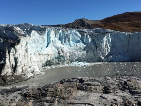
I also photographed the calving edge of a huge tidewater glacier, where huge pieces of ice (bigger than a football field, weighing 1 million tons or more) break off the glacier and drop into the sea. In this picture, you can see how dark the surface of the glacier has become as it travels to the sea, in contrast to the clean blue ice below. The darkening accelerates the melting of the glacier; it is due to deposition of some of the pollutants (soot) that we measure, and also to algae that grow on the ice. Scientists don’t yet know how much of this dark material is “natural” versus human-caused, and they are studying the ice to understand how much darkening is caused by deposition in the form of soot from fires or by pollution-related nutrients that stimulate the growth of algae.
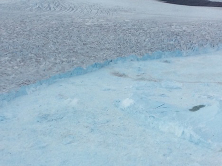
The end of the line: calving front of a tidewater glacier in western Greenland. As ice flows down from the Greenland ice cap to the sea, the surface darkens due to deposition of atmospheric pollutants and growth of algae. The picture shows the boundary where the moving glacier enters the ocean. Huge pieces of ice break off (“calving”) the leading edge and drop into the water—the origin of icebergs. (Photo: Steve Wofsy)
After flying over Eureka and the west coast of Greenland, we landed in Kangerlussuaq, just a short distance south of the Arctic Circle. The area around Kangerlussuaq is stark and beautiful. The town is very reminiscent of many communities across the Arctic. It lies in the midst of a deglaciated area of bare rock mountains and a thin layer of tundra, in a lovely fjord. The river roars like a freight train as it goes under the bridge, carrying meltwater from the ice cap to the sea. The weather was very warm and dry. My afternoon run was interrupted by an encounter with a musk ox. The Sunday dinner at the Boat Club may have been the best of my month long trip around the world, featuring at least eight types of smoked or cured fish. This country is really breathtaking. But it was also a rather sad place, very, very quiet, with dozens of buildings left empty after the closing of the extensive military facilities when the Cold War ended, and the summer had been much warmer than average, drying up soils and plants.
After two days in Kangerlussuaq, we set out for home across Arctic Canada, arriving for a brief overnight in Minneapolis. We stayed at a hotel just across the road from the Mall of America, a vast place with reportedly 30-40 million visitors per year. The contrast with Kangerlussuaq was very dramatic—scenery, culture, sounds, smells, climate, air quality.
This transition was in many ways so typical of the ATom experience, and ATom science. We went from the high desert, with its fires and searing heat, directly to the floating ice near the North Pole, then Hawaii and American Samoa in the subtropics, then suddenly to winter in New Zealand and Chile, back to the subtropics on Ascension Island and the Açores (Portugal), and then again to a land of ice caps and glaciers in Greenland – all in the space of three weeks.
We measured the chemicals in the atmosphere, from bottom to top and along the whole route, and all in the space of just over three weeks. We saw some stunningly dirty air even in the middle of the ocean, in the subtropics and in the Arctic, with a lot of pollution coming from biomass fires, and also some very clean air. Our instruments are extremely sensitive, though, and in even the remote region of the Antarctic polar vortex, we appear to have detected traces of pollution.
After traveling on the DC8 across both the Atlantic and the Pacific, the world seemed smaller than ever before, and the atmosphere, not at all infinite or inexhaustible.
The goal of ATom is to learn about how the most remote parts of the atmosphere are affected by pollutants emitted on land. We have a lot to work with! It will take months to analyze our data and really understand what we have measured, and to assess what we have learned about humanity’s impact on air quality and climate. We also have a lot of memories and impressions (and some sleep to catch up on). I know it will take me months, or years, to fully process what I have experienced and, along with the wonderful ATom team, to extract the quantitative scientific information we need to understand the environment.
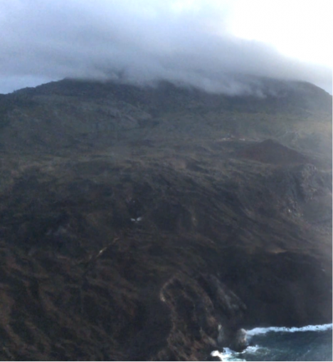
This image shows a deglaciated region in western Greenland, with the ice cap in the background. (Inset: Map of Greenland, showing location of our landing site at Kangerlussuaq at 67o N, 50.7 W). According to Richard Alley of Penn State University, this area around Kangerlussuaq was deglaciated at the end of the last ice age, 8-10,000 years ago, but ice returned and scraped the ridges bare during the Little Ice Age, a period between about 1300 and 1870 AD during which Europe and North America had colder winters than in the 20th century.
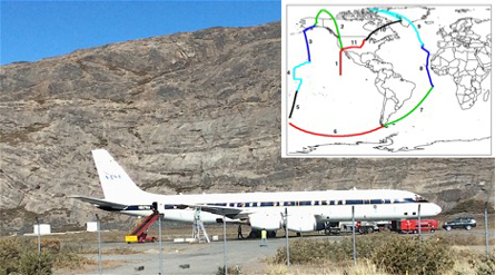
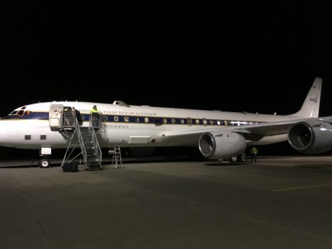
The NASA DC8 Flying Laboratory in Kangerlussuaq, Greenland. Inset: Our flight paths during ATom-1. We overnighted in 11 different time zones at 10 sites (one clock shift) in 23 days, covering 65,000 km (40,500 mi, equal to 1.6 times around the earth). We made 160 vertical soundings, and measured more than 300 chemical and aerosol parameters.
As we prepare for our last flight in ATom-1, I’ve been reflecting on what I should do differently next time around as we begin preparation for ATom-2, which will start uploading in December 2016 for flights starting in January 2017.
I’m a bit of a girly girl who likes her comforts. But after hauling bags for miles as we get on and off the aircraft, I’m seriously considering becoming a minimalist! The weight of the instrument laptop seems to have increased as the project has gone on, so what I consider “essential” for each stop has been streamlined to a very short list! Washing clothes has also proved easier than I thought so I could have managed with less clothes (I can’t believe I’m admitting that!) but I did wear everything I brought at some stage so nothing was a waste of space. In fact, the list of things I wish I had brought is quite short: my hiking boots! I had assumed that taking off from and landing into warm areas meant I could wear light clothes – which was true (to a point). While on each flight, I ended up wearing my thermal vest, long johns, jeans, and my ski jacket as the aircraft is so cold. My toes were particularly cold by the end of each flight! With the ATom-2 happening in Northern Hemisphere winter, we are still trying to figure out if we can borrow suitable clothes to wear when we arrive in Alaska and Greenland. But, as I’m barely 5 feet tall, with child size feet, I’ll probably end up needing to bring my own gear anyway, so maybe my snow boots can work as my aircraft slippers next time?
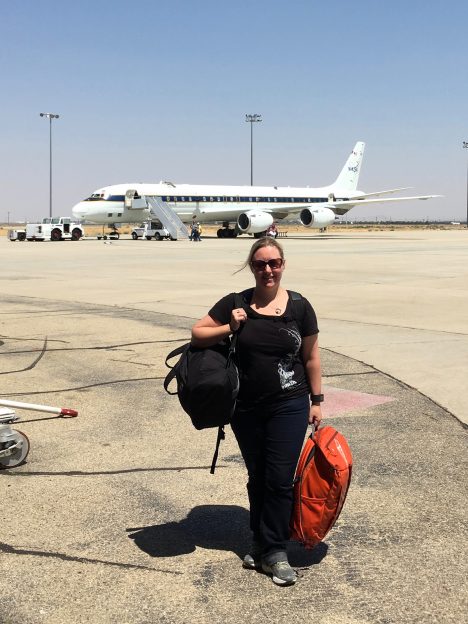
Róisín Commane hauling her bags off the DC8 for the final time on Atom-1.
It’s really easy for me to put on weight during projects like ATom. So I’ve been trying to eat small portions of healthy food, as well as be active on days we don’t fly. My running is slower than some people’s walking but at least it’s something! For lunch on the aircraft, I have mostly eaten ham and cheese sandwiches, with some peanut butter sandwiches when we couldn’t get meat and cheese. My lunches have been functional but uninspiring. And then Shuka Schwartz wanders by with the most amazing smelling food and I get food envy! I’m still trying to figure out how he makes such good lunches. I’m open to suggestions on this as I’m not a particularly inventive chef. Maybe we can bring a few more ingredients to help construct more imaginative lunches. Or maybe I’ll just start ordering extra at dinner the night before a flight for lack of better options.
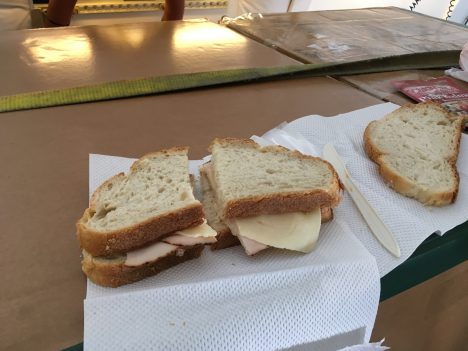
Not the most inspiring lunch… Photo by Róisín Commane
We knew internet access would be difficult in some locations but it turned out to work quite well in most locations in the Pacific. I think this gave me a false sense of confidence in internet infrastructure and I didn’t arrange to not contact people while in the Atlantic. The internet was down while we were on Ascension Island, but I did manage to send a text, from the one working phone, telling my family I arrived safely. Internet access was really expensive in Kangerlussuaq, but I have to admit that I was happy to have a break from answering emails for a few days – and I don’t think I was the only one! I think I will just plan on a complete contact black out for those locations next time so my family is not concerned.
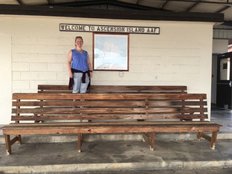
Róisín in Ascension Island.
This is the first time I’ve been involved in where I’m one of the ‘media people’. Like most people, I’m used to taking photos (to show my family and friends) but videos have proved to be more useful to the NASA media reps. They are doing are doing a wonderful job given how little I’m giving them to work with! We’ve also done some discussion of the science on video. It took a lot of encouragement, but I have started to not worry too much about how awful I think I look on camera or how weird my voice sounds. Instead, I’m just not looking at it 😉
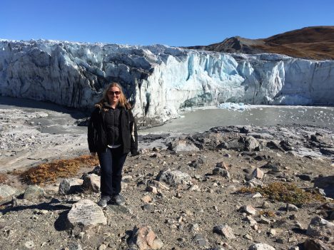
Róisín Commane at Russel Glacier, Greenland.
As part of doing the media outreach I’ve been asking the ATom scientists and crew to think of their favorite ATom memory. Most people have great memories of places and events. I will always remember the strikingly blue melt ponds on the Greenland ice sheet and how little sea ice there was north of Alaska. But I think my favorite memory from ATom will be the people. We’ve travelled around the world on an aircraft with 42 people on board: some people left us in Christchurch while more arrived to join the adventure. In such close quarters, I was aware that little things could have mushroomed into major conflicts. But people worked really well together. Friendships were formed and the science benefited greatly from a fantastic team effort. In particular, we owe a huge thank you to the crew of the DC-8 who brought us safely around the world and made all the measurements possible.
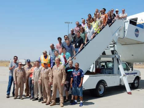
ATom Scientists and crew are happy to be home! Photo by Michael Prather.
ATom-1, the first of four ATom deployments over the next few years, is about to wind down. We’ve covered over 60,000 km and flown all the way around the world, but unlike the Jules Verne classic, it took us only 24 days (and not 80) to make it back to Palmdale, California. I managed not to get sick (or break any bones, which is an achievement if you know me!), despite the nearly 100 flight hours and lots of sleep deprivation.
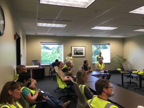
Tired ATom scientists at our final pre-flight briefing. Photo by Róisín Commane
I have found the second half of the ATom-1 deployment a lot more challenging than the first half. Some of the challenge was the constant changing of location and lack of routine outside of the aircraft. It has gotten to the stage that I might not know what city I’m in, what day it is or what the local time is, but I can get the instrument ready to measure. That’s both comforting and a little disturbing!
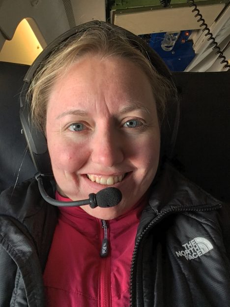
Róisín Commane trying to stay warm on the final ATom flight. Photo by Róisín Commane
Some of the challenge was the fatigue brought on by the long length of working days on the aircraft and time changes, the effects of which I didn’t fully appreciate beforehand. On a typical flight day we wake up at 3 a.m. to shower and pack our bags, we start preparing the instrument for the flight at 4 a.m., we take off at 7 a.m., fly and measure for 10 hours, and land at 5 p.m. if we don’t change time zones. As we constantly fly to a new location, it then takes another hour or two to get off the aircraft and to the hotel. With such a long flight day, all I’m able to do after a flight is fall into bed – ideally after finding some food!
Preparing to leave Punta Arenas, Chile in the dark. Photo by Róisín Commane
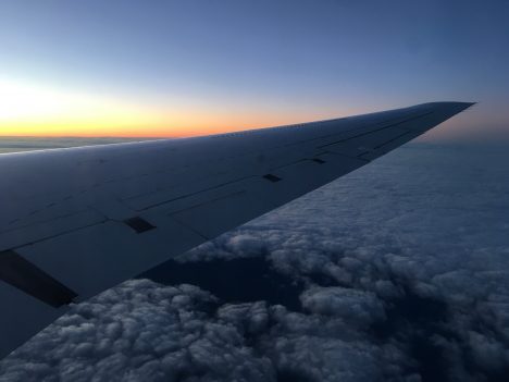
Flying into the sunrise. Photo by Róisín Commane
Flying east was a lot harder than flying west and to help this I think we are planning an extra day in Punta Arenas, Chile for ATom-2. We needed more than a day to get back on track after an 8 hour time change. It was winter in Punta Arenas this time so it was a little too cold to spend long in the sunshine (to encourage my sleep cycle to normalize). But in February, it will be southern hemisphere summer and being outside will be much easier. And hopefully I will fulfill a long-time ambition and see a penguin in the wild next time too! And not just a black and white cormorant that looks like a penguin!
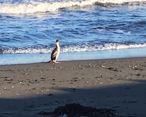
A cormorant on the beach in Punta Arenas, Chile. Hopefully next time I’ll see a penguin! Photo by Róisín Commane
As the first phase of the ATom project draws to a close, I am still surprised at just how far the influence of land, and fires in particular, can travel through the atmosphere.
Most of the time, the influence of land (and pollution that people generate) can only be seen a few miles from shore. When flying south into Alaska from the Arctic ocean, we saw the tell-tale chemicals of land influence about three miles offshore; uptake by plants reduced the amount of carbon dioxide (CO2) and increased the methane from emission from wetlands. Flying from James’ Bay in over the Hudson Bay Lowlands, we saw an even larger increase in methane a mile offshore than we saw in Alaska. I should not have been surprised, because Hudson Bay Lowlands are the largest source of natural methane in North America.
The Hudson Bay Lowlands in Canada are a large source of methane. Photo by Róisín Commane
But in other places we also saw pollution thousands of miles from shore, in amongst some of the cleanest air in the world. In fact, some layers of pollution were so concentrated that we could see them by just looking out the window. In the photo below you can see a brown/pink layer of pollution that we found hundreds of miles from land as it cuts through the beautiful blue sky and ocean below. In layers like this, CO, other pollution related gases and particles like black carbon will be pretty high. We saw pollution from Asia transported out over the Pacific ocean and pollution from the U.S. over the Atlantic ocean.
Pollution layers over the Pacific ocean. Photo by Róisín Commane
I’ve learned that pollution can be transported anywhere. The amount of pollution in the Arctic was especially stark. In Greenland we could see the black layers forming on the top of the ice sheet as pollution from far away gets transported to the arctic and deposits on the ice. The black layers absorb more heat than clean ice leading to increased melting at the top of the ice sheet, which forms deceptively beautiful melt ponds on the ice sheet. We met researchers from the UK “Black and Bloom” project (@BlackandBloom) in Kangarlussuaq and heard how some of this black layer can be composed of algae, which will also enhance warming and melting.
Russel Glacier near Kangerlussuaq, Greenland. Photo by Róisín Commane
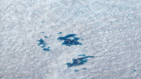
Bright blue melt ponds on the Greenland Ice Sheet. Photo by Róisín Commane
However, not all pollution is man-made in the typical sense. In the Arctic regions north of Alaska and Greenland, which we sampled almost three weeks apart, we saw the high carbon monoxide (CO) given off by the fires in Siberia. Fires in this area are a part of the natural cycle, but as temperatures have been rising in the Arctic, the frequency and magnitude of big fires like these have increased. In Alaska last year, over five million acres burned. In Canada the year before 11 million acres burned. These regions have carbon rich soils similar to dry peat bogs, that often continue to smolder and incompletely burn long after the hot temperatures of the main burn. Lower temperatures and incomplete burning leads to the release of more CO, soot and other pollutants than for a hot, completely burning fire.
The arctic regions are not the only place we see the influence of very distant fires. We sampled air from fires burning in Africa as we came into land in Ascension Island. As the Island is 1,000 miles from any continent, I was really surprised that the high CO could survive that journey! CO has a lifetime of about a month in the troposphere, and some of the other chemicals are much shorter, so the air has to travel to remote islands like Ascension fairly quickly.
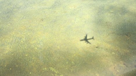
I’m often a little torn by seeing layers of high pollution in the remote atmosphere. While it’s exciting to see high numbers on our instruments, it’s really disappointing to think that the places we think of as pristine see so much human influence. But any time I get a little down, nature has a way of cheering me up: such as when the sun and clouds combine to create a glory around our aircraft. You can tell from where the glory is centered that I was sitting just behind the starboard (right) wing of the aircraft as we ascended through the cloud layer. A glory forms around an aircraft when there are clouds (or water) in the air and the sun is directly behind the aircraft.
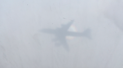
The shadow of the DC-8 on clouds below, haloed by a “glory”. Róisín Commane
The ATom mission is the first to traverse the whole lengths of the Atlantic and Pacific Oceans while making atmospheric measurements from the ocean surface to high altitudes. When we planned ATom, one idea was to compare pollution impacts between the oceans. I expected that human activities would have much greater influence in the Atlantic, because it is smaller than the Pacific and it receives industrial emissions from both sides – the U.S. on the west and Europe to the east. The big emissions from Asia appear to go north to the Arctic, mostly bypassing the Pacific.
Already, our measurements have shown me that our notions did not always match reality. The North Pacific was full of pollutants from Asia, but not from industry as we might have expected—they came mostly from forest fires in the Arctic. Near the coast of California, we did see industrial pollution, but even there, the impact from the large forest and brush fires raging through the Western U.S. this summer was much greater.
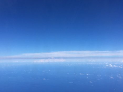
So we departed New Zealand and flew to Punta Arenas, Chile, across the tempests of the Southern Ocean off of Antarctica. We found the cleanest air we encountered anywhere, although even there, we could detect very faint traces of soot and other combustion products. It was windy, snowy and cold in Punta Arenas.
Crisp air had arrived from Antarctica, by the time we embarked two days later for the Atlantic. It was just as clean as it looked.
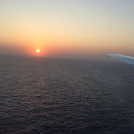
Crisp, clean sunrise seen from 500 ft over the South Atlantic east of Argentina. Photo: NASA DC-8 forward camera.
We headed from Punta Arenas to Ascension Island, a small, isolated, mostly barren volcanic protrusion emerging from the very center of the Atlantic at the Mid-Atlantic ridge, where the ocean basin is created, 12 degrees south of the Equator. It is extremely remote, more than 1000 miles from the nearest land.
Ascension Island, our destination in the middle of the tropical South Atlantic. Photo: Steven Wofsy
An hour or so after leaving Chile, we crossed the frontal region of stormy weather that separates the wintry middle latitudes from the subtropics and tropics in the south Atlantic—the southern polar jet stream. Air quality started to deteriorate immediately after we had crossed the jet stream, and pollution got stronger and stronger as we approached Ascension. By the time we arrived there, smoke and haze were so thick we could not see the surface of the ocean looking down from above. Here we were — actually dead center in the middle of the ocean — and pollutants from brush and forest fires in Africa were as heavy, or heavier, than the smoke and haze we encountered when we started out in Palmdale, California, where there was a large brush fire nearby and the City of Los Angeles just upwind!
Dense smoke and haze obscure the sunset as we approach Ascension Island, in the center of the tropical Atlantic Ocean. Compare this image with the sunrise that we observed on departing Chile! Photo: Steven Wofsy
I was not surprised to find pollution at Ascension, its presence had, once again, been forecast by our modelers, Junhua Liu and Sarah Strode from Goddard Space Flight Center. But I was stunned at how dense and extensive this pall of haze and noxious gas was. We found quite a bit more than what the models predicted. No wonder we had earlier seen African pollution way out in the Pacific, 3/4 of the world away from the source!
We had wonderful hospitality from the U.S. airbase on Ascension, but this part of the trip was really discouraging. The rocky little island was inhabited by all manner of invasive species—plants, rodents, feral livestock, etc. The accommodations were spartan, and we were mostly cut off from communications with the outside world. The air that we came to study was a mess. We had traversed 12 time zones in a few days, so our bodies wanted to sleep when we needed to be awake and vice versa.
We were thankful to our gracious hosts, but ready to move on to our next destination, Lajes Airfield on Ihla de Terceira in Portugal’s Açore Islands. On this leg of our trip, we crossed the Intertropical Convergence Zone once again. On the north side, there was still a lot of pollution from African biomass fires and a good dose of Saharan dust, too.
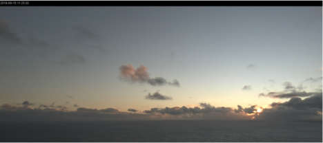
We arrived at Lajes just after a storm had passed through, putting us in air from middle latitudes. The air was much cleaner. We stayed at a quiet town, Praia da Vitoria-Santa Cruz, on Ihla Terceira, with comfortable lodgings and excellent restaurants that emphasized local seafood and produce. It reminded me of the fresh-as-ever cuisine of Provence, France. I slept a lot, and enjoyed the place thoroughly.
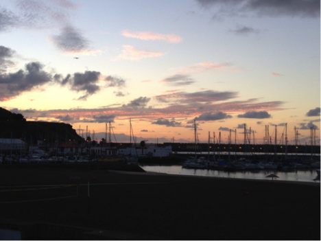
Praia da Vitoria-Santa Cruz, Ihla Terceira, Açores, Portugal, at sunrise. Photo: Steven Wofsy
But I admit to having had a feeling of unease. The atmosphere over the Atlantic was far more polluted than I had imagined, and a large fraction of the whole ocean was being affected.
Nevertheless, I came away refreshed and invigorated after two days in the Açores, and I think the whole crew felt renewed and eager for the final legs of our journey—on to Greenland, ground zero for climate change.
