To accomplish the science goals of ATom, every scientific instrument on the NASA DC-8 is tenderly cared for. In the case of the Single Particle Soot Photometer (SP2) an instrument for quantifying black carbon aerosol concentration, this care includes gentle heating after cold nights, frequent laser intensity calibrations, and renewal of drying agents used to produce conditioned air to keep laser components clean.
However, as in those occasions in which the instruments fail in one way or another, the most important component is not mechanical or electrical, but rather biological; the caretakers themselves need some coddling to ensure that they (we… I!) can think clearly and effectively when “push comes to shove”. During the ATom flights from Christchurch, New Zealand to Punta Arenas, Chile, and from Chile to Ascension Island, we traveled over 12 time zones in short order; long, warm showers and extra naps seemed to be the popular prescriptions to deal with this stress.
I highly recommend more regular maintenance during flights, in the form of carefully thought out meals. These provide not only calories, but also a welcome break from the potential monotony of the ATom flights; for black carbon, most of the excitement lies not in the second-to-second observation of the data stream, but rather in the global-scale trends in concentrations that we can extract from the measurements only after careful quality controlling and data analysis. Many on the DC-8 simply buy a fast-food sandwich before each flight (if departure times allow) and eat at their seats. I prefer to use the whole of the aircraft as kitchen and dining parlor.
Let’s take a look at the facilities: the DC-8 is equipped with a coffee machine (with hot water tap), a microwave (so old!), a hodgepodge of communal condiments and utensils, and a cooler stocked with water.
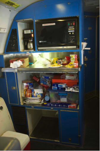
The DC-8 mess. Credit: Joshua Schwarz
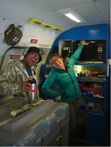
The mess in action: Matt Berry (Mission Director) and Stacy Hughes (Whole-air sampling princess), bringing life to the rear cabin. Stacy is testing a new application of the microwave: to warm her hands because the flight was brutally cold. I think she was heating a New Zealand meat pie as her meal. Credit: Joshua Schwarz
In my experience, there are three foundational elements to a successful research-aircraft dining experience:
The first is fairly easy to achieve: quantity, quantity, quantity. All you need is plenty of candy. Now, flying to Ascension Island, I have a Chilean-version Kit Kat, Nutty Bars (a terrific ace in the hole, which I stocked up on in the U.S. before the mission began), NZ potato chips, apples, prunes (yum!), Crunchie bars, Crispy Rolls (from Chile, these appear to be chocolate-covered corn flakes), Sabor frambuesa batido (raspberry yogurt from Chile), a bag of pimiento olives, and a “sahne-nuss” chocolate nut bar, hummus, and carrots.
These are stashed on the floor between the SP2 rack and the wall, where a chilly breeze keeps everything refrigerated. Of course sweet drinks (hot chocolate and chocolate milk rate high, orange juice is a refined alternative, regional specialties are always worth trying (except for “L&P”, the exception to the rule, popular in New Zealand, but probably inspired by a marriage of Pinesol and simple syrup. Ugh!). This could be a little light for today’s 9 ½ hour trek, but extra treats from the rest of the ensemble can usually be begged. And one can always hope for unexpected treats – on the last flight Jim Elkins (NOAA) passed out macademia nuts; I remember a different mission where we celebrated crossing the equator with cookies.
The scale to a achieve a meisterwerk slides depending on many factors: the availability of foodstuffs at the departure airport (I remember leaving Easter Island with only ramen noodles); the quality of the rest of the crew’s meals (competition is growing more fierce); flight conditions (turbulence quickly narrows the range of possibilities – soups are OUT!); and one’s own standards for a fine dining experience.
My standards are happily very low in this regard. On the flight out of New Zealand, my magnum opus was nachos made with New Zealand tortilla chips (yellow corn, meh), hand cut cheese in the microwave (Colby, quite good), topped with Frank’s Original Hot sauce (one of my contributions to the kitty), and adorned with pureed avocado (the fresh avos in Christchurch were all rock hard). In the old days, simply bringing a frozen Indian meal (I’m a tikka masala man) was sufficient to set the bar. I do have plans to perfume a pig, and hope to extend a ramen soup with a fresh egg, cheese, and sesame oil. I considered making ceviche, but decided against the risking a fishy-smelling cabin for the rest of the mission.
To ensure that your meal is appropriately obvious to the others on the plane, I recommend a highly scented hot meal marched up and down the aisle as you eat. On the New Zealand flight, I used a “hot scotch toffee cake” to spread a warm glow of sweetness through the cabin. Leadership by example, I say! Let’s not let these hard-thinking scientists forget to keep every tool in their chest oiled and ready for use in the service of science, society, and high altitude gastronomy.
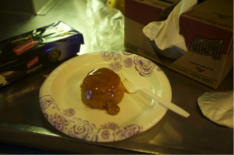
The “meisterwerk” hot scotch toffee cake. Credit: Joshua Schwarz
Joshua “Shuka” Schwarz is part of Chemical Sciences Division at NOAA and is investigating black carbon throughout the atmosphere.
As the DC-8 flies around the world for the ATom project, we are crossing many time zones and occasionally loosing and gaining days! For most of the first half of the project, I didn’t really notice these time changes. I gained the most time leaving Boston for California and had one to two hourly stretches in the evening after that. This has meant that getting up for 4 a.m. pre-flights has actually been do-able! I thought I was doing great — for a night owl. We lost time last week when flying from American Samoa on Monday morning and arriving into New Zealand on Tuesday afternoon. But I had already lost track of the day of the week so that didn’t really have any impact on my routine. In New Zealand, I finally had the time to take a whole day off (for the first time in over 2 weeks!) so we explored Aoraki/Mt. Cook National Park for a few hours.
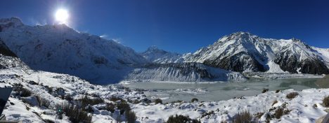
Snow blowing from the mountains onto the glacier in Aoraki/Mount Cook National Park, New Zealand. Credit: Róisín Commane
And then there was the flight from Christchurch, New Zealand to Punta Arenas, Chile.
We gained back the lost day and more as we flew 10 hours from Christchurch on Saturday morning to arrive in Chile at 4 a.m. on Saturday morning. My poor body clock has no idea which way is up! On the plus side, maybe this body clock mayhem will make the 3:30 a.m. wake up call for our pre-flight tomorrow slightly less ruthless? Wishful thinking perhaps.
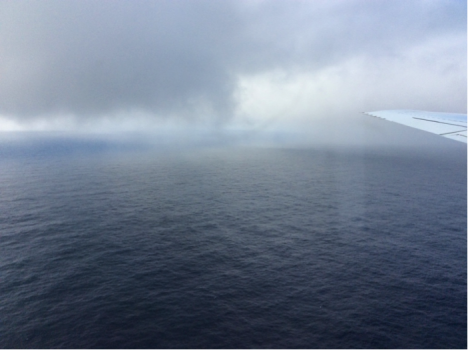
But at least the flight from New Zealand was worth all the effort! We flew south from New Zealand to 65 degrees S, profiling from the top to the bottom of the atmosphere as much as we could. We saw Antarctic sea ice, lots of sea salt particles and not at lot of CO at the low altitudes, while at the highest altitudes we saw the Polar vortex and its -70 degrees C temperatures. We also saw CO2 over 401 parts per million (ppm) for most of the flight.
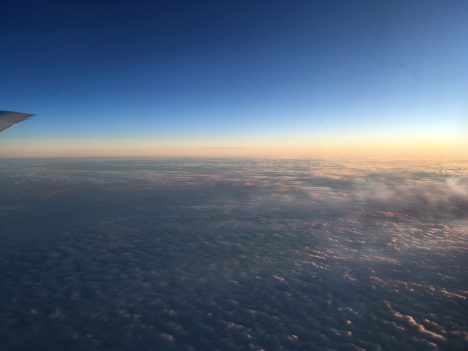
Watching the sun set mid-way through our flight from New Zealand to Punta Arenas, Chile. Credit: Róisín Commane
There is a wonderful exhibit in our hotel here in Punta Arenas about Shackleton’s Trans-Antarctic Expedition (1914-1917) from Chile to Antarctica, which included the great Irish-man Tom Crean. Disaster befell the expedition in Antarctic waters and resulted in five men (including Crean and Shackleton) sailing a 20-foot boat across 700 plus miles of Southern ocean to get help. After seeing the choppy seas of the Southern Ocean on our last flight, I have no idea how they found the island of South Georgia. But hopefully we will have just as good luck as they did when we venture east again to find Ascension Island in the middle of the South Atlantic tomorrow.
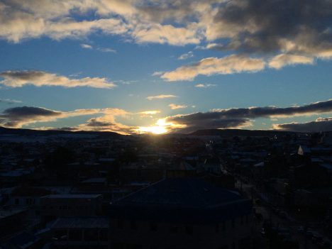
Our first sunset in Punta Arenas, Chile. Credit: Róisín Commane
On the next part of our journey the DC-8 traversed the tropical Pacific Ocean. I have always been deeply fascinated by this part of the atmosphere. The tropical Pacific Ocean lies over very warm water heated by the sun, and it is often considered to be the “firebox” of the atmosphere, the place where vast amounts of energy enter the atmosphere and drive many major features of our weather and climate.
The plane crossed two very important boundaries in the atmosphere. We encountered the first one, the Intertropical Convergence Zone (often abbreviated as the ITCZ), as our DC-8 passed 10 degrees north of the equator on the flight from Kona, Hawaii, to Pago Pago, American Samoa. The ITCZ is usually located north of the equator in Northern Hemisphere summer, and right along the equator in winter. It stands as the great meeting place between the Northern and Southern Hemispheres. Air circulates within each hemisphere in a few months, but it takes roughly a year for air to be mixed between the hemispheres by crossing the ITCZ.
I expected our measurements would see very different concentrations of pollutants as we crossed this boundary, with higher concentrations in the north than in the south. And indeed we did. The amount of carbon monoxide (CO), a major pollutant arising from all forms of combustion, dropped abruptly. But the change wasn’t as big as I expected. Other pollutants behaved the same way. The air was very clean in the northern tropical Pacific, so the North-South contrast was muted.
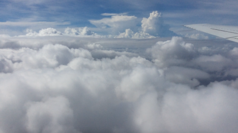
The DC-8 flies among the developing showers of the ITCZ along the equator on the flight from Kona to American Samoa. Credit: Steven Wofsy, Harvard University
But I was in for a surprise a short while later. After we had passed the ITCZ, we turned the plane to the east and travelled along the equator. Every time the DC-8 dipped down below about 10,000 feet, we saw strangely high pollutant levels, including carbon monoxide and indicators of fresh burning, such as benzene and fine particles of smoke and soot. Here we were in the midst of fresh pollution, in the Southern Hemisphere where air is supposed to be so clean. We were more than 6,000 miles from the nearest land!
Maybe I should not have been surprised. Our atmospheric computer models had actually predicted that we would see these chemicals. According to Junhua Liu, the scientist at Goddard Space Flight Center who generated the forecast, the chemicals originated in South America where fires are set each August to remove weeds and crop residues from agricultural fields and to clear trees in the forest. The goal of our ATom mission is to find out where, and how, pollutants reach the most remote parts of the planet, and we had certainly found a big input in a very surprising place, where very few people have been able to sample before us.
We encountered the second boundary, the South Pacific Convergence Zone (SPCZ) on the next flight of the DC-8 from Pago Pago to Christchurch, New Zealand. American Samoa is a lush tropical island with craggy mountains covered in jungle and clouds and generally mild weather. All that was about to change in a hurry.
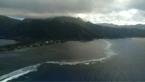
The DC-8 climbs steeply away from the tropical island of American Samoa, with its mountains covered by warm clouds. The next land we see on the ATom mission is the South Island of New Zealand, deep in winter. Credit: Bruce Daube, Harvard University.
First we came upon the SPCZ. The SPCZ is a powerful, nearly stationary feature of the South Pacific, where cold winter air from the south meets the warm, humid air from the tropics. This front is a continuous band of heavy rain and winds. Embedded in the front is the subtropical jet stream, which had winds over 200 knots (230 miles per hour) and powerful turbulence at its core the day that we were there. Our safe passage and successful sampling required close coordination between the crew and the meteorological team of ATom — Paul Newman of NASA’s Goddard Space Flight Center on the plane, and Eric Ray of NOAA’s Environmental Systems Research Laboratory on the ground.
The leading edge of the SPCZ. The DC-8 sampled down to 500 feet over the ocean at the northern edge of the SPCZ, finding a view more likely to be seen from a boat than a jet aircraft. With stormy weather ahead, we took our samples quickly and climbed as high as we could. Even at the ceiling of the DC-8’s altitude, we still encountered rough flying conditions. Credit: Steven Wofsy, Harvard University
Finally, we approached the South Island of New Zealand. What a contrast to American Samoa! The mountains were clothed in snow. The valleys had been made into tidy farms with wind breaks and agricultural fields. One of the scientists on board, Róisín Cammane of Harvard, thought the farms looked just like her home country in Ireland, although the mountains are bigger.
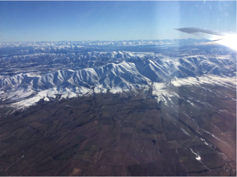
Coastal mountains on the South Island of New Zealand, near Lauder Station, overlooking agricultural lands. Credit: Steven Wofsy, Harvard University
We made a low pass over the famous observatory at Lauder, with more than 50 years of measurements of the atmosphere. A team of scientists at New Zealand’s National Institute of Water and Atmospheric Research (NIWA), led by Dave Pollard, run the station. The station is part of NASA’s Total Carbon Column Observing Network (TCCON) and hosts a spectrometer that looks at the sun and, by looking at the part of the light spectra that is known to be absorbed by carbon dioxide, measures the total amount of carbon dioxide in the atmosphere. TCCON was designed and implemented for NASA by Paul Wennberg of Caltech to help calibrate the Orbiting Carbon Observatory satellite.
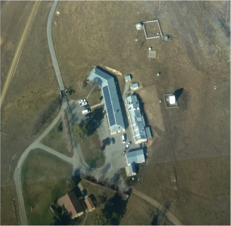
Lauder Station of New Zealand’s National Institute of Water and Atmospheric Research (NIWA). The DC-8 made a low pass over this site in order to help calibrate the TCCON measurements of carbon dioxide, which are made by looking at the sun with a spectrometer housed in the domed structure at the top of the image. Credit: Bruce C. Daube, Harvard University, from the NASA DC-8
Our aircraft measurements provide a direct link between the measurements that scientists make by sampling air at the ground and the measurements made by satellite and the TCCON looking at sunlight. On the airplane we measure samples of air, just like sampling on the ground, but we can take those samples along most of the path from the ground to the top of the troposphere, getting the total amount of carbon dioxide for the whole column, which the TCCON sites measure. My group have done these type of measurements all over the world, starting in 2004, and we have been to Lauder five times before, but never have we had such a clear day as we did on this flight.
Correction: Aug 19. The Goddard weather forecaster was misidentified in the original post. It has been corrected in the text.
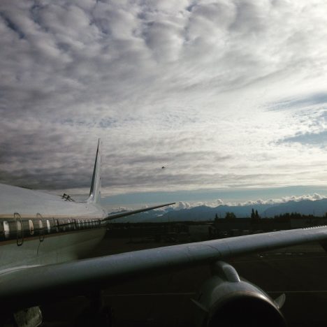
The DC-8 departs Kona for American Samoa (credit: Dave Jordan)
The other day I had a unique and difficult experience. I was on the tarmac at Kona International Airport, Hawaii, and I watched the DC-8 take-off, with all my colleagues, our crew and my instruments on board. This wasn’t planned, and no, I hadn’t just missed my flight.
Somewhere between California and Alaska I caught a seemingly innocuous cold. Then somewhere between Alaska and Hawaii this cold stopped me from being able to equalize the pressure in my ears. On a normal flight this can be extremely painful and can risk lasting damage to the ear drum and hearing. On a flight where you simulate take-off and landing 8 times … well you can imagine.
We’d been told in our safety briefings to mention ear discomfort to the crew should it arise, so after waiting a little bit too long because I wanted to tough it out and not cause a fuss (very ill advised, don’t do that) I mentioned this to the crew. They immediately showered me with all kinds of medication to help and techniques to equalize pressure and reduce pain. This, and being able to ask the pilots to pause and level out for a bit when we were going down, got me through a few more descents, but the pain became really unbearable in the end.
The project principal investigator, Steve Wofsy, and crew came up with a plan to do our last descent in stages, leveling out every few hundred feet to make it less painful for me as well as being a new and excellent way for some of the instruments on board to sample the atmosphere. By leveling out for five or ten minutes at a time, they could collect samples at unique altitude levels for later comparison to see the vertical structure of the atmosphere here. I’m so glad it worked out that way.
Me having successfully landed in Hawaii with both eardrums intact (credit: Maximilian Dollner, University of Vienna).
We had two hard down days in Hawaii before flying to Samoa and I felt sure I’d recover in time. I thought things would clear up on landing, but they didn’t, and I spent the next morning in urgent care, getting prescriptions for antibiotics and steroids. I slept a lot and tried every trick in the book to clear my ears. However, nothing was improving.
Just in-case, I trained two of my colleague on running my instruments, and hatched a plan with my supervisor back in Colorado that if I couldn’t take the flight on Saturday, I’d fly commercial to New Zealand the next day and catch up there to do some maintenance and hand over properly to my colleague who’s scheduled to fly the second half.
I desperately wanted to be on that flight to Samoa. The last 14 months of work have been all preparing for this. I love the excitement of the flights and watching the data come in, the camaraderie among the team, seeing all these new and different places. I also hate the idea of not being strong enough for something, it’s a bug-bear of mine. Above all, this mission is too important to mess up.
And that’s when I realized, the mission really is too important to mess up. And that means, if its not sensible to fly, I do not fly. If I flew with bad ears and the pilots had to divert the course every instrument on that plane loses data. If I arrive in Samoa with a burst ear drum, not only is it much harder to deal with, but I’m a greater risk flying on subsequent missions because of the weak spot.
If I don’t fly, actually I’m proud to say, my instruments do pretty fine without me now. We did a lot of work to ensure they automatically cope with all the pressure changes and other challenges of the flights, and it has paid off. And the features I notice along the way, well I get so darn excited about them I tend to explain them to anyone who’ll listen, so my colleagues can spot a lot of them for me after five flights together now. We have a chat link set up with the DC-8 while it flies, so for each of the two flights I’ll miss I’ll be online on the ground diagnosing any issue that come up for the instruments and helping out my colleagues who are kindly running them for me.
I tried until the last minute, even during the pre-flight meeting to equalize my ears, although I’d told the science and mission directors the previous evening that if there wasn’t a dramatic improvement I would not be flying. They didn’t equalize. In fact they still haven’t. My team are in American Samoa, preparing to fly to New Zealand and I’m in Hawaii on strict medical advise not to fly for three more days. I won’t even catch up in New Zealand. Instead, I will fly back to Colorado as soon as my ears allow.
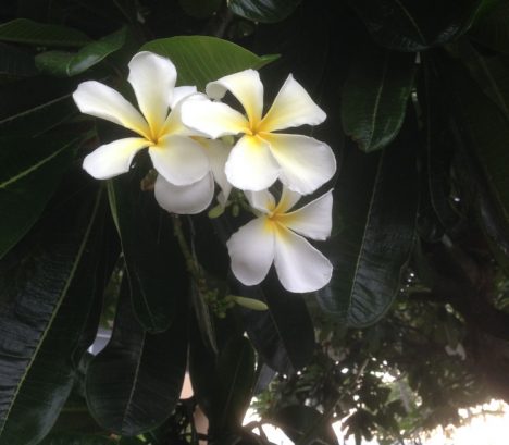
Plumeria flowers on Kona, Hawaii (credit: Christina Williamson)
As science gets to be more about successful collaborations, given the large scale and complex nature of the questions we’re now addressing, being a good scientist becomes more about good team work. This is no place for personal heroics or thinking you’re not expendable. Sometimes, a little humility and discretion can go a long way.
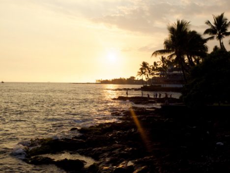
Sunset on Kona, Hawaii (credit: Christina Williamson)
Christina Williamson blogs regularly about the ATom Mission and other adventures in atmospheric science at christinajwilliamson.wordpress.com and tweets as @chasingcloudsCW.
The DC-8 preparing to leave Anchorage, Alaska (credit: Christina Williamson).
We had a gently warm morning for takeoff to Hawaii, with sun peaking through the clouds. Getting above the clouds we had spectacular views of snow capped peaks. We made a missed approach at Cold Point, population 109 at the last census. Low clouds prevented us from seeing too much there visually, but through the instruments we saw that many chemical species were very low, perhaps because the air had been recently cleared by rain.
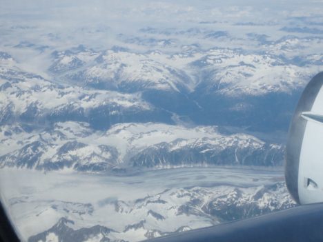
Mountain views leaving Anchorage, Alaska (credit: Christina Williamson).
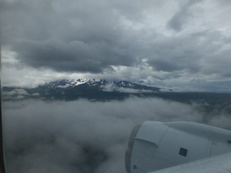
Missed approach at Cold Point (credit: Christina Williamson)
We then flew over the Kodiak Archipelago, which I was told back in Anchorage is the place people go when Alaska feels too crowded! It looked very remote and intriguing.
From there it was pretty much a straight shot down the pacific to Hawaii, where we landed on the largest island, Kona. We passed through a ship track at one point, where we can clearly see the plume in lots of instruments, including the number of aerosol particles that I’m measuring. Other than that it feels quite featureless. It’s funny to go out and purposefully measure “almost -nothing”. It’s not nothing, its the atmospheric background and there’s always stuff going on, but its the kind of stuff I’ll only be able to see once I look at a lot of data together, finding patterns over space or correlations with other measured values. It may not be the most exciting data to report here, but in terms of our long-term understanding of atmospheric processes and rigorous testing of global climate models, it’s absolutely key.
We keep the cabin cool while we fly as it’s good for the instruments (although less comfortable for the humans). We knew Kona would be very humid, and if we just landed and opened the doors to let humid air in to condense on cold instruments we’d be in trouble, so we added heat in the last descent to stop this from happening.
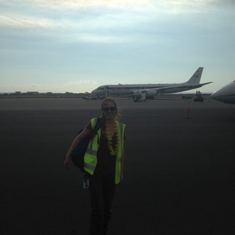
It was indeed hot and humid when we landed. The ocean was a beautiful bright turquoise as we flew over it and the volcano was shrouded in mist. Our logistics manager had arrived before us and came onto the plane greeting each of us with traditional leis to welcome us.
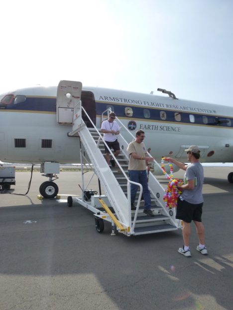
Leis handed out by Dave Jordan (NASA AIMES) as we land in Kona, Hawaii (credit: Karl Froyd)
Wandering along the shore that evening to have dinner watching the sunset over a palm fringed beach it felt surreal that we had breakfasted in Alaska and seen so much in-between.
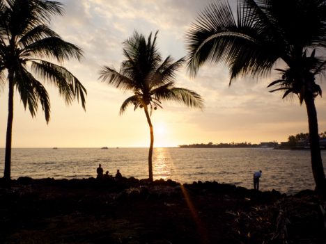
Palm trees on the shore on Kona, Hawaii (credit: Christina Williamson)
Christina Williamson blogs regularly about the ATom Mission and other adventures in atmospheric science at christinajwilliamson.wordpress.com and tweets as @chasingcloudsCW.
