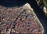
he red tile roofs and historic buildings of Cuba’s Old Havana appear distinctly in this high-resolution photograph taken by astronauts on board the International Space Station.
Published Jan 5, 2003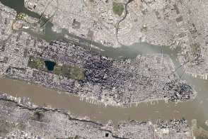
Aspects of city planning and building have effects on the urban heat island.
Published Jun 9, 2014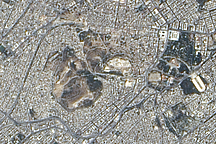
Acquired July 2, 2004, this true-color image shows central Athens, including famous sites from antiquity and an industrialized area to the west.
Published Dec 27, 2009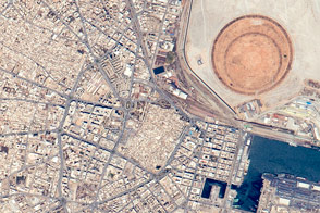
Tunisia’s “second city” is home to a large fishing fleet and a vast coastal redevelopment project.
Published Jul 13, 2015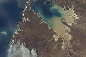
Off the northwestern coast of Australia, the sound has the second greatest daily tidal change in the world.
Published Sep 1, 2014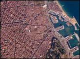
Barcelona, Spain, occupies a low plateau along the Mediterranean coastal plain. The city is the second largest in Spain (after the capital, Madrid), and it hosts the country’s largest seaport, portions of which are visible in the lower right of the image. This detailed astronaut photograph captures several notable features of the Barcelona urban landscape. The architectural design of the Eixample district (image center) displays a grid pattern distinctive for Barcelona. Built during the 19th and 20th centuries, the district was built with octagonal city blocks—rectangular blocks with the corners cut off. (At the level of detail of this photograph, the blocks appear to be squares.) The original intention was for buildings to occupy only two or three sides of the octagonal blocks, surrounding gardens and open space. While the original street grid pattern remains, today many of the octagonal blocks are completely built up.
Published Feb 19, 2007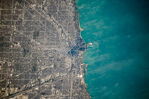
A photograph from the space station shows some of the natural features that have governed the growth of the city.
Published Dec 22, 2014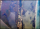
North Carolina’s Outer Banks—known as Pine Island in the area shown in this image—protects a network of interconnected waterways, including Currituck Sound, a shallow, 3-mile-wide water body; the North River; and the well-known Albemarle Sound. Wakes from barges on the Intracoastal Waterway appear on the North River, which provides a connection between the Hampton Roads area to the north and Pamlico Sound to the south.
Published Nov 20, 2006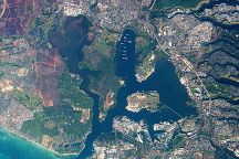
An astronaut captured this photo of the historic stretch of southern coastline of Oahu.
Published Dec 7, 2009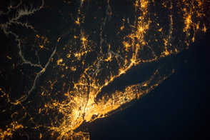
City lights trace one of the most densely populated portions of the United States.
Published Sep 30, 2013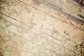
Fortifications and earthworks from an old war look very similar to oil pads from drilling operations.
Published Feb 2, 2015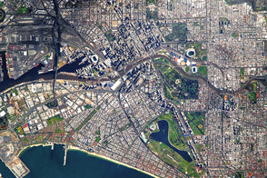
Australia’s second-largest city has an historic past.
Published Feb 6, 2017
The above photo of the International Space Station was taken by an astronaut aboard the space shuttle on April 17, 2002. Although its construction is not yet complete, Space Station Alpha began operations in November 2000. It now serves as home to three astronauts as well as dozens of already ongoing science experiments.
Published Jan 25, 2003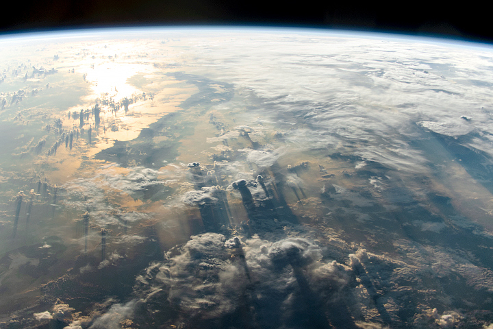
The International Space Station was crossing over the equator when an astronaut looked east and took this photo just after a sunrise.
Published Jul 28, 2019
The second holiest city of Islam is centered around the Prophet’s Mosque (Al-Masjid an–Nabawi).
Published Apr 9, 2018
The convention facilities, missions, The Alamo, and the overall historical character of the city bring 26 million visitors every year.
Published Jan 11, 2016
Taken March 14, 2011, this astronaut photograph shows the Japanese coast north, of the city of Sendai, in the wake of a devastating earthquake and tsunami.
Published Mar 15, 2011alert message
