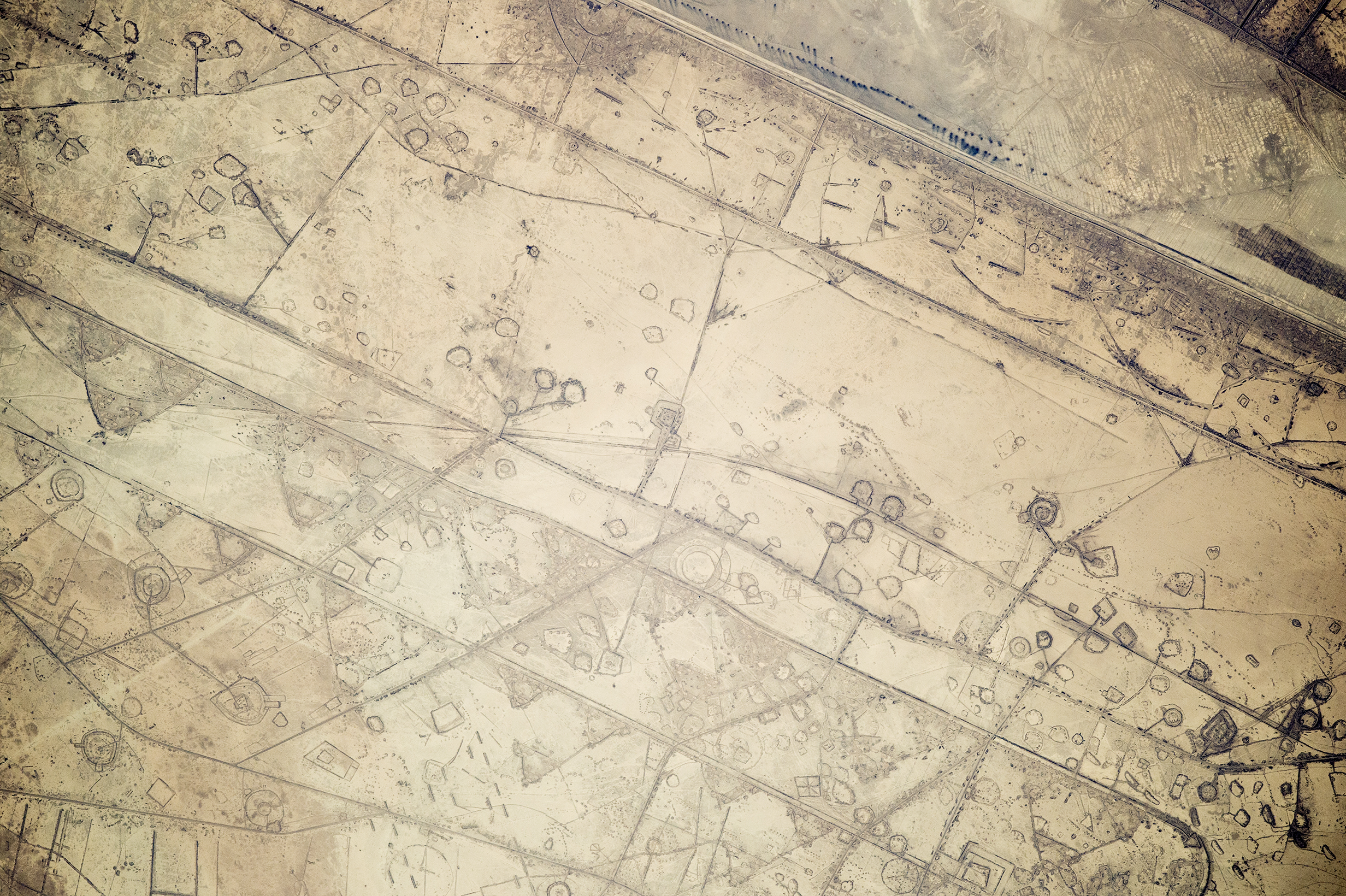
Astronauts aboard the International Space Station took this photograph of land fortifications along a 20-kilometer (12-mile) stretch of the Iraq-Iran border, near the coast of the Persian Gulf. Systems of large curved earthworks, circular gun emplacements, and straight connecting roads run parallel to the international border.
First thought by the ISS team to be oil-pad installations, the strategic location of these formations along the international boundary made it easier to see these as patterns of military fortifications. This region of oil refining and exporting was the center of numerous military actions during the war in the 1980s, especially during the defense of the southern city of Basra. The similarity to oil-pad patterns is apparent in May 2006 astronaut photos of West Texas that you can see here and here.
Astronaut photograph ISS041-E-111072 was acquired on November 7, 2014, with a Nikon D4 digital camera using an 800 millimeter lens, and is provided by the ISS Crew Earth Observations Facility and the Earth Science and Remote Sensing Unit, Johnson Space Center. The image was taken by the Expedition 41 crew. It has been cropped and enhanced to improve contrast, and lens artifacts have been removed. The International Space Station Program supports the laboratory as part of the ISS National Lab to help astronauts take pictures of Earth that will be of the greatest value to scientists and the public, and to make those images freely available on the Internet. Additional images taken by astronauts and cosmonauts can be viewed at the NASA/JSC Gateway to Astronaut Photography of Earth. Caption by M. Justin Wilkinson, Texas State University, Jacobs Contract at NASA-JSC.
alert message