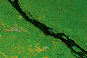
JPL’s airborne radar instrument opens up a view of tropical wetlands and forest around the Napo River.
Published Apr 25, 2013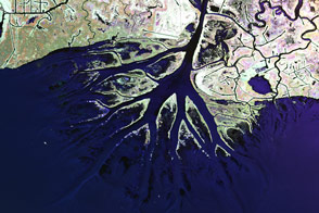
Plane-mounted radar and other instruments are studying the shrinking and growing wetlands along the Gulf Coast.
Published Jun 25, 2015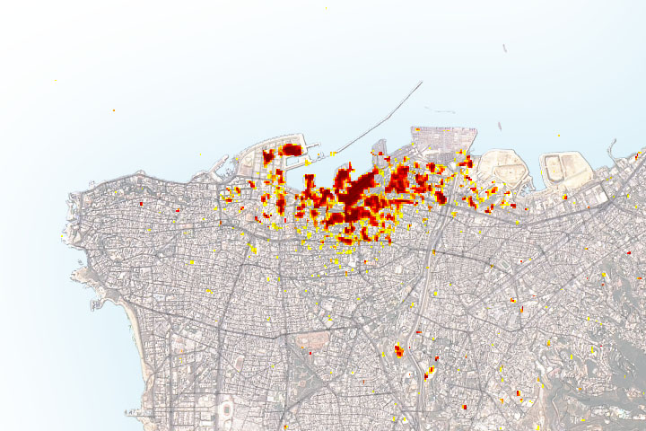
Radar imagery of ground surface changes could help with efforts at disaster relief and recovery after the explosion.
Published Aug 11, 2020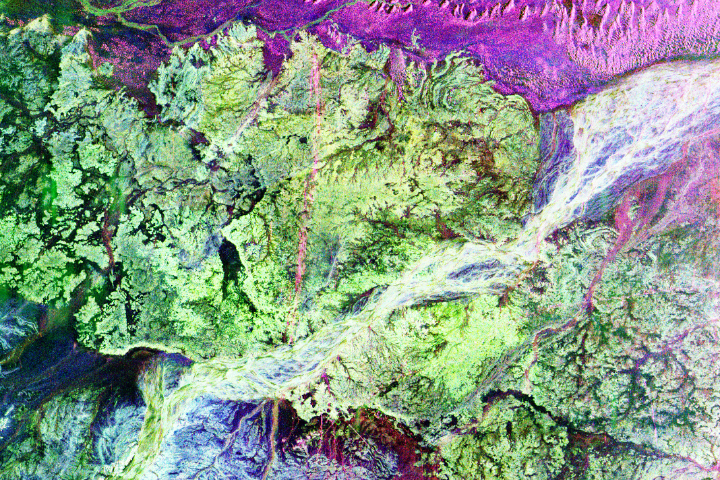
Instruments such as imaging radar helped usher in a new era in archaeology.
Published Aug 29, 2017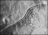
This image shows the surface of the Gulf of Mexico, northeast of the Yucatan Peninsula. Acquired by an imaging radar, the scene shows several features that would be difficult to observe with visible light. In the center of the image are a series of widely-spaced internal waves. The subsurface, internal waves are detectable by radar imagers because they modify the patterns of shorter wavelength waves on the sea surface. The brightness of the radar image depends on the roughness of the surface (smooth surfaces reflect radar waves away from the sensor, while rough surfaces reflect them back towards the sensor).
Published Jul 2, 2003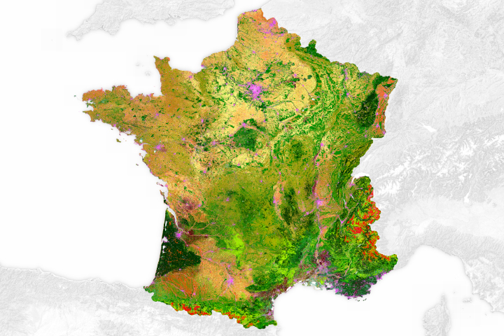
From vineyards to roadways, this map paints a detailed picture of surface types found across the country.
Published Aug 15, 2017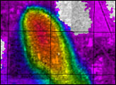
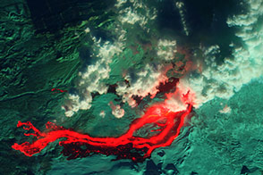
Acquired December 1, 2012, these images provide natural- and false-color views of restless Tolbachik Volcano.
Published Dec 8, 2012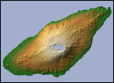
Aoba Volcano is the dominant feature in this shaded-relief image of Ambae Island, part of the Vanuatu archipelago.
Published Jan 7, 2006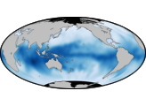

Ash and steam stream from a remote Japanese island.
Published Jul 16, 2014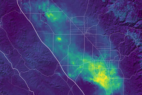
Groundwater pumping in California has been causing land subsidence.
Published Mar 5, 2017
This image of Earth is a composite of the first full day of data gathered by the Moderate Resolution Imaging Spectroradiometer on the Terra spacecraft.
Published Jun 30, 2000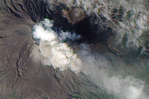
A NASA satellite captured this image of an eruption at Japan’s Sakurajima Volcano on February 15, 2010.
Published Feb 17, 2010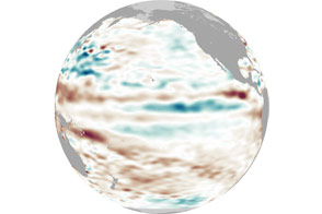
After appearing for two consecutive winters, La Niña appears to be taking some time off.
Published May 4, 2012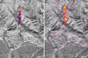
The observation by the Earth Observing-1 satellite is an important breakthrough as scientists work to measure and monitor emissions of this potent greenhouse gas from space.
Published Jun 24, 2016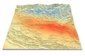
Using satellite radar sensors, scientists have been able to detect the rising and falling of the landscape in the Himalayas caused by the Gorkha earthquake.
Published May 14, 2015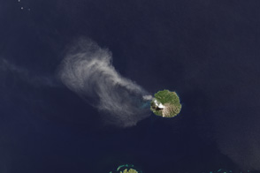
The TIRS instrument on the new Landsat Data Continuity Mission satellite helps scientists pinpoint fine differences in temperature.
Published May 7, 2013Image of the Day Atmosphere Heat Land Volcanoes Temperature Extremes
alert message
