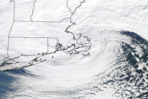
The storm that hammered New England on January 12, 2011, is a classic, comma shaped Nor’easter, as shown in this photo-like image.
Published Jan 13, 2011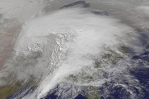
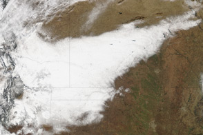
This animation shows a huge winter storm tracking across the United States between January 31 and February 2, 2011.
Published Feb 3, 2011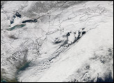
A classic nor'easter blew across the East Coast of the United States on February 11 and 12, 2006, dumping heavy snow from Virginia to Massachusetts.
Published Feb 14, 2006Image of the Day Atmosphere Land Life Unique Imagery Snow and Ice
The snowpack near Boston is greater than in all but two reported locations in Alaska.
Published Feb 18, 2015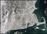
A strip of white defines the path of a deadly winter storm across New Mexico, Texas, Oklahoma, Colorado, and Kansas in this satellite image from December 21, 2011.
Published Dec 23, 2011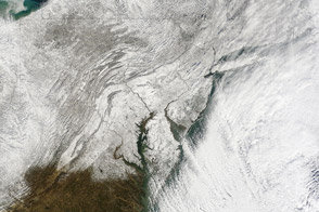
The first winter storm of 2014 dropped as much as 24 inches (61 centimeters) of snow in the hardest hit areas.
Published Jan 5, 2014
A great blizzard has painted many states white.
Published Jan 26, 2016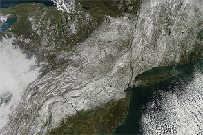
An unseasonably early storm dropped wet, heavy snow from West Virginia to Maine in late October 2011.
Published Nov 1, 2011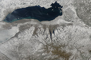
Snow cover sprawled across the northeastern United States in early March 2013, in the wake of a winter storm.
Published Mar 12, 2013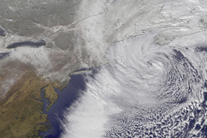
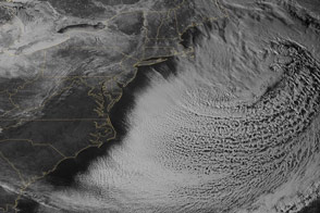
This time-lapse animation shows the merging of two storm fronts into a potent blizzard in February 2013.
Published Feb 13, 2013alert message
