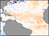
In early August, forecasters at the National Oceanic and Atmospheric Administration (NOAA) revised downward slightly their early-season predictions of the 2006 Atlantic hurricane season.
Published Aug 16, 2006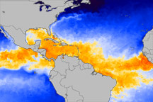
This color-coded image from June 1, 2010, shows which equatorial ocean waters are warm enough to promote hurricane formation.
Published Jun 3, 2010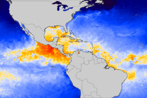
Tropical waters are warm, as usual, but not unusually so.
Published Jun 1, 2012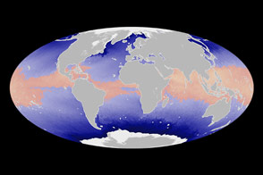
Satellite measurements of sea surface temperatures provide clues to the potential for tropical cyclone development.
Published Jun 4, 2014
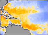
September 8, 2013, was an unusual day in an unusual season for tropical cyclones.
Published Sep 15, 2013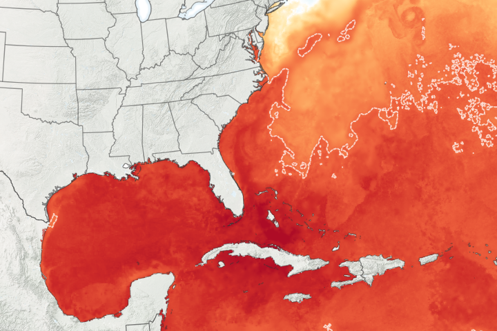
Abnormally warm ocean temperatures and a potential La Niña set the stage for an above-average Atlantic hurricane season.
Published Jul 17, 2020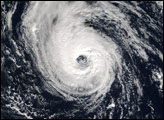

In early September 2017, hurricanes Katia, Irma, and Jose lined up across the Atlantic basin.
Published Sep 7, 2017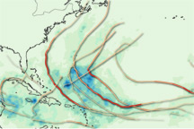
This map provides a summary of the very active 2010 Atlantic hurricane season, showing both the track each storm took and the rain it produced.
Published Dec 3, 2010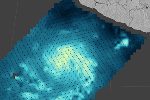
The storm became the earliest second major hurricane in eastern Pacific records, but the dynamic storm appeared to stir up enough cold seawater to cut down on its own strength.
Published Jun 6, 2015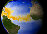
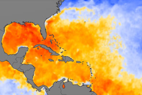
Plenty of warm-water fuel waits in the Atlantic Basin for Hurricane Irene and other tropical storms to build themselves up in August 2011.
Published Aug 25, 2011alert message
