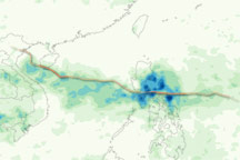
This color-coded image shows rainfall amounts and the storm track associated with Tropical Storm / Typhoon Conson from July 12–18, 2010.
Published Jul 19, 2010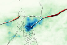
Patches of intense rain follow the track of two tropical cyclones in this rainfall image of the Philippines from May 2009.
Published May 12, 2009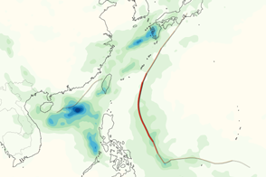
Guchol and Talim brought heavy rain to the western Pacific Ocean in June 2012. This image shows rainfall totals and storm tracks.
Published Jun 20, 2012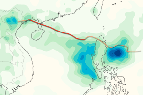
This color-coded image shows rainfall totals and the storm track for Typhoon Kai-tak in August 2012.
Published Aug 20, 2012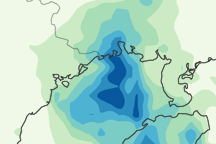
This image shows Parma’s path between October 4 and 14, 2009. It also shows regional rainfall between October 8 and 14.
Published Oct 15, 2009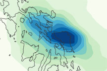
This color-coded image shows rainfall amounts over the Philippines associated with Tropical Storm Aere from May 5 to 12, 2011.
Published May 16, 2011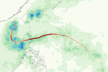
This color-coded image shows rainfall along Typhoon Megi’s path across the western Pacific between October 13 and 23, 2010.
Published Oct 26, 2010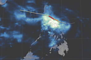
Typhoon Haima is the second typhoon in the span of a week to bring heavy wind and rain to the Philippines.
Published Oct 20, 2016Image of the Day Water Severe Storms Human Presence Remote Sensing
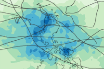
Between May and October 2009, 12 tropical cyclones poured rain over the Philippine Islands. This image illustrates how much rain fell over the islands when the storms were active.
Published Dec 5, 2009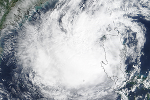
Typhoon Koppu has weakened, but the system is still expected to bring widespread flooding to the Philippine’s Luzon Island.
Published Oct 19, 2015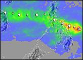
alert message
