The Earth Observatory has published its last Image of the Day on this website. Please join us on our new home at science.nasa.gov/earth/earth-observatory.
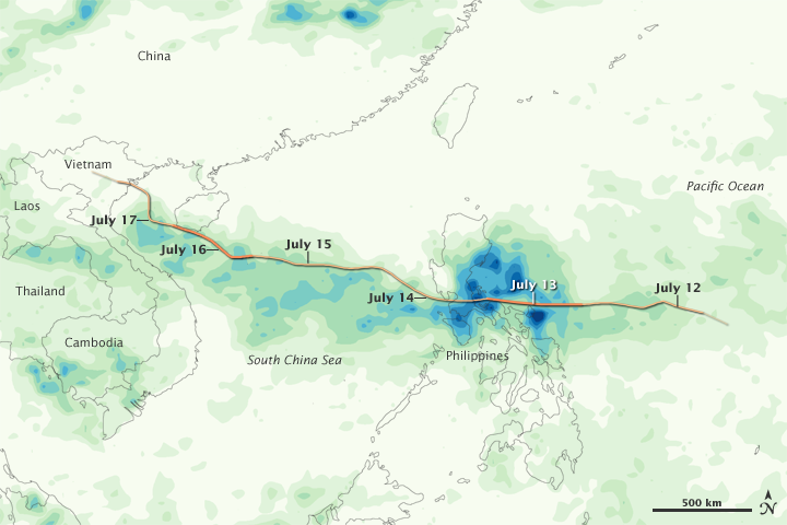
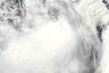
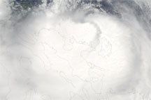
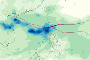
Conson, which ranged in intensity from a tropical depression to a typhoon, formed east of the Philippines on July 11, 2010, and began heading west. After bringing deadly rains to the Philippines, the storm continued toward Southeast Asia. On July 12 and again on July 15, Conson reached typhoon strength, in both cases remaining a typhoon for hours.
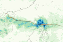
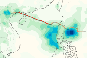
This color-coded image shows rainfall amounts from July 12–18, 2010. The lightest rainfall amounts (less than 50 millimeters or about 2 inches) appear in pale green. The heaviest amounts (more than 400 millimeters or about 16 inches) appear in dark blue. The heaviest rainfall amounts appear over the Philippines, but a corridor of relatively heavy rain also occurs along the storm’s entire route.
Superimposed on the rainfall amounts is a storm track for Conson. Darker shades of orange indicate greater storm strength. The greatest storm intensities occur over the Philippines, and just west of Vietnam and south of the island of Hainan.
In addition to rain along the storm track, heavy precipitation also appears in southern Cambodia and Thailand, and in mainland China. China had already experienced severe flooding before the arrival of Conson.
This image is based on data from the Multisatellite Precipitation Analysis produced at Goddard Space Flight Center, which estimates rainfall by combining measurements from many satellites and calibrating them using rainfall measurements from the Tropical Rainfall Measuring Mission (TRMM) satellite.
NASA image by Jesse Allen, using near-real-time data provided courtesy of TRMM Science Data and Information System at Goddard Space Flight Center and storm track data from the Joint Typhoon Warning Center. Caption by Michon Scott.