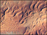
One of the main reasons that rainless regions like the Sahara Desert are interesting from the perspective of landscape science is that the work of flowing water—mainly streams and rivers—becomes less important than the work of wind. Over millennia, if enough sand is available, winds can generate dunes of enormous size, arranged in regular patterns. Long, linear dunes stretch generally north to south across much of northeast Algeria, covering a vast tract (~140,000 square kilometers) of the Sahara Desert known as the Erg Oriental. Erg means “dune sea” in Arabic, and the term has been adopted by modern geologists. Spanning this image from a point on the southwest margin of the erg (image center point: 28.9°N 4.8°W) are a series of 2-kilometer-wide linear dunes, comprised of red sand. The dune chains are more than 100 meters high. The “streets” between the dunes are grayer areas free of sand.
Published Sep 11, 2006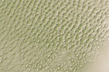
This digital elevation map of the Badain Jaran Desert shows multi-generation dunes, with smaller dunes resting atop larger ones.
Published Apr 20, 2011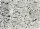
This astronaut photograph shows classic large and small sand masses of the central Sahara Desert, where wind is a more powerful land-shaping agent than water.
Published Jan 19, 2009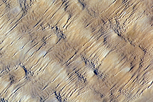
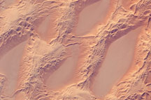
Layers of dunes march across a sand sea in the east-central Tenéré Desert of Niger in this astronaut photo from December 1, 2009.
Published Dec 28, 2009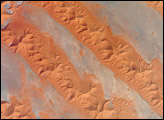
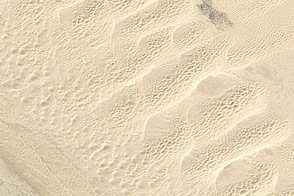
This detailed true-color image from February 24, 2011, shows the variety of sand dunes that make up the Algodones Dunes in southeastern California.
Published May 27, 2011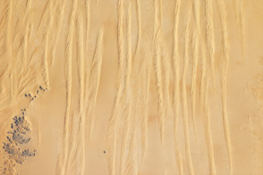
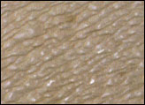
Winds shape the sands that were left behind by an ancient river.
Published Jun 4, 2012
White sand dunes spill across the Snake River Plain in a wide arc in this detailed, photo-like image acquired by the Advanced Land Imager on NASA’s EO-1 satellite on September 25, 2010.
Published Sep 29, 2010alert message
