Acquired in March 2011 and February 2012, these images document the recession of flood waters after the Tohoku tsunami.
Published Mar 13, 2012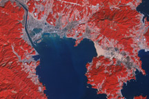
Acquired March 14, 2011, and March 1, 2007, these false-color images show the city of Rikuzentakata before and after a tsunami reshaped the local coastline.
Published Mar 18, 2011Image of the Day Land Water Floods Human Presence Earthquakes
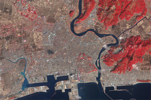
Skies over northeastern Japan were entirely cloud-free on March 13, 2011, providing a clear view of tsunami flooding along the coastline.
Published Mar 13, 2011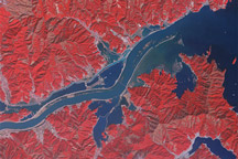
Acquired March 15, 2011, and January 16, 2011, these false-color images show part of the Kitaami River before and after the 8,9-magnitude earthquake and tsunami struck Japan in early March 2011.
Published Mar 16, 2011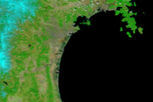
Taken on April 1, 2011, this image shows that floods linger in Japan’s tsunami-hit areas a full three weeks after the disaster occurred.
Published Apr 1, 2011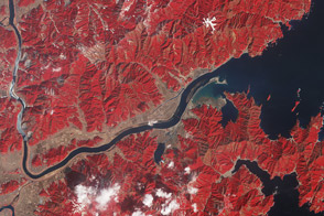
One year after the tsunami, the landscape near the mouth of the Kitakami river remains irrevocably altered.
Published Mar 11, 2012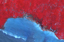
Satellite imagery reveals tsunami damage along the southern coast of Upolu, Samoa.
Published Oct 15, 2009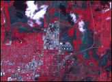
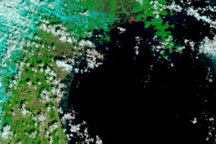
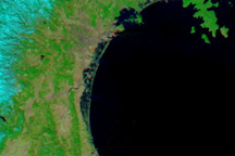
The Japanese coastline near Sendai is flooded in this false-color image, taken March 12, 2011, nearly a day after a earthquake-generated tsunami inundated the coast.
Published Mar 13, 2011alert message
