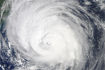
Acquired September 2, 2010, this natural-color image shows Hurricane Earl grazing the North Carolina coast.
Published Sep 3, 2010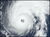
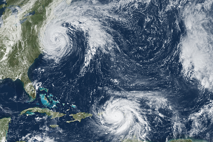
Hurricane Maria brought potent winds and dire warnings to Caribbean islands just two weeks after Irma devastated the region.
Published Sep 20, 2017Image of the Day Atmosphere Land Water Severe Storms Human Presence Remote Sensing

Satellites and astronauts observed the potent storm as it headed for landfall in the southeastern United States.
Published Sep 12, 2018
The powerful hurricane is believed to be the strongest on record to hit the northwestern Bahamas.
Published Sep 1, 2019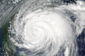
Hurricane Irene extends from central Florida to North Carolina in this image taken at 2:05 Eastern Daylight Time on August 26, 2011.
Published Aug 29, 2011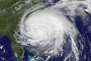
Irene, the first hurricane of the 2011 Atlantic season, was poised on August 26 to be the first to make land-fall in tU.S. since 2008. More than 50 million people were estimated to lie within the path of the storm.
Published Aug 27, 2011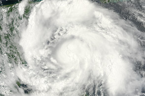
Acquired August 7, 2012, this image shows Hurricane Ernesto approaching the Yucatán Peninsula.
Published Aug 7, 2012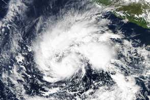
Sandra was a tropical storm before growing into a late-season hurricane.
Published Nov 25, 2015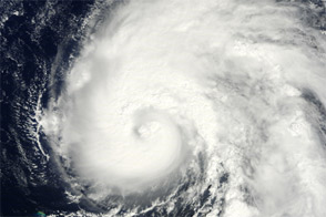
Acquired September 29, 2011, this natural-color image shows Ophelia east-northeast of Puerto Rico.
Published Sep 30, 2011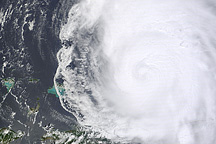
This image shows Hurricane Earl north of Puerto Rico on August 31, 2010.
Published Sep 1, 2010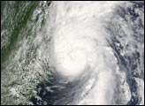
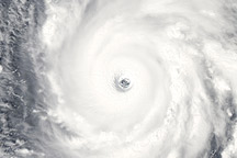
Acquired September 13, 2010, this natural-color image shows Hurricane Igor, a Category 4 hurricane, over the Atlantic Ocean.
Published Sep 13, 2010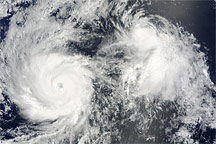
Hurricane Felicia, with its distinct eye and tight bands of spiraling clouds, and the less distinct Tropical Storm Enrique sat side by side over the East Pacific Ocean on August 4, 2009.
Published Aug 6, 2009alert message
