These false-color images show the difference in rivers and floodplains in the Indian state of Bihar in Mid-July and late August 2009.
Published Aug 31, 2009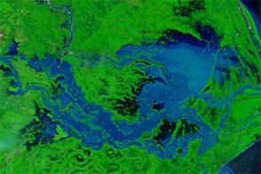
Acquired September 27, 2011, and September 28, 2010, these false-color images compare conditions along the Brahmani and Mahanadi Rivers in India. Severe flooding struck the region in 2011.
Published Sep 28, 2011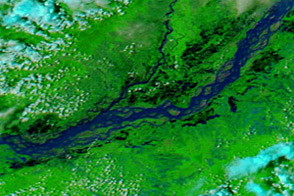
Acquired July 2, 2012, and June 18, 2012, these images compare conditions along the Brahmaputra River.
Published Jul 2, 2012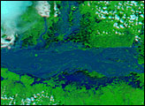
India’s Brahmaputra River was already flooded in early August, but those floods turned out to be small compared to the floods that hit the river in early September. The river flooded for the third time in 2007 when monsoon rain pounded northeastern India, Bhutan, and Bangladesh in September.
Published Sep 14, 2007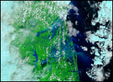
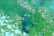
Acquired on July 18 and August 1, 2009, these false-color images provide a before-and-after view of the Sitamarhi District of the Indian state of Bihar. The image from August 1 shows swollen waterways and large areas of standing water.
Published Aug 3, 2009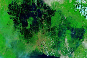
Acquired in November 2008 and 2011, these images compare conditions in Bangkok, where floods crept toward the city center in 2011.
Published Nov 8, 2011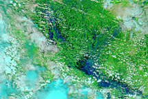
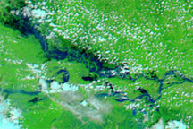
Acquired July 23 and August 24, 2009, these false-color images show swollen rivers along the India-Nepal border. The Ganges and Ghaghara Rivers are both swollen.
Published Aug 26, 2009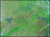
alert message
