The 12,000-year old town of Hasankeyf could soon be underwater due to the construction of a new dam.
Published Mar 17, 2020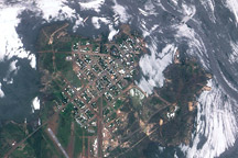
Flood waters nearly surround the tiny town of Normanton, Australia in this satellite image.
Published Feb 20, 2009
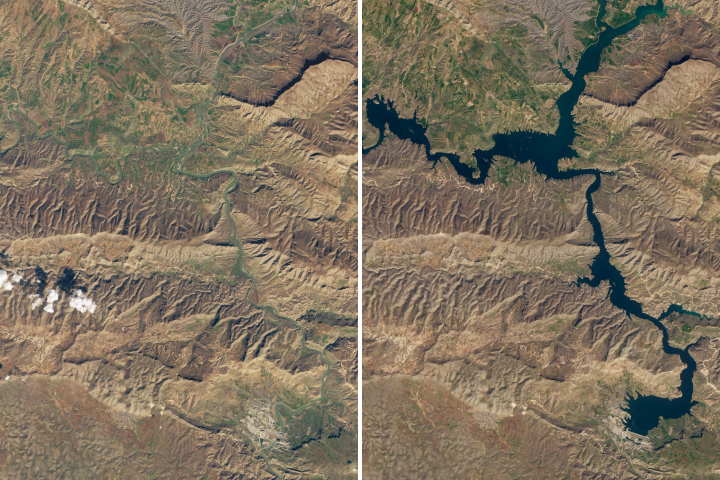
Satellite data shows that water levels in Iraq’s largest reservoir have reached heights not seen in more than a decade.
Published May 8, 2019
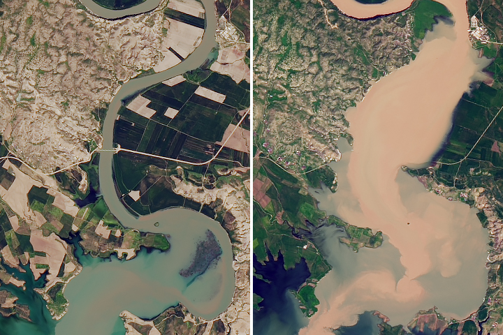
Water has stopped pouring from the broken wall of the Sardoba Reservoir, but many areas are still submerged.
Published May 11, 2020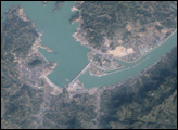
The longest river in Asia, the Yangtze River brings mixed blessings to China. Although it meets the water needs of millions of people, the river regularly overflows its banks. To protect residents and land in the lower Yangtze floodplains, China began construction on the Three Gorges Dam in 1994.
Published Jun 13, 2007
Acquired December 26, 2009, this image shows the edge of snow cover in northern Texas, near the town of Snyder.
Published Dec 30, 2009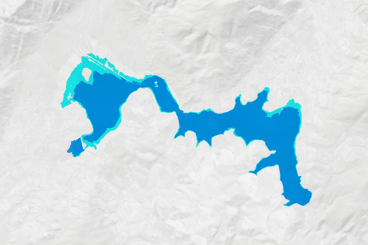
After nearly running out of water in early 2018, the city’s reservoirs are being replenished by rain, conservation efforts, and engineering fixes.
Published Jul 16, 2018Image of the Day Land Water Drought Human Presence Remote Sensing
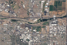
These satellite images show Tempe Town Lake before and after a rubber dam maintaining the reservoir burst.
Published Aug 8, 2010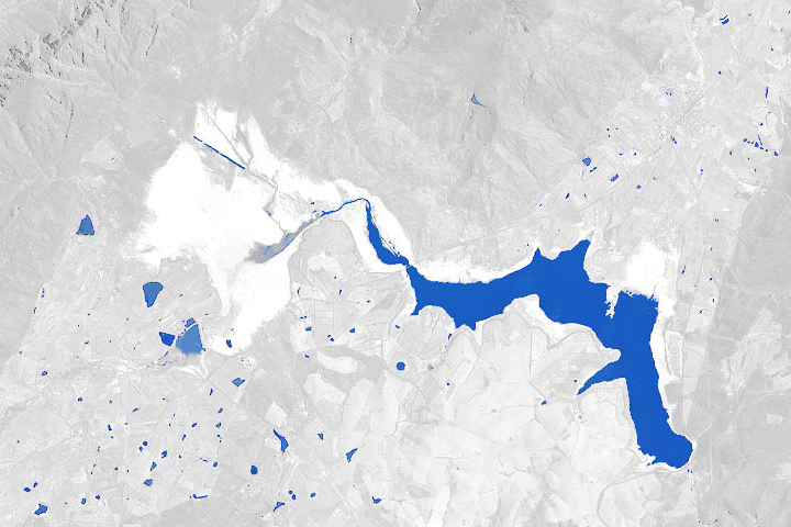
A multi-year drought, a growing population, and management choices have put the city’s water supply in a precarious position.
Published Jan 29, 2018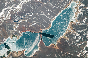
Winter traces white and blue across the high country.
Published Mar 27, 2017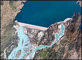
The Indus River basin extends from the Himalaya Mountains that form the northeastern boundary of Pakistan to the alluvial plains of Sindh near the Arabian Sea coastline. Tarbela Dam is part of the Indus Basin Project, which resulted from a water treaty signed in 1960 between India and Pakistan. This treaty guaranteed Pakistan water supplies independent of upstream control by India. Designed primarily for water storage rather than power generation, the dam was completed in 1977. Turquoise waters of the Indus River (to the south of the dam) reflect the high proportion of silt and clay suspended in waters released by the spillways.
Published May 30, 2005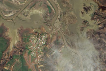
This pair of natural-color and infrared-enhanced images from the Advanced Land Imager (ALI) on NASA’s Earth Observing-1 (EO-1) satellite reveal that floods still surrounded much of the Queensland town of Normanton on the morning of March 12, 2009.
Published Mar 14, 2009
The town of Mariental sits at the convergence of the Kalahari Desert and the Central Plateau.
Published Jun 25, 2020