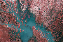
Wide channels brimming with water transform the Cuvelai basin in this image of flooding, taken on March 28, 2009.
Published Apr 1, 2009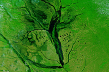
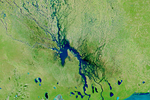
Rivers throughout the western portion of southern Africa were visibly flooded on March 25, 2009, when this image was captured.
Published Mar 25, 2009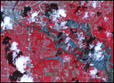
By the time the Advanced Spaceborne Thermal Emission and Reflection Radiometer (ASTER) on NASA’s Terra satellite passed over Des Moines, Iowa, on June 29, 2008, and captured this image, the floods that had struck the city in mid-June when an aging levee failed were no longer apparent in the city itself. However, downstream (southeast) of the city, the flooding remained dramatic.
Published Jul 8, 2008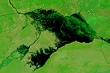
Water stretches across kilometers of land in Namibia's Caprivi strip in this Terra MODIS image from April 14, 2009.
Published Apr 16, 2009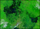
Channels of water flowed through normally dry northern Namibia on March 23, 2009, when this image was captured.
Published Mar 23, 2009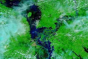
The lower Mekong River caused widespread flooding in Cambodia.
Published Oct 21, 2013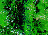

This pair of images from the Advanced Spaceborne Thermal Emission and Reflection Radiometer (ASTER) on NASA’ Terra satellite shows wide-spread flooding in Oshakati, Namibia, on March 28, 2009.
Published Apr 1, 2009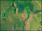
alert message
