The northern Namibian city of Ondangwa seems to be built on a sponge in these images, which show flooding around the city on March 28, 2009.
Published Apr 1, 2009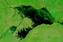
Water stretches across kilometers of land in Namibia's Caprivi strip in this Terra MODIS image from April 14, 2009.
Published Apr 16, 2009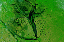
Rivers throughout the western portion of southern Africa were visibly flooded on March 25, 2009, when this image was captured.
Published Mar 25, 2009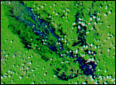
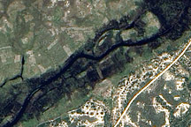
This detailed, photo-like image from April 1, 2009, shows floods covering fields of crops around the Bukalo Channel in northern Namibia.
Published Apr 7, 2009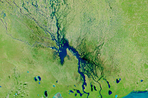
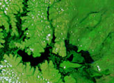
Channels of water flowed through normally dry northern Namibia on March 23, 2009, when this image was captured.
Published Mar 23, 2009
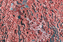
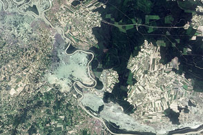
This pair of images from the Advanced Spaceborne Thermal Emission and Reflection Radiometer (ASTER) on NASA’ Terra satellite shows wide-spread flooding in Oshakati, Namibia, on March 28, 2009.
Published Apr 1, 2009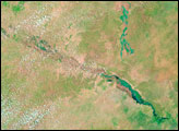
The swollen Sava River covers at least three towns in this image. It is one of many flooded rivers in the Balkan states.
Published May 25, 2014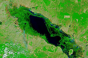
High waters remained in Thailand and Cambodia in January 2012, months after flooding struck the region.
Published Jan 9, 2012alert message
