A key shipping route through Egypt recently received a major overhaul.
Published Apr 30, 2016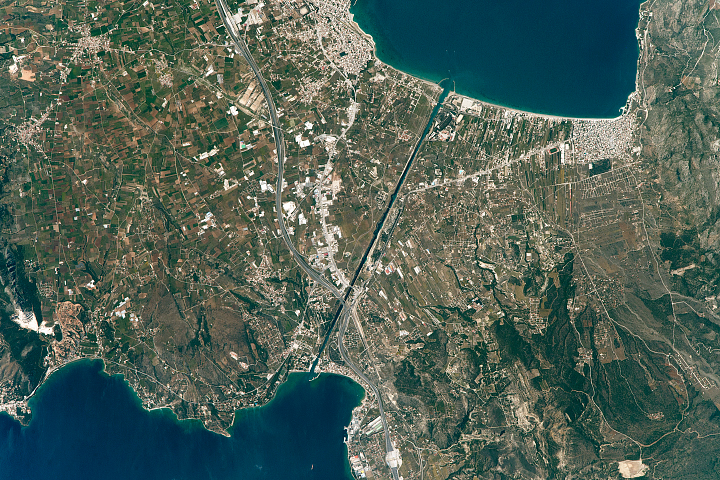
This passage through the Peloponnese Peninsula was 2500 years in the making.
Published May 22, 2017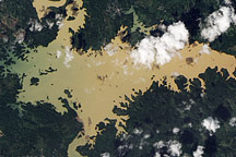
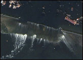
Acquired December 17, 2010, this natural-color image shows a sediment-laden Lago Alajuela, a reservoir of the Panama Canal.
Published Dec 21, 2010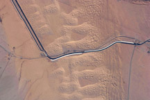
The largest irrigation canal in the world and a key landmark along the U.S.-Mexico border shows up in this astronaut photograph. This image captures about 15 kilometers (9.3 miles) of the important infrastructure corridor just west of Yuma, Arizona.
Published Feb 23, 2009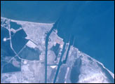
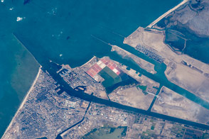
This time series of photographs of the Mediterranean coast near the Suez Canal shows ten years of changes associated with two of Egypt’s “Mega” Development Projects. At the mouth of the canal, a large auxiliary channel has been formed as part of a new central hub port and industrial zone, known as the East Port-Said Project. Further south, the effects of the Al-Salam (El Salam or “Peace”) Canal and North Sinai Agricultural Development Program can be seen as desert is converted to irrigated agriculture.
Published Jun 10, 2001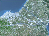
Modern international shipping meets the ancient world in the famous canal.
Published Nov 16, 2015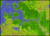
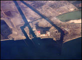
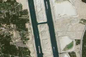
This astronaut photograph captures a northbound convoy of cargo ships entering the Mediterranean Sea from the Suez Canal in Egypt.
Published Jul 31, 2006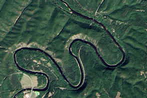
A particularly curvy part of the Potomac River was a formidable challenge for C&O Canal engineers.
Published Oct 8, 2016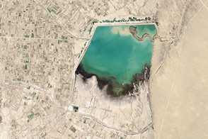
An engineering wonder and boon for citizens in Turkmenistan is also an environmental problem.
Published Jul 1, 2014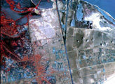
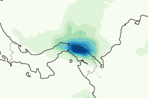
This color-coded image shows rainfall amounts in andaround Panama from December 6 to December 12, 2010.
Published Dec 16, 2010alert message
