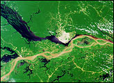
Two rivers meet near the port city of Santarém in the interior of Brazil.
Published Nov 2, 2015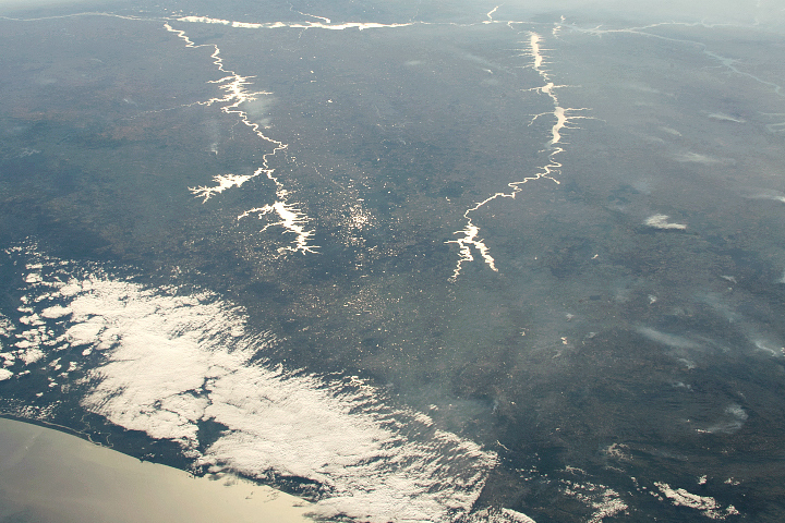
Sunlight highlights details around Rio Paraná, Rio Tiete, and Rio Paranapanema.
Published Dec 22, 2019
The impact of severe drought on the Negro River, a tributary of the Amazon River, and other rivers in the basin is dramatically evident in this pair of images, which show that every body of water has shrunk in 2010 compared to 2008.
Published Dec 11, 2010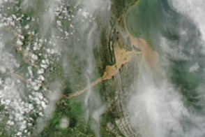
A plume of muddy sediment appears along the coast of southeastern Brazil in early January 2012, following days of heavy rains.
Published Jan 6, 2012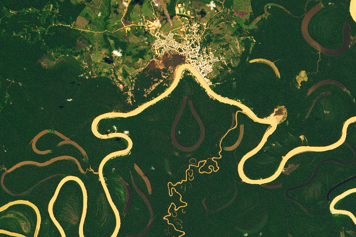
Heavy sediment loads play a role in making it one of the most sinuous rivers in the Amazon Basin.
Published Nov 13, 2019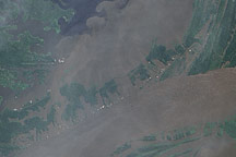
In June 2009, the waters of the Amazon surrounded the villages near its confluence with the Negro River, seeping into the cleared land and filling what had been pale green angular shapes with murky brown water.
Published Jul 17, 2009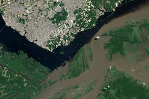
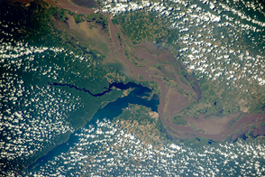
The confluence of the Rio Negro and Rio Solimões in Brazil is famous for unusual mixing patterns.
Published Sep 7, 2012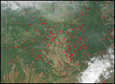
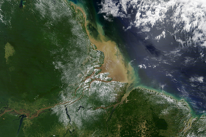
Most of the sediment that flows into the Atlantic Ocean from the mouth of the river comes from thousands of miles upstream.
Published Oct 2, 2020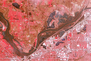
Acquired April 30, 2013, and April 30, 2007, these images compare conditions along the Grand River near Grand Rapids, Michigan.
Published May 3, 2013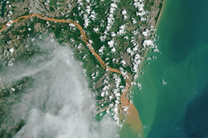
Contaminated water has turned the Rio Doce orange-brown as it flows into the Atlantic Ocean.
Published Dec 3, 2015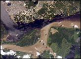
The largest river on the planet, the Amazon, forms from the confluence of the Solimões (the upper Amazon River) and the Negro at the Brazilian city of Manaus in central Amazonas. At the river confluence, the muddy, tan-colored waters of the Solimões meet the “black” water of the Negro River. The unique mixing zone where the waters meet extends downstream through the rainforest for hundreds of kilometers, and is a famous attraction for tourists from all over the world. The tourism contributes to substantial growth in the city of Manaus. Twenty years ago the large park near the city center (center) lay on the eastern outskirts of Manaus.
Published Feb 12, 2005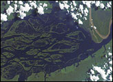
The wide, multi-island zone in the Rio Negro (Black River) shown in this astronaut photograph from September 2, 2006, is one of two, long “archipelagoes” upstream of the city of Manaus (not shown) in central Amazonia. Sixty kilometers of the total 120-kilemeter length of this archipelago appear in this image.
Published Dec 4, 2006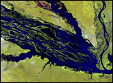
alert message
