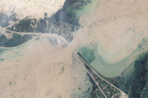
The muddy, swollen Indus River surges past an irrigation structure in southern Pakistan in this Landsat image from August 12, 2010.
Published Aug 19, 2010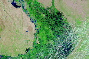
Acquired September 21, 2011, and September 22, 2009, these false-color images compare conditions in southern Pakistan, which suffered severe flooding in 2011.
Published Sep 21, 2011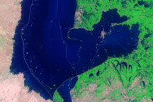
Acquired on September 4, 2010, November 7, 2010, and January 26, 2011, these false-color images show the very slow retreat of flood waters from an area in Sindh Province.
Published Apr 12, 2011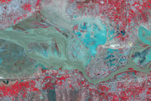
Blue and green flood water covers part of the Pakistani city of Kheshgi in this false-color image from August 4, 2010.
Published Aug 4, 2010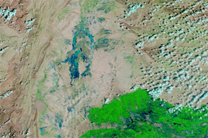
Acquired September 4, 2011, and September 5, 2009, these false-color images compare conditions in southern Pakistan, hit by flooding in 2011.
Published Sep 7, 2011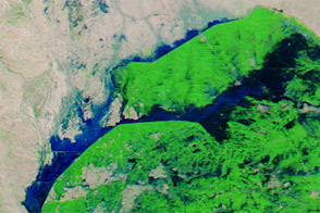
Acquired September 21, 2012, and September 1, 2012, these images compare conditions in farmed fields west of the Indus River in Pakistan. Floods struck the region in September 2012.
Published Sep 22, 2012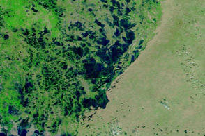
Acquired October 17, 2011, and October 15, 2009, these images compare conditions in southern Pakistan, inundated by heavy monsoon rains in 2011.
Published Oct 18, 2011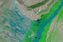
In August 2010, entire villages were washed away, more than 1,100 people died, and an estimated 2.5 million people were affected by dramatic monsoon rains.
Published Aug 3, 2010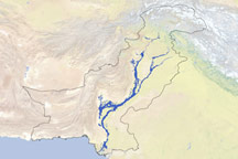
Derived from satellite data, this map shows the extent of flooding in Pakistan caused by the 2010 monsoon.
Published Apr 26, 2011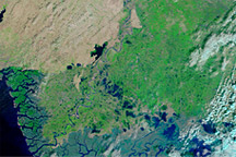
These false-color images show parts of Pakistan affected by the 2010 monsoon floods. The image from November 201, shows the area after flooding. The image from November 2009 shows conditions one year before.
Published Nov 15, 2010alert message
