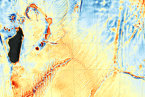
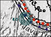
The recent discovery of the Mammerickx Microplate was made possible by new satellite-derived maps of the ocean floor.
Published Jan 13, 2016
When the Apollo 11 astronauts left the surface of the Moon on July 21, 1969, they brought home samples of solar wind particles, lunar rocks and dirt, and a big helping of perspective.
Published Jul 20, 2019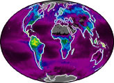

From one million miles away, the DSCOVR satellite returned its first view of the entire sunlit side of Earth.
Published Jul 21, 2015

On July 19, 2013, NASA spacecraft got not one but two rare and unique views of Earth from opposite ends of the solar system.
Published Jul 24, 2013
The Curiosity rover on Mars looked up and saw home on the horizon.
Published Mar 9, 2014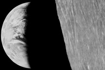
Long before man journeyed to the moon and looked back at the tiny, fragile planet that houses humanity, lunar orbiters were sending back pictures of home.
Published Nov 15, 2008
These iconic photos are not new, but their message never gets old.
Published Dec 24, 2018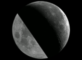

Sixteen operating satellites monitor Earth. Four more are scheduled to launch in 2014.
Published Jul 5, 2013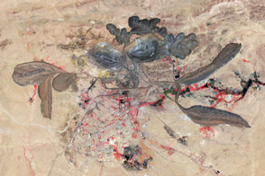
A mining operation in China dominates the global market for rare metals used in consumer products.
Published Apr 21, 2012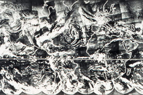
Before there was a Blue Marble photograph or composite image of Earth, there was TIROS IX.
Published Apr 22, 2015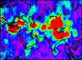
The first image released from the Gravity Recovery and Climate Experiment (GRACE), a joint NASA-German Aerospace Center mission, graphically illustrates the sensitivity of the mission’s twin spacecraft to changes in Earth’s gravity
Published Dec 11, 2002