Where the Pacific plate and North American plate meet, the intense pressure of the collision creates an 800-mile-long fracture zone.
Published Jun 23, 2009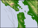
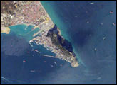
Gibraltar Bay, located near the southernmost tip of the Iberian Peninsula, is the central feature of this astronaut photograph. The famous Rock of Gibraltar that forms the northeastern border of the bay is formed of Jurassic-era seafloor sediments that solidified into limestone, a rock formed mostly of the mineral calcite, which is found in the shells of sea creatures. The limestone was subsequently lifted above the ocean surface when the African and Eurasian tectonic plates collided. The cities of La Linea and Algeciras bordering the bay, together with petroleum-processing facilities along the northern shoreline, are part of Spain, whereas the city of Gibraltar itself (to the west of and including the Rock) is under the jurisdiction of the United Kingdom.
Published Jan 8, 2007
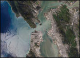
Despite the bay’s calm waters, constant reminders of the city break through.
Published Oct 5, 2017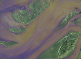
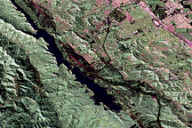
Astronauts aboard the International Space Station (ISS) took this photograph of the San Francisco Bay area in April, 2002. The gray urban footprint of San Francisco, Oakland, San Jose, and their surrounding suburbs contrast strongly with the green hillsides. Of particular note are the Pacific Ocean water patterns that are highlighted in the sun glint. Sets of internal waves traveling east impinge on the coastline south of San Francisco. At the same time, fresher bay water flows out from the bay beneath the Golden Gate Bridge, creating a large plume traveling westward. Tidal current channels suggest the tidal flow deep in thebay. Because the ISS orbits are not synchronous with the sun, astronauts view the Earth with variable solar illumination angles. This allows them to document phenomena such as the sun reflecting differentially off surface waters in a way that outlines complicated water structures.
Published May 26, 2002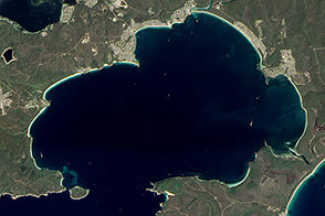
Rising and falling seas and ancient rivers formed a bay lined with the whitest sands in the world.
Published May 11, 2013

Once an important port during World War II, the bay is comprised of a complex delta system that makes it a very scenic and popular tourist destination in Australia.
Published May 30, 2020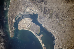
Astronauts flying on the International Space Station took this photograph of California’s southernmost coastal city.
Published Mar 16, 2015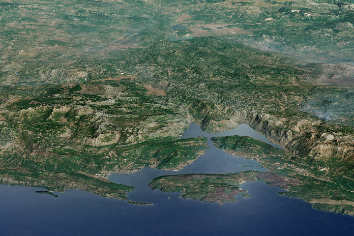
The stunning scenery in this bay in Montenegro has made it a popular destination for cruises ships.
Published Sep 17, 2017