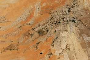
Several new farms, parks, gardens, and tree-planting projects have made Al Ain one of the greenest cities in the Middle East.
Published Sep 6, 2015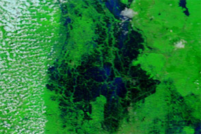
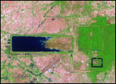
Acquired October 19, 2011, and November 12, 2008, these false-color images compare conditions around Bangkok, where flooding loomed in late October 2011.
Published Oct 20, 2011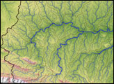
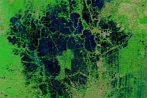
In 2004, a small group of freshwater conservation biologists at World Wildlife Fund who were studying the Madre de Dios River in the southwestern Amazon found a creative way to locate rivers. The team used high-resolution topographic maps based on radar data collected by the Space Shuttle Endeavour in 2000 to map how water would flow across the landscape. This image shows the result of their efforts, including elevation, river channels, and watershed boundaries.
Published Feb 10, 2007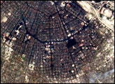
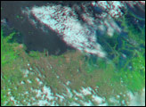
Although improved over the previous several weeks, flood conditions lingered around Ayutthaya and Bangkok in early December 2011.
Published Dec 16, 2011
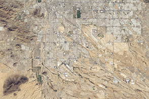
An astronaut photo from 1965 and a satellite image from 46 years later show cityscape engulfing green areas in the dry Southwest.
Published Jul 24, 2012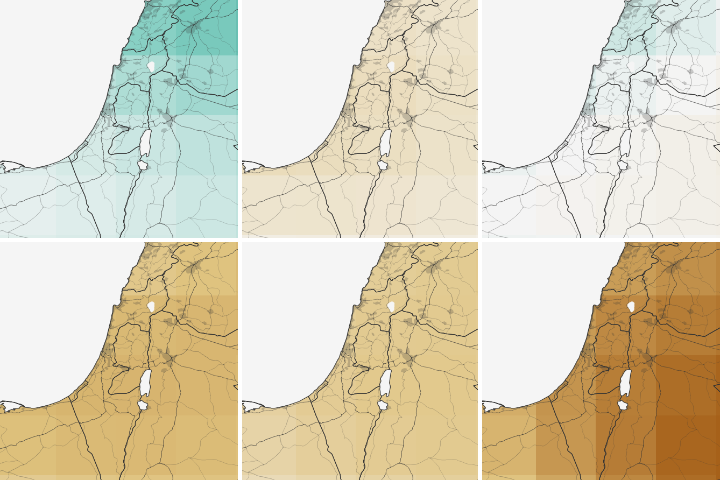
Water shortages in the Middle East lead to sanitation issues in schools, resulting in periodic school closures. NASA is working to change that.
Published Jul 27, 2018