The Terra satellite observed two large bushfires in Western Australia. One of them threatened the towns of Northcliffe and Windy Harbour.
Published Feb 6, 2015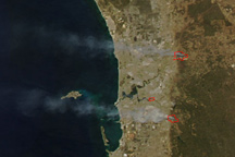
Two large wildfires burn in the tree-covered hills east of Perth, Australia, in this true-color image from February 6, 2011.
Published Feb 8, 2011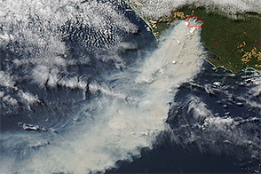
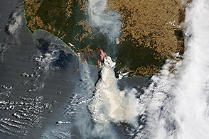
A vigorous bushfire threatened homes in Western Australia in February 2015.
Published Feb 2, 2015
This image from June 9, 2011, shows Arizona’s Wallow Fire in the White Mountains near the border with New Mexico.
Published Jun 10, 2011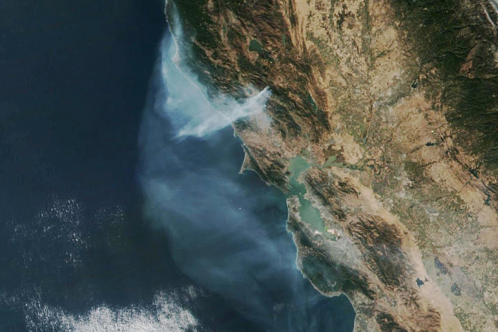
The eastern part of the fire was active overnight, expanding the burned area to 76,000 acres.
Published Oct 30, 2019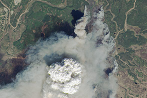
Fire weather clouds are one indication of the intensity of the fast-growing fire on Alaska’s Kenai Peninsula.
Published May 23, 2014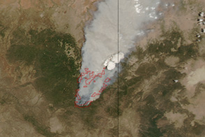
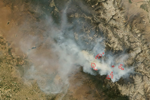
Dense smoke billows from a massive wildfire—the Wallow Fire—in eastern Arizona in this photo-like image from June 4, 2011.
Published Jun 6, 2011
A blaze in Western Australia devastated the town of Yarloop.
Published Jan 19, 2016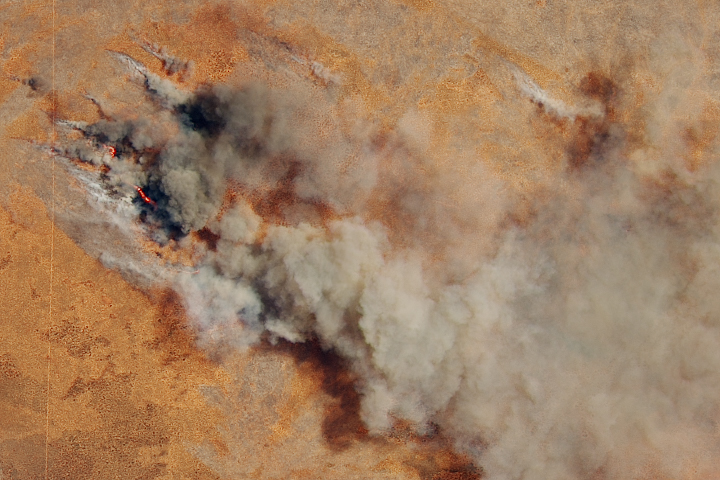
The late-spring fire follows what has been a dry winter and spring across most of the country.
Published Nov 5, 2019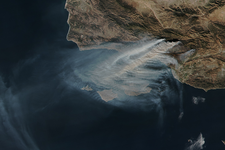
The Thomas fire is now the fourth largest wildfire on record in California.
Published Dec 15, 2017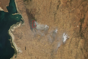
South Australia’s long-lived Bangor fire threatened four communities as it burned out of control on February 11 and 12.
Published Feb 11, 2014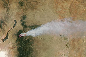
Smoke from the fire spread out in an interesting pattern over northern Texas.
Published Jun 11, 2012
An expansive, destructive wildfire north of Los Angeles is visible from space by day and night.
Published Jun 28, 2016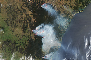
On October 21, 2013, destructive wildfires burning in New South Wales were poised to worsen.
Published Oct 21, 2013
The blaze is the largest in Arizona this year and the largest in the United States right now.
Published Jun 16, 2020Image of the Day Heat Land Fires Human Presence Remote Sensing
In early September 2015, the Rough Fire was the largest active wildfire in California.
Published Sep 8, 2015