Geologists estimate that Mauna Loa, the world’s largest active volcano, has erupted about once every six years for the past three millennia.
Published Nov 1, 2015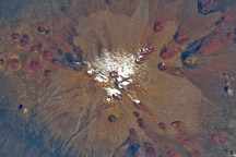
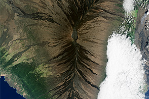
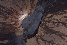
A detailed astronaut photograph shows pyroclastic deposits on Hawaii’s Muana Kea Volcano.
Published May 18, 2009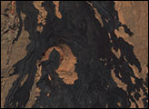
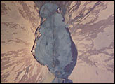
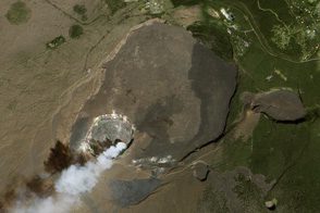
Mauna Loa is the largest volcano on our planet—the summit elevation is 4,170 m (over 13,600 ft), but the volcano’s summit rises 9 km above the sea floor. The sharp features of the summit caldera and lava flows that drain outward from the summit are tribute to the fact that Mauna Loa is one of the Earth’s most active volcanoes. The most recent eruption was in 1984. The straight line the cuts through the center of the crater from top to bottom is a rift zone—an area that pulls apart as magma reaches the surface.
Published Jul 28, 2002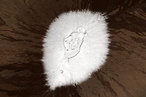
Multiple snowstorms in December left the island’s highest peaks blanketed in white.
Published Dec 29, 2016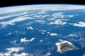
The Island of Hawaii is a vast canvas of environments from desert shores to rain forests to frozen mountain heights.
Published Jan 29, 2014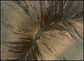
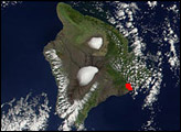
January 2012 marks the 100th anniversary of the Hawaiian Volcano Observatory, situated on the rim of Kilauea Caldera.
Published Jan 31, 2012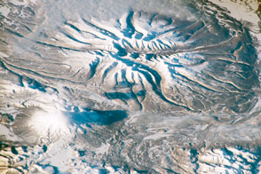
Astronauts captured this view of two snow-covered volcanoes in southern Kamchatka, Russia.
Published Dec 21, 2015
This satellite image of the summit of Mauna Loa overlaid with contour lines helps illustrate why volcanic emissions from the summit rarely reach the observatory where atmospheric carbon dioxide is measured.
Published Mar 19, 2010