
Differences in how international and national institutions classify forests can lead to large discrepancies in measurements of land cover.
Published Nov 17, 2015
By changing a percentage, institutions can take some forested lands off the map.
Published Dec 18, 2015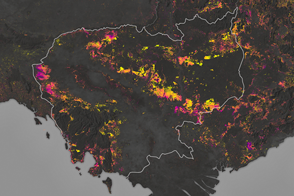
Forests are being turned into rubber plantations, farmland, and timber at a rapid rate.
Published Jan 10, 2017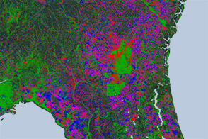
Open-access data from the NASA-USGS Landsat mission and cloud computing make for a highly detailed view of gains and losses in global and regional tree cover since 2000.
Published Nov 16, 2013
Since the mid-1200s, the state has controlled Niepołomice Forest, which contains some of the last pockets of old-growth forest in Poland.
Published Nov 29, 2013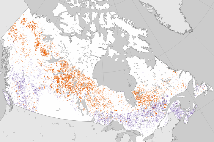
Researchers analyzed 25 years of Landsat data to establish where forests had burned or been cut.
Published Jun 27, 2017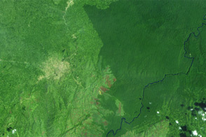
Landsat observed the loss of 3.7 million hectares (14,000 square miles) of tropical forest.
Published Sep 26, 2012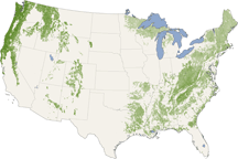
From the Pacific Northwest—home of the towering redwoods&mdash to the Southern Appalachians, this map shows forest canopy heights across the United States.
Published Jul 22, 2010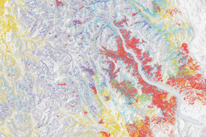
Wildfires make a significant mark on the bird’s nesting and roosting habitat.
Published Dec 23, 2019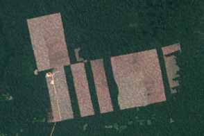
Free, open-access imagery helps scientists monitor remote areas and protect tropical forests.
Published Nov 19, 2013
Forests in drylands are much more extensive than previously reported.
Published Aug 10, 2017
Political change in Eastern Europe and Russia has left its mark on forests in the region.
Published Jul 16, 2015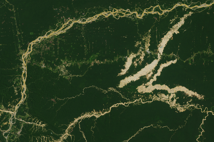
The Madre de Dios region has a rich concentration of endemic species, but their habitats are being threatened by human activity.
Published Apr 19, 2019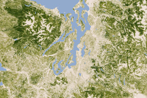
A new map of the biomass in the United States allows scientists and land managers to see tree cover down to the scale of individual plots of land.
Published Feb 17, 2012
In British Columbia’s Coast Mountains, some 200 kilometers (125 miles) inland from the Pacific Ocean, rivers and lakes cut tortuous paths through rugged terrain. The peaks and valleys in this region are covered with forest, but the forest has changed over the years due to human use and insect pests, in particular, the mountain pine beetle.
Published Oct 12, 2008
Between 1990 and 2000, Paraguay lost about 13 percent of its forests, including nearly 40 percent of the Atlantic Forest.
Published Nov 26, 2009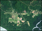
In June 2008, an international team of researchers released a report on the state of Papua New Guinea’s forests. The study summarized the findings from a five-year project in which the scientists compared high-resolution satellite imagery from the early 1970s and the early 2000s. The researchers found evidence of rapid deforestation and degradation, driven primarily by logging, subsistence agriculture, fires, and the development of mines and plantations.
Published Jun 8, 2008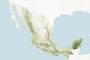
Mapping the density and location of tree cover can help the nation reduce deforestation and offset carbon emissions.
Published Nov 5, 2015
A small plane flying low over remote forests is sending back eye-popping aerial photography—as well as scientific measurements that will improve understanding of how Alaska’s forests are responding to global warming.
Published Jul 25, 2014