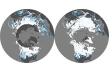
This pair of maps shows average percent snow cover in December 2008 and February 2009, the first and last months of meteorological winter in the Northern Hemisphere.
Published Mar 6, 2009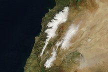
Fresh snow highlights Lebanon’s two mountain ranges in this true-color image from March 17, 2011.
Published Mar 25, 2011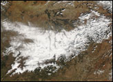
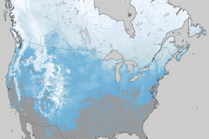
What a difference one year has made in the snow cover over North America.
Published Mar 30, 2012
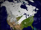
This satellite map of snow cover shows that every state in the contiguous U.S., except for Florida, received snow in January 2011.
Published Feb 25, 2011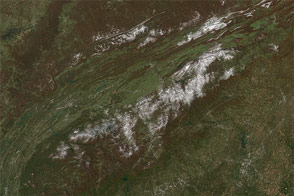
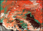
A potent weather system with origins in Manitoba moved south across the Great Lakes on Halloween and blew all the way to Florida, bringing snow and hard frost to regions that don't see either in some winters.
Published Nov 4, 2014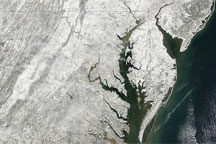
Acquired February 7, 2010, this true-color image shows snow blanketing much of the U.S. East Coast. Snow extends hundreds of kilometers inland from the Atlantic coastline, but thins near New York City.
Published Feb 9, 2010