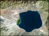
The Uvs Nuur Basin sits on the northern edge of the Central Asian steppes, bounded on all sides by mountains. Though largely arid, the basin is dotted with water. A large salt lake, the Uvs Nuur Lake, sits at the center of the basin, and several smaller lakes are scattered across the 600 kilometers east to west and 120 kilometers north to south that make up the basin.
Published Oct 11, 2007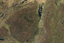
The red and orange tones of autumn had faded to brown in the mountains of New York and Vermont when this true color image was taken on November 8, 2009. The contrast between the green and gold valleys and brown mountains help reveal the unique geography of the region.
Published Nov 14, 2009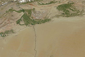
Acquired January 26, 2011, and August 6, 2011, these images compare conditions in China’s Tarim Basin in winter and summer.
Published Aug 10, 2011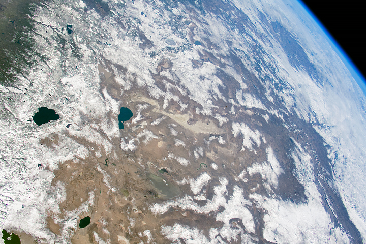
A blanket of white comes and goes from the mountains and deserts of the American West.
Published Apr 16, 2018
Water from the Kaidu River made it possible to turn part of the Taklamakan Desert into an oasis for agriculture, but it has also disturbed the water table.
Published Aug 18, 2012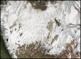
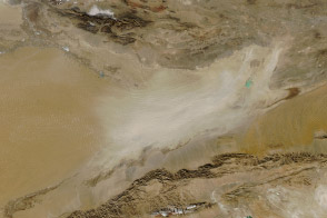
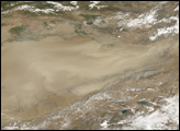
The largest desert in China experiences frequent dust storms as lakes dry, leaving loose, fine mineral soil that lifts easily on the wind.
Published Feb 6, 2014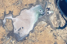
Along Tunisia’s southeastern coast is a flat plain of about 150 square kilometers (58 square miles) that lies below sea level. Known as Sebkhat El Melah (or Sebkha El Melah), it is in an evaporite basin.
Published Dec 7, 2008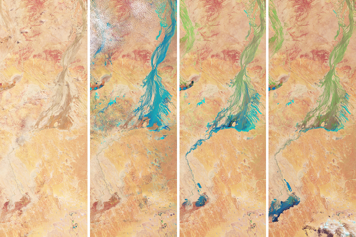
Flood water from northern Queensland drained toward a large basin in Australia’s interior—painting the desert landscape green.
Published May 4, 2018