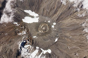
A recent expedition revealed a new rift in Kilimanjaro’s northern ice field.
Published Nov 8, 2012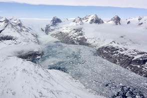
NASA aircraft return to the Arctic to assess the health of the region’s ice.
Published May 3, 2012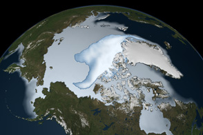
Thick ice that used to last through multiple summers has been in steep decline for three decades.
Published Mar 1, 2012
This approximately true-color image shows ice fragments left over from previous breakups of the Wilkins Ice Shelf.
Published Apr 19, 2009
The icefields of Patagonia, located at the southern end of South America, are the largest masses of ice in the temperate Southern Hemisphere (approximately 55,000 square kilometers).
Published May 8, 2006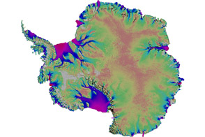
Scientists mapped the motion of Antarctica’s ice sheets and revealed unexpected patterns.
Published Aug 19, 2011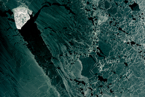
A diamond-shaped piece of ice is a stranger amid thin ice.
Published Mar 1, 2017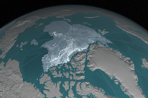
In 1984, there were 1.86 million square kilometers of old ice spread across the Arctic at its yearly minimum extent. In September 2016, there were only 110,000 square kilometers of old ice left.
Published Nov 4, 2016
To the untrained eye, Antarctica may look like a giant piece of solid ice that rarely changes, but scientists studying the continent have long known better. The icy surface is dynamic, with glaciers and "streams" of ice flowing toward the ocean.
Published Apr 27, 2007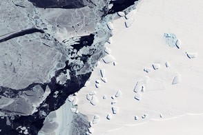
Acquired October 7, 2011, this natural-color image shows an ice menagerie off the coast of East Antarctica.
Published Oct 23, 2011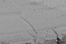
Acquired July 22, 2010, this high-resolution image shows cracks on the surface of the Petermann Glacier in northwestern Greenland.
Published Aug 11, 2010
Researchers working in Antarctica have found evidence of large-scale ice making at the bottom of that continent's massive ice sheets.
Published Apr 21, 2011