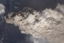
NASA satellites detected ash from Mount Kelut nearly 20 kilometers (12 miles) in the atmosphere within two hours of the explosive February 13 eruption.
Published Feb 15, 2014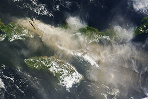
An explosive volcanic eruption in Indonesia has proved a hazard to air travelers.
Published Jun 3, 2014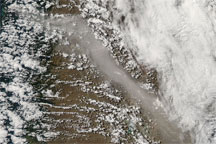
A new eruption of the Chaitén Volcano forced authorities to evacuate residents who had returned to the nearby town of the same name. Ash emissions from the eruption spread across Patagonia to the Argentine east coast.
Published Feb 20, 2009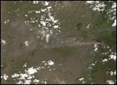
Increased activity at Eyjafjallajökull Volcano caused a new wave of flight cancellations in Ireland and Great Britain in early May 2010.
Published May 5, 2010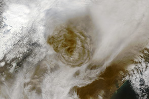
Acquired May 22, 2011, this natural-color image shows a plume from Grímsvötn on Iceland.
Published May 24, 2011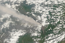
A thick plume of ash rose from Mount Merapi on November 10, 2010, when this photo-like image was taken. It is the most cloud-free image of the eruption to date.
Published Nov 11, 2010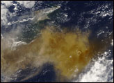
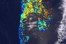
Color codes reveal ash layers at different altitudes during eruptions at Eyjafjallajökull Volcano on April 19, 2010.
Published Apr 28, 2010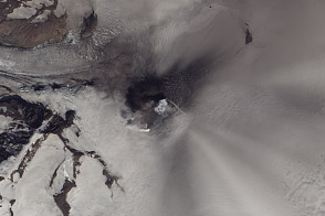
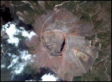
Satellite images captured the ongoing, low-level eruption of one of the Alaskan Peninsula’s largest volcanoes.
Published Aug 3, 2013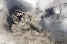
Acquired May 13, 2010, this natural-color image of Eyjafjallajökull Volcano shows a puffball of volcanic ash towering over a lower-altitude ash plume that fans out toward the southeast.
Published May 17, 2010