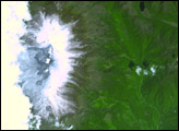
The landscape in the central Andes Mountains, near the border between Chile and Argentina, is dominated by volcanoes and associated landforms.
Published Sep 6, 2010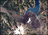
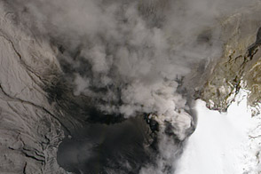
Nevado del Ruiz Volcano, infamous for its deadly lahars, sprang to life in March 2012.
Published Jun 7, 2012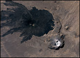
The Tibesti Mountain Range in northern Chad is one of the world’s least-studied volcanic regions. A look at the area from space, however, must intrigue vulcanologists. One of the Tibesti Mountain’s features is Tarso Toussidé.
Published Mar 18, 2007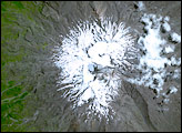
These images show Mount Ruapehu on the North Island of New Zealand and its summit lake, observed by the Advanced Spaceborne Thermal Emission and Reflection Radiometer (ASTER) on NASA’s Terra satellite. The first image is a simulated true-color image taken on January 12, 2001. The series of thermal infrared images show maps of the lake temperature over time, showing times of enhanced volcanism.
Published Dec 27, 2007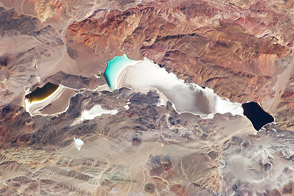
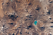
High in the Andes Mountains in Argentina, this salt lake hosts microbes that give the lakes distinct colors.
Published May 13, 2013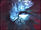
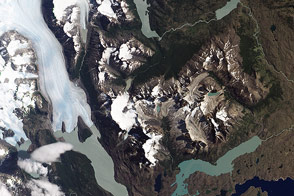
Grinding glaciers, freshwater lakes, and granite peaks mingle in this Chilean treasure.
Published Jan 29, 2013