Seasonal snowpack in the Sierra Nevada depends on whether a winter is wet or dry, and 2015 shaped up to be exceptionally dry.
Published Oct 21, 2015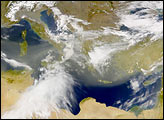
A blanket of white comes and goes from the mountains and deserts of the American West.
Published Apr 16, 2018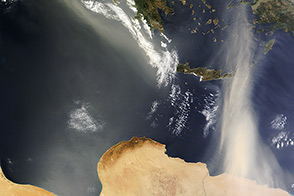
Dust was lofted from Africa toward Europe on May 29, 2013.
Published May 29, 2013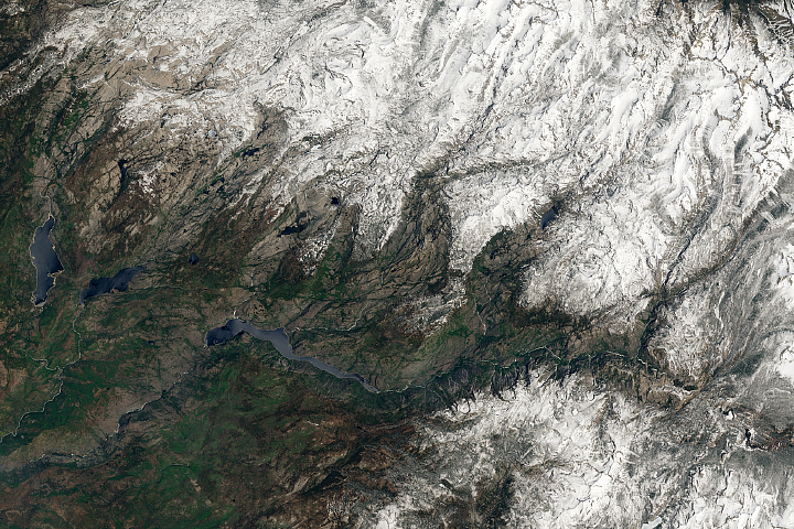
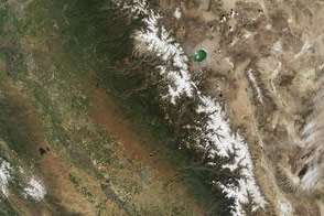
Thanks to a series of drought-busting storms, the mountain range has unusually thick and extensive snow cover this year.
Published Jun 15, 2017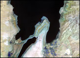
The lowest spot on dry land, the Dead Sea depression sinks 400 meters (1,300 feet) below sea level.
Published Nov 12, 2006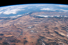
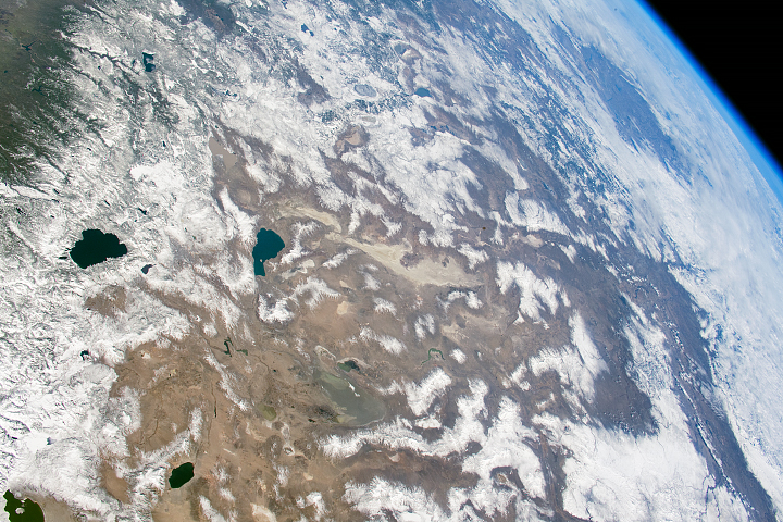
This panoramic view of the southwestern USA and Pacific Ocean was taken by an astronaut looking out at an angle from the International Space Station
Published Oct 4, 2010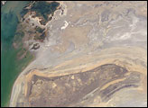
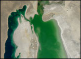
The arrow-shaped island in the Aral Sea used to be a 35-kilometer-long visual marker, indicating the Aral Sea to astronauts. An image from the present International Space Station increment shows how much the coastline has changed as the sea level has dropped during the last three decades.
Published Aug 15, 2005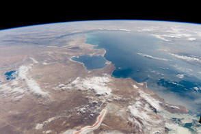
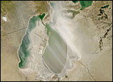
The inland sea in Central Asia has a host of distinctive features along its shores.
Published Oct 24, 2016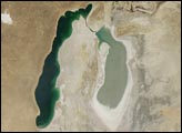
A Soviet-era plan to turn the arid plains of Kazakhstan, Uzbekistan, and Turkmenistan into fertile cropland resulted in the near-total diversion of the water that once fed the Aral Sea. Prior to the scheme, two rivers—the Amudar’ya in the south and the Syrdar’ya in the north—flowed out of distant mountains and pooled in a desert basin in what is now southern Kazakhstan and northern Uzbekistan. The irrigation project began in the mid-1900s, and by 1960, the sea had already begun to dry out.
Published Aug 26, 2008