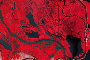
In this false-color image of the flood plains above Morgan City, Louisiana, there are tell-tale signs of floodwater from the Morganza Spillway.
Published Jun 5, 2011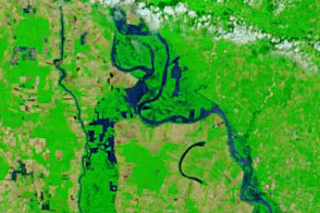
Acquired May 18, 2011, and May 4, 2011, these false-color images show flooded conditions along the Lower Mississippi River, including diverted water entering the Morganza Floodway on May 18.
Published May 18, 2011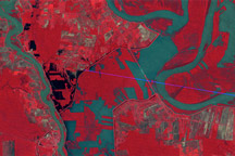
Observations by Landsat 1 from 1973 show the Morganza Floodway after its first and only opening in 57 years.
Published May 14, 2011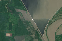
This image from the Advanced Land Imager on NASA's Earth Observing-1 satellite was acquired on May 15, 2011, about 24 hours after the Morganza Spillway was partially opened by the U.S. Army Corps of Engineers to ease flooding along the Mississippi River.
Published May 17, 2011
Acquired May 11, 2011, and April 21, 2007, these false-color images show the Mississippi River near Natchez, Mississippi. The image from May 2011 shows flooded conditions.
Published May 13, 2011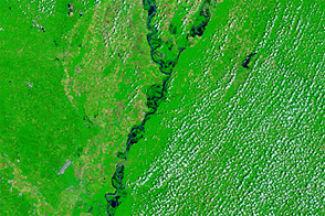
Acquired June 1, 2011, and May 28, 2010, these false-color images compare conditions along the Lower Mississippi River.
Published Jun 1, 2011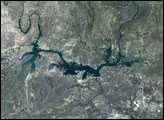
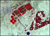

Natural vegetation and irrigated farmland along the Snake River Plain in Idaho use dramatically different amounts of water during the growing season.
Published Jan 26, 2010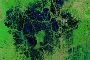
Although improved over the previous several weeks, flood conditions lingered around Ayutthaya and Bangkok in early December 2011.
Published Dec 16, 2011