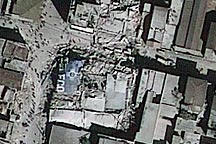
Rubble spills onto the streets of Port-au-Prince, Haiti, in this GeoEye-1 image from January 14, 2010.
Published Jan 15, 2010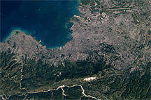
This regional view of Port-Au-Prince, Haiti, from January 15, 2010, shows the densely developed urban area and the limited number of transportation hubs available for bringing aid into the earthquake-hit nation.
Published Jan 15, 2010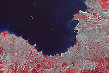
Acquired January 21, 2010, this false-color image shows Port-au-Prince nine days after a severe earthquake, as relief ships sail into the newly restored port.
Published Jan 21, 2010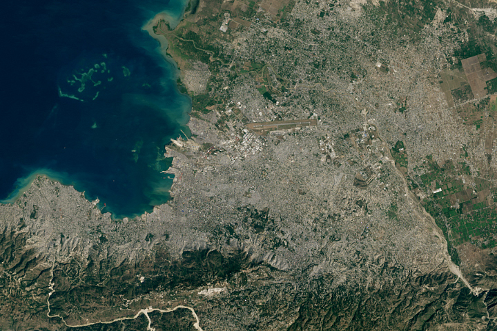
After a catastrophic earthquake left Port-au-Prince in a shambles, many people flocked to the new city of Canaan in search of a better life.
Published Jun 1, 2020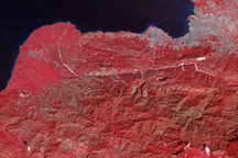
Tiny white flecks against Haiti’s plant-covered hills and mountains point to the locations of potential landslides in this false-color image from January 21, 2010.
Published Jan 21, 2010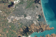
This natural color image of Christchurch, New Zealand, is overlain with a measure of the ground shaking in the area during the February 2011 earthquake.
Published Mar 9, 2011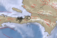
This map shows the region around the earthquake that struck the Haitian capital of Port-au-Prince on January 12, 2010. Blue areas indicate water and brown areas indicate land. Lighter colors indicate higher elevation or shallower depth. Circles indicate earthquake locations, with circle size corresponding to earthquake magnitude. Lines indicate faults.
Published Jan 13, 2010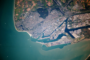
The second largest container port in France is also a World Heritage Site for its unique concrete buildings.
Published Nov 18, 2013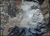
The magnitude 7.6 earthquake that shattered Pakistan on October 8, 2005, caused the most damage in the region surrounding the city of Muzaffarabad, about 10 kilometers southwest of the earthquake’s epicenter. The Ikonos satellite captured an image of a landslide in Makhri, a village on the northern outskirts of Muzzaffarabad, on October 9, 2005. The western face of the mountain has collapsed, sending a cascade of white-grey rock into the Neelum River. The landslide is likely only one of many to occur along the river, which is almost unrecognizable after the earthquake.
Published Oct 23, 2005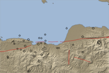
A long valley reveals the location of the Enriquillo-Plaintain Garden Fault in southern Haiti, the site of a deadly earthquake in mid-January 2010.
Published Jan 14, 2010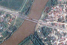
The day after a powerful 7.3-magnitude earthquake shook Honduras, Taiwan’s Formosat-2 satellite captured this detailed, photo-like image showing the collapsed span of the earthquake-damaged Democracy bridge.
Published Jun 3, 2009