
By January 7, 2007, Colorado had endured three major snowstorms in as many weeks.
Published Jan 9, 2007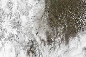
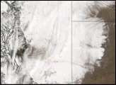
Acquired May 2 and April 27, 2013, these images document a dramatic change in Colorado thanks to a late-spring snowstorm.
Published May 3, 2013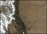
A strip of white defines the path of a deadly winter storm across New Mexico, Texas, Oklahoma, Colorado, and Kansas in this satellite image from December 21, 2011.
Published Dec 23, 2011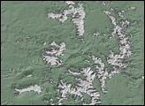
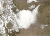
Coloradans hoping for a white Christmas saw too much of a good thing in December 2006. Severe storms struck on December 20 and 21, December 28, and January 5, 2007.
Published Dec 29, 2006
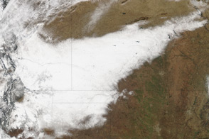
Acquired November 17, 2009, this true-color image shows snow nearly covering the northeastern quadrant of Colorado and stretching into neighboring states.
Published Nov 18, 2009