The Flinders River in northern Queensland, Australia, spread over more than 100 kilometers on February 18, 2009, when this image was taken.
Published Feb 21, 2009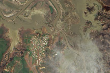
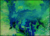
This pair of natural-color and infrared-enhanced images from the Advanced Land Imager (ALI) on NASA’s Earth Observing-1 (EO-1) satellite reveal that floods still surrounded much of the Queensland town of Normanton on the morning of March 12, 2009.
Published Mar 14, 2009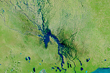
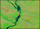
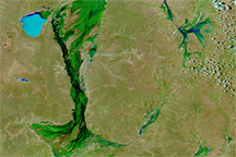
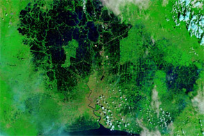
Channels of water flowed through normally dry northern Namibia on March 23, 2009, when this image was captured.
Published Mar 23, 2009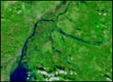
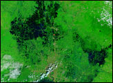
Floods continued to spread across the interior of Australia in late January 2011, with high waters apparent in Queensland, New South Wales, and South Australia.
Published Jan 20, 2011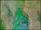
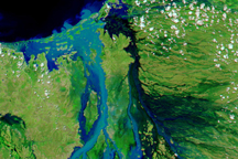
Acquired in November 2008 and 2011, these images compare conditions in Bangkok, where floods crept toward the city center in 2011.
Published Nov 8, 2011