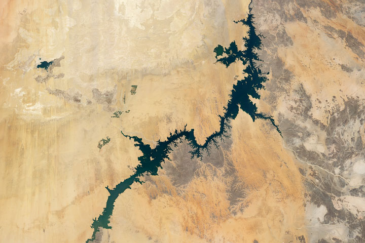
Irrigation from Lake Nasser, one of the world’s largest man-made lakes, has increased the amount of arable land and crop production in Egypt.
Published Jul 8, 2020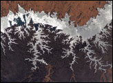
One of the world’s largest artificial lakes, Lake Nasser is named after the Egyptian President Gamal Abdul Nasser, who is largely responsible for the lake’s creation. President Nasser decided to build the Aswan High Dam across the Nile, forming a lake approximately 550 kilometers (340 miles) long.
Published Nov 3, 2005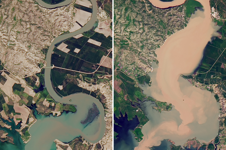
Satellite data shows that water levels in Iraq’s largest reservoir have reached heights not seen in more than a decade.
Published May 8, 2019
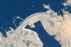
The vast dam in southern Egypt is one of the largest earthen embankment dams in the world.
Published Jun 8, 2015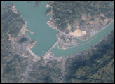
The longest river in Asia, the Yangtze River brings mixed blessings to China. Although it meets the water needs of millions of people, the river regularly overflows its banks. To protect residents and land in the lower Yangtze floodplains, China began construction on the Three Gorges Dam in 1994.
Published Jun 13, 2007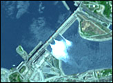
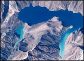
Lake Sarez, deep in the Pamir mountains of Tajikistan, was created 90 years ago when a strong earthquake triggered a massive landslide that, in turn, became a huge dam along the Murghob River, now called the Usoi Dam. The resulting lake is perched above surrounding drainages at an elevation greater than 3000 meters. The lake is 61 kilometers long and as deep as 500 meters, and holds an estimated 17 cubic kilometers of water. The area experiences considerable seismic activity, and scientists fear that part of the right bank may slump into the lake, creating a huge wave that will top over and possibly breach the natural dam. Such a wave would create a catastrophic flood downstream along the Bartang, Panj and Amu Darya Rivers, perhaps reaching all the way to the Aral Sea.
Published Jan 6, 2002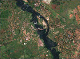
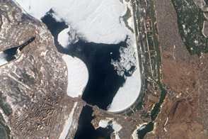
Authorities keeps a watchful eye on ice near a key dam on the Kyiv Reservoir.
Published Mar 31, 2012
In May 2016, the reservoir behind Hoover Dam reached its lowest level since the 1930s.
Published May 27, 2016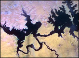
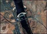
In the 1950s, construction began on the Glen Canyon Dam on the Colorado River in northern Arizona. The dam created Lake Powell: a long, skinny, meandering reservoir straddling the Arizona-Utah border. Ingenuity of human design, however, did not protect this massive reservoir from the drought that struck much of the southwestern United States between 2000 and 2007.
Published Oct 17, 2007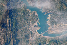
This image from April 15, 2009, is one of the first images that astronauts on the International Space Station have been able to capture of the flooding behind the Three Gorges Dam in China.
Published Jun 8, 2009