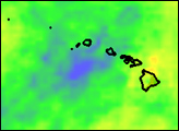
La Niña, the counterpart to El Niño, alters rainfall patterns over the Pacific and Indian Ocean basins. La Niña develops when stronger-than-average trade winds push the warm surface waters of the equatorial Pacific west. Since cold water rises to replace the warm water, La Niña leaves the eastern and central Pacific Ocean much cooler than normal, while the western Pacific is much warmer than normal. These anomalies in sea surface temperature are mirrored in rainfall patterns, with warmer-than-normal temperatures resulting in enhanced rainfall. In general, La Niña brings unusually heavy rain to the West Pacific, Indonesia, parts of Southeast Asia, and northern Australia.
Published Jan 23, 2008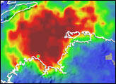
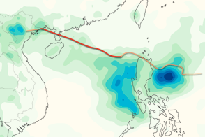
This color-coded image shows rainfall totals and the storm track for Typhoon Kai-tak in August 2012.
Published Aug 20, 2012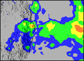
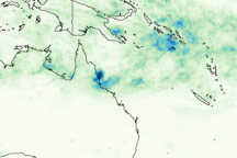
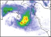
This image shows rainfall totals for January 27 through February 3, 2009, for northeastern Australia and the surrounding region, where Cyclone Ellie made landfall on February 2.
Published Feb 4, 2009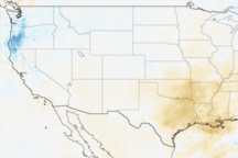
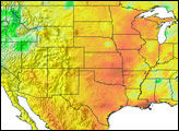
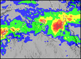
Rainfall across the United States in the winter of 2005–06 has shown the classic pattern of a La Niña event. This ocean-atmosphere pattern was likely responsible for the drought in the Southwest, the South, the central Plains, and Florida which led to several devastating wildfires.
Published Mar 15, 2006