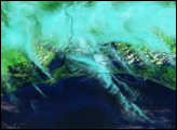
Hurricane Ike came ashore along the U.S. Gulf Coast on September 13, 2008, and the storm’s eye narrowly missed Galveston and Houston. Although the storm produced tremendous damage in both cities, perhaps the greatest damage was caused by the storm surge, which inundated the coastline near Galveston. The storm surge was greatest east of Galveston, reaching 4.6 meters (15 feet) above sea level. The area devastated by the storm surge includes coastline immediately east of Galveston Bay.
Published Oct 1, 2008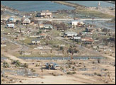
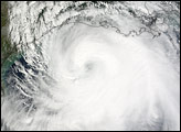
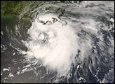
Ike had sustained winds of 165 kilometer per hour (105 miles per hour) with stronger gusts about the time this image was taken. Despite the strong winds, the real danger associated with Ike was coastal flooding and large, damaging waves.
Published Sep 13, 2008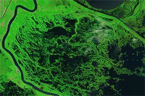
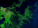
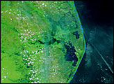
Ten years after the storm made landfall, a record of Katrina’s fury remains in the marshes surrounding Delacroix.
Published Aug 28, 2015