Forest buffers help protect grazing land and animals from the Japanese island's cold, windy winters.
Published May 6, 2020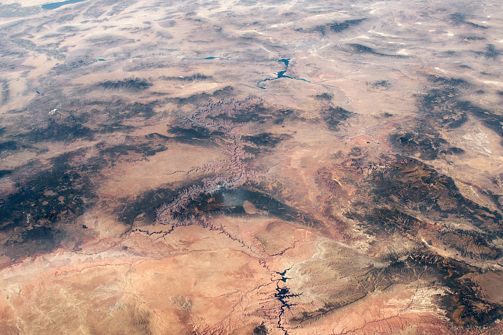
Ancient geologic features and modern creations share the spotlight in this photo of southeastern Utah and northern Arizona taken from the ISS.
Published Feb 23, 2020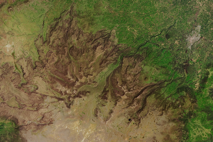
In a unique ecosystem with several rare and endangered species, grazing and fires are altering the landscape.
Published Feb 27, 2018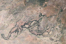
Porcupine Gorge and other sandstone canyons carving through a basalt plateau create dramatic topography in central Queensland.
Published Jan 18, 2009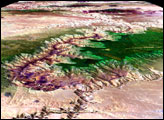
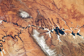
Striking landforms and broad vistas mark the Utah-Arizona border region of the Colorado Plateau.
Published Mar 25, 2013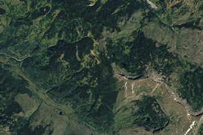
The 2012 U.S. Capitol Christmas tree — a 73-foot Engelmann spruce — hails from northwestern Colorado.
Published Dec 22, 2012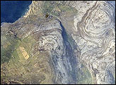
Adjoining Galway Bay to the north, the Burren Plateau (Burren is Gaelic for “stony place”) is an example of karst terrain. Karst terrain is generally formed when sedimentary rocks are dissolved by groundwater. This astronaut photograph illustrates the northwestern-most portion of the Burren Plateau, which is characterized by the distinctive bare exposures of almost horizontal, layered Paleozoic-age limestone rocks that form Gleninagh Mountain.
Published May 5, 2008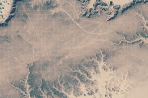
Seismic surveying that was part of oil exploration left this distinctive grid on the Messak Settafet plateau.
Published Jun 27, 2015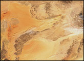
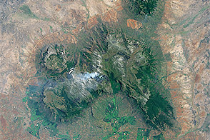
Forests thrive in Mount Mulanje’s many valleys and ravines, but the trees have to compete with people who depend on them for firewood and charcoal.
Published Jan 2, 2015
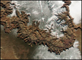
The Semien Mountains are the highest parts of the Ethiopian Plateau (more than 2,000 meters; or 6,560 feet). They are surrounded by a steep, ragged escarpment (step), with dramatic vertical cliffs, pinnacles, and rock spires. Although the plateau lies in the latitude of the Sahara–Arabia deserts, its high altitude makes for a cool, wet climate. In fact, the Semien Mountains are one of the few places in Africa to regularly receive snow, and they receive plentiful rainfall (more than 1,280 millimeters, or 55 inches). The moderate climate is shown by light green vegetation on the mountains, compared with the brown canyons, which are hot and dry.
Published Apr 7, 2008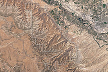
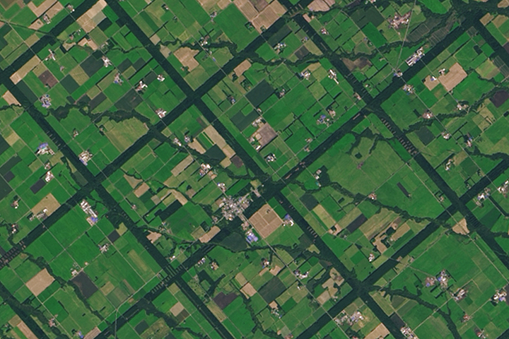
Acquired April 2, 2002, this natural-color image shows Colorado National Monument and nearby agricultural and residential areas.
Published Mar 6, 2011