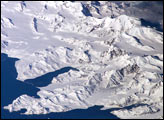
There is no permanent human base on South Georgia Island, a British territory in the South Atlantic Ocean that lies 1,300 kilometers east of the Falkland Islands. The crew of the International Space Station captured this image of the rugged and isolated landscape of the northern shore of the island. The first recorded explorer to land on the island was Captain James Cook aboard the HMS Resolution in 1775. He mapped part of the coastline, but was discouraged by the thick ice cover, lack of vegetation, and steep mountains. Mt. Paget, the highest peak, rises to 2,934 meters (9,625 feet) above sea level, and the island supports 161 glaciers. Cook named the southernmost point of the island “Cape Disappointment” when he realized he had not reached Antarctica.
Published Oct 17, 2005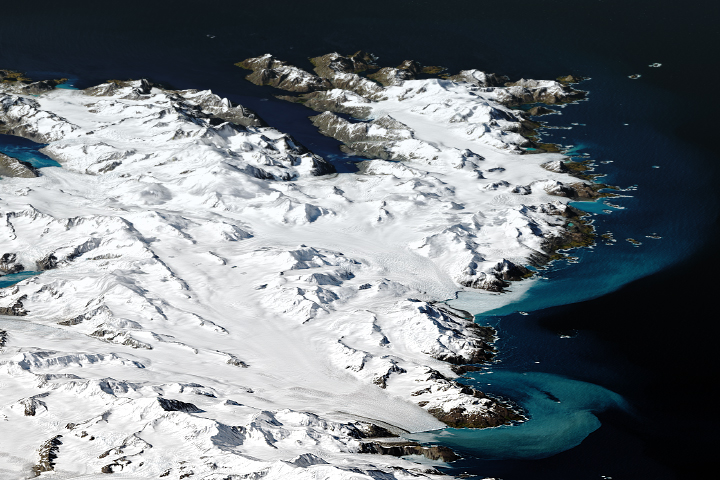
The remote island may be inhospitable to humans, but it provides a home to major populations of wildlife.
Published Mar 4, 2019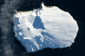
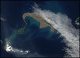
Bouvet Island, a territory of Norway, is one of the most remote islands in the world.
Published Feb 26, 2014
Bouvet Island is known as the most remote island in the world; Antarctica, over 1600 kilometers (994 miles) to the south, is the nearest land mass. Located near the junction between the South American, African, and Antarctic tectonic plates, the island is mostly formed from a shield volcano—a broad, gently sloping cone formed by thin, fluid lavas—that is almost entirely covered by glaciers.
Published Oct 6, 2008

The ghostly white shapes northeast and immediately southwest of Wrangel Island are sea ice. Over the course of the satellite record, Arctic sea ice has advanced and retreated past Wrangel Island many times. From 1979 to 2000, the sea ice edge at the end of summer generally fell somewhere in the vicinity of Wrangel Island, but this is not the first summer when the sea ice edge has retreated well north of the island.
Published Aug 29, 2008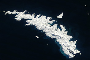
Acquired September 29, 2012, this natural-color image shows South Georgia Island and nearby icebergs.
Published Oct 6, 2012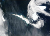
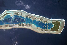
This astronaut photo of Millennium Island shows emerald islets surrounding a turquoise lagoon dotted with coral.
Published Jul 13, 2009
Named Isla de Aves in Spanish, (meaning “Island of the Birds”) Aves Island lies west of the Lesser Antilles in the Caribbean. It provides a nesting site to green sea turtles (Chelonia mydas) and, of course, birds. Because the abundant bird droppings, known as guano, could be used in fertilizer and gunpowder, guano miners worked on the island until they depleted the supply. Since its discovery by Europeans, likely in the late 16th century, Aves Island was subsequently claimed by several European nations. The island is currently claimed by Venezuela, although disputes about ownership of the island, and the surrounding exclusive economic zone in the Caribbean, continue today.
Published Jun 19, 2006