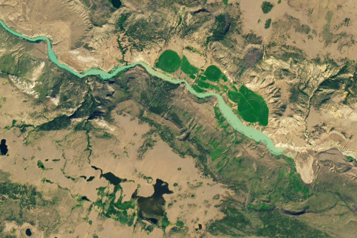
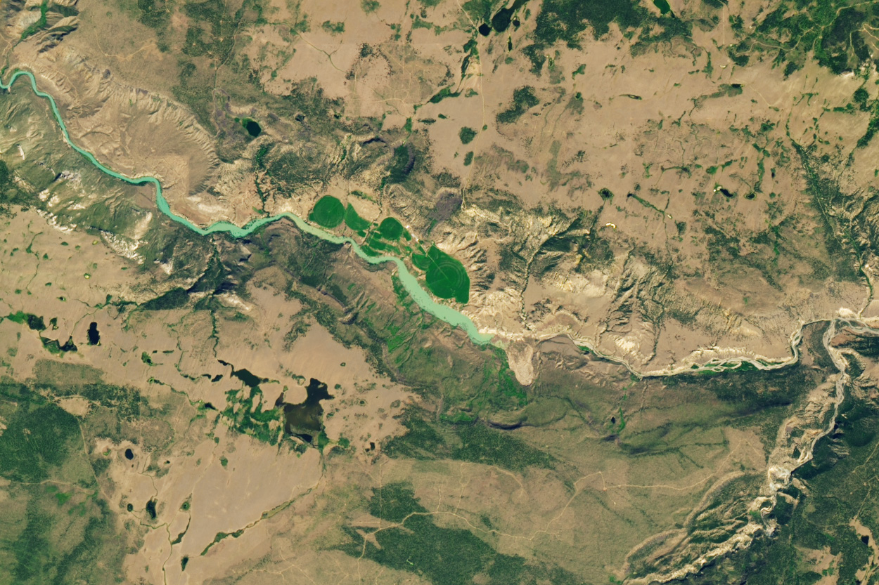
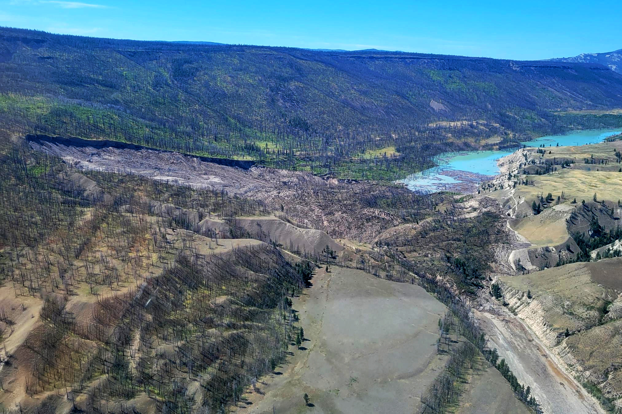
Late on July 30, 2024, land along the south bank of the Chilcotin River in Farwell Canyon began to sink and flow into the valley below. When the landslide stopped moving, a large piece of earth had dropped more than 50 meters (160 feet), leaving a mound of debris 1,000 meters long, 600 meters wide, and 30 meters deep that blocked the river and completely halted its flow.
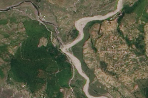
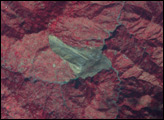
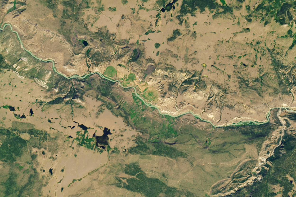
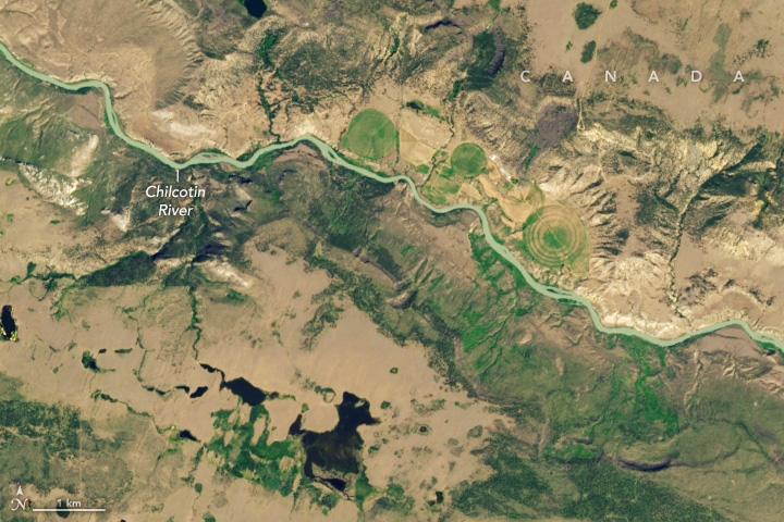
When the OLI-2 (Operational Land Imager-2) on Landsat 9 captured this image (right) on August 1, 2024, water had begun to pool behind the landslide deposit, creating a long, narrow lake. The first image (left) shows the same area on July 16, about two weeks before the landslide.
Soon after the event was discovered, local authorities issued flood warnings for areas upstream of the landslide and evacuation orders for areas immediately downstream. “The major threat in situations like this is that large amounts of water build up behind the landslide dam and eventually trigger destructive outburst floods,” said Robert Emberson, a member of NASA’s Landslides research team and one of the associate program managers for NASA’s Disasters program.
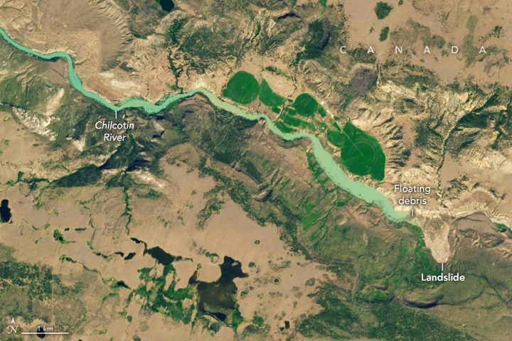
On August 5, water began to overwhelm the natural dam, causing water levels downstream to increase rapidly and carry woody debris down the river. Preliminary modeling from British Columbia’s River Forecast Center indicated that water levels would surge above typical spring flooding levels on the Chilcotin upstream of the point where it flows into the Fraser River.
On the Fraser, estimated flows are likely to be similar to or below peak flows that occur during typical spring flooding. However, “the water will react differently, with greater momentum and force, than a gradual increase in water levels,” officials from the Ministry of Emergency Management and Climate Readiness (EMCR) warned.
As a trickle and then a gushing torrent of water chiseled through the landslide debris, authorities urged people to stay away from the riverbanks due to the risk of fast-moving water and debris. A gauge downstream at Big Bar showed Fraser River water levels peaking on August 6 at 3,640 cubic meters per second: a sharp increase, though not a historical record for that date.
“Fortunately, the Chilcotin River is sparsely populated, and evacuation warnings have already been issued,” Emberson said. “But the impact of flooding on agriculture downstream is still a concern.”
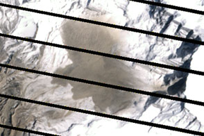
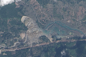
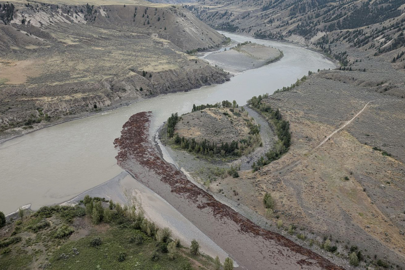
The photograph above, provided by EMCR, shows debris-filled water pooling behind the landslide dam on August 1. The image below, also provided by EMCR, shows the leading edge of the floodwater after it broke through the dam and flowed south along the Chilcotin River into the Fraser River on August 5.
The event occurred in a remote part of British Columbia, about 100 kilometers southwest of Williams Lake, in an area known as Nagwentled by the Tšilhqot’in, an Athabaskan-speaking indigenous group in the area. Nagwentled roughly translates to “landslides across the river.” Indeed, scars along the south side of the river and tongue-shaped debris fields visible in multiple areas indicate that landslides occur relatively frequently.
“The scalloped edges in the terrain immediately south of the point of failure appear to be ancient landslide scarps, some of which were likely considerably larger than the event in July,” said Daniel Shugar, a geomorphologist at the University of Calgary.
The river is also an important waterway for several types of salmon. In a statement issued after the landslide, the Tšilhqot‘in National Government expressed particular concern that the event had blocked the movement of Taseko sockeye, an endangered population that had been on track to return to spawning grounds at record low levels prior to the landslide.
“[We are] calling on all levels of government, downstream First Nations, the Pacific Salmon Commission, and other Nations and States, especially Alaskan fisheries, to take all precautionary measures possible to conserve Tšilhqot‘in territory-bound salmon,” the group said.
There are some ranches, farms, and mining operations along the river edges, and people regularly canoe and camp along the Chilcotin. A stretch of the canyon downstream with large sand dunes is a common destination for hikers, campers, and mountain bikers. According to the Canadian Broadcast Company, one person in the area was partially buried by the initial landslide and had to be rescued by a local resident.
Government officials and university scientists will be monitoring the situation in the coming days and weeks from the ground and from the air with helicopters and uncrewed vehicles using a variety of technologies. They will also be using satellites and other forms of remote sensing. “Satellites are indispensable for near-real-time monitoring of evolving disaster situations like this,” Shugar said. “Having eyes in the sky to see the entire slide and impounded lake is tremendously useful.”
NASA Earth Observatory images by Wanmei Liang, using Landsat data from the U.S. Geological Survey. Photographs courtesy of the Province of British Columbia. Story by Adam Voiland.