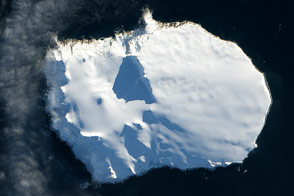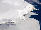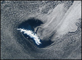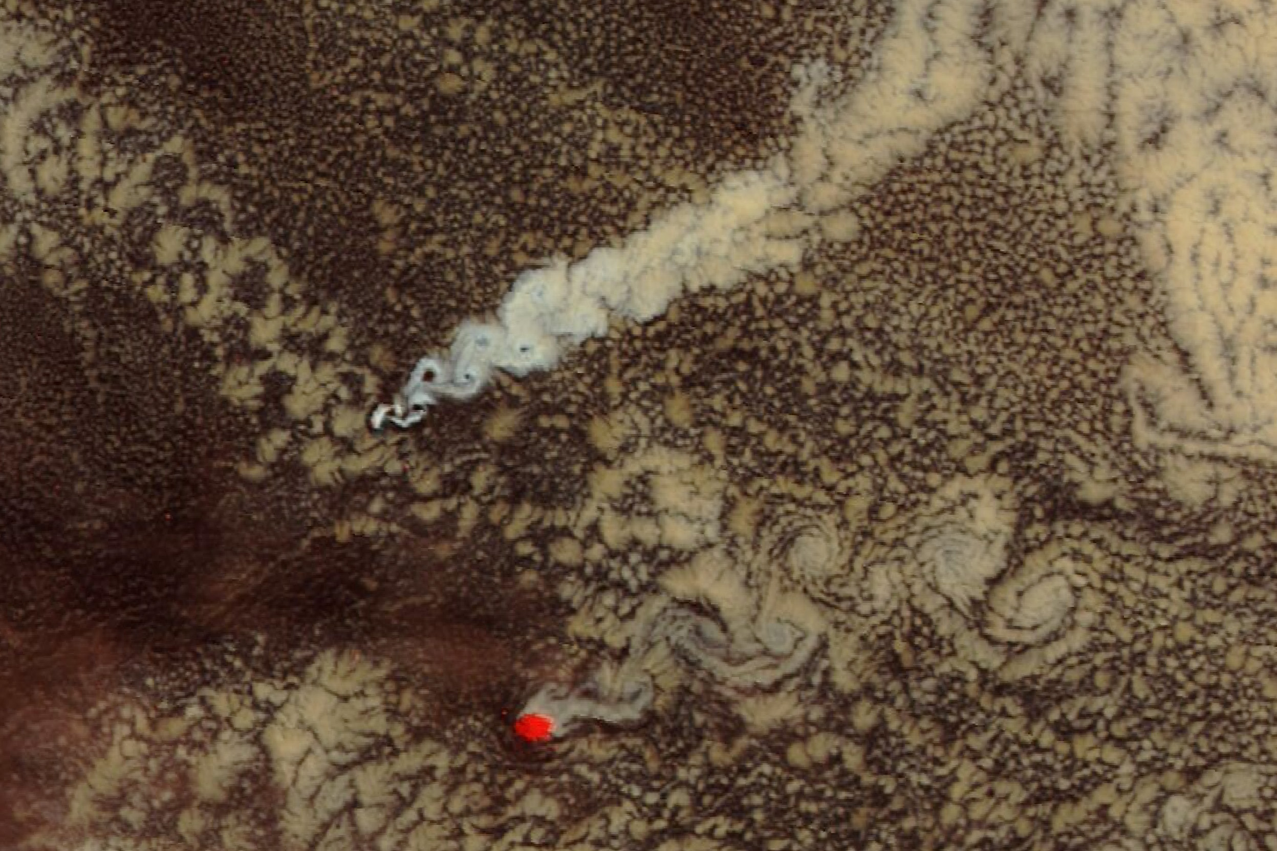
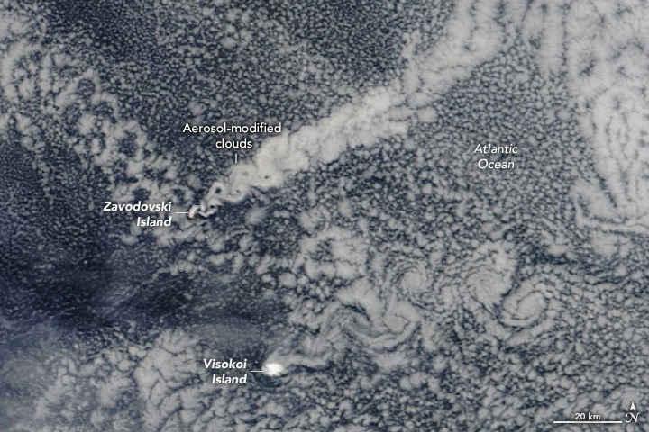
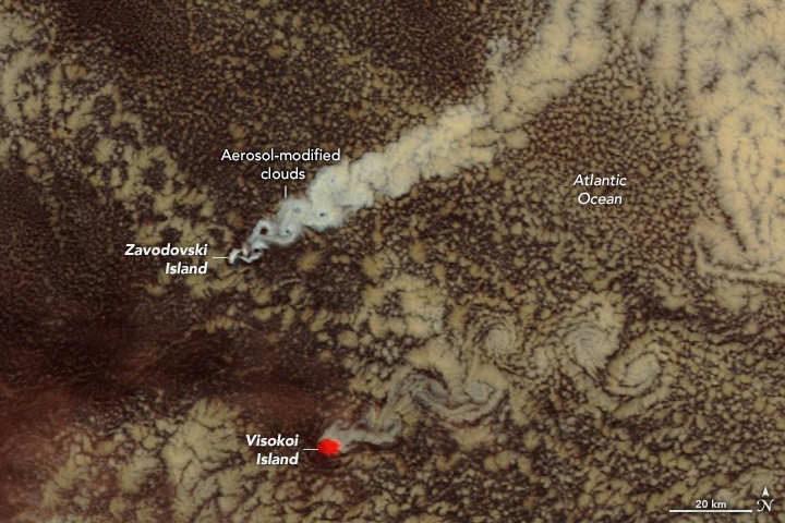
Zavodovski and Visokoi islands, located in a remote part of the South Atlantic Ocean north of the Antarctic Circle, frequently stir up compelling patterns in the atmosphere. Their peaks stand only 551 meters (1,808 feet) and 1,005 meters (3,297 feet), respectively, above the ocean surface, but that’s high enough to disrupt the flow of air. Atmospheric eddies and waves on the islands’ lee sides become visible in satellite images when clouds are present, producing a pattern known as cloud wake.
On January 9, 2024, the clouds behind Zavodovski Island were modified by more than that; volcanic emissions made the cloud wake that day appear brighter than usual. The brightened clouds are visible in these images, acquired with the MODIS (Moderate Resolution Imaging Spectroradiometer) on NASA’s Terra satellite.
Santiago Gassó, an atmospheric scientist based at NASA’s Goddard Space Flight Center, spotted the cloud wakes in satellite images, calling the clouds that trailed Zavodovski Island a volcano track. These “tracks” occur when sulfate aerosols from an active volcano provide a nucleus on which water molecules collect, forming droplets and ultimately clouds. The sulfate-seeded cloud droplets are small, numerous, and reflective, making them appear brighter than the surrounding clouds.
The brightening effect is faintly visible in the cloud wake of Zavodovski Island in the natural-color image on the left. It is more striking in the false-color image on the right (MODIS bands 3-6-7) in which snow and ice appear red and water clouds appear white. Gassó attributes the cloud brightening to activity at the island’s volcano, Mount Curry (also known as Mount Asphyxia). For comparison, typical less-bright clouds trail behind Visokoi Island and its inactive volcano, Mount Hodson, to the southeast. Note that the white patch (red in the false-color image) on Visokoi Island is snow and ice.
Zavodovski Island’s Mount Curry frequently emits a stream of gases and aerosols capable of affecting the atmosphere. This low-level activity, called volcanic degassing, differs from explosive eruptions. The last period with more intense activity was reported in June and July 2016.
NASA Earth Observatory images by Wanmei Liang, using MODIS data from NASA EOSDIS LANCE and GIBS/Worldview. Story by Kathryn Hansen.