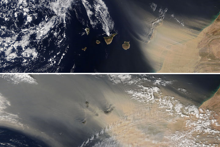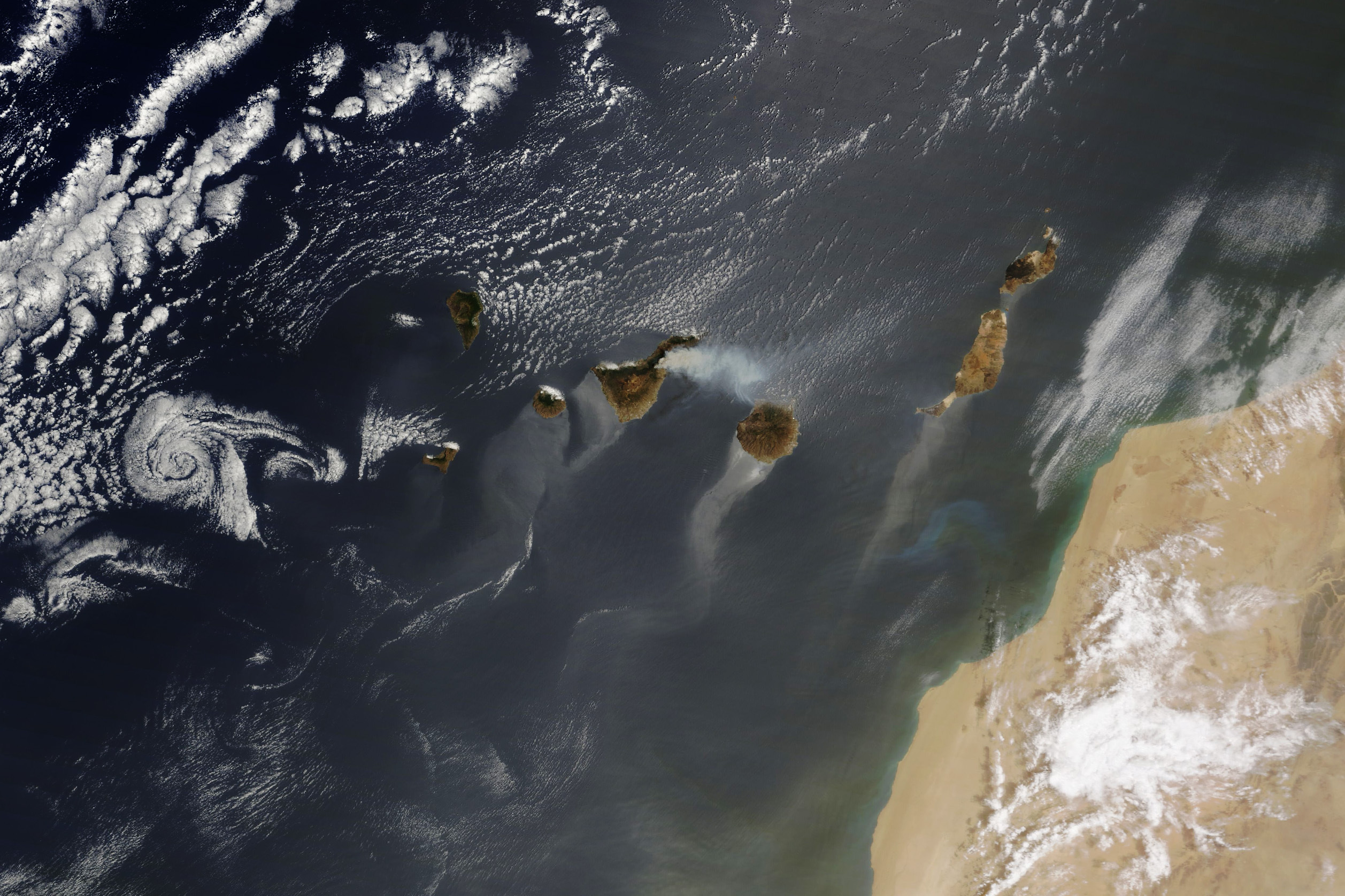
The Canary Islands were at the center of a mélange of natural events in summer 2023. The Moderate Resolution Imaging Spectroradiometer (MODIS) on NASA’s Terra satellite captured this assemblage of phenomena off the coast of Africa on August 16, 2023.
In the center of the scene, smoke is seen rising from a wildfire burning on Tenerife in the Canary Islands. The blaze started amid hot and dry conditions on August 15 in forests surrounding the Teide Volcano. Authorities issued evacuation orders to five villages, and responders focused on containing the fire’s spread and protecting residential areas near the coast, according to news reports. Other fires have burned on the Canary Islands this summer, including on La Palma in July.
To the west, a swirling cloud moves across the Atlantic. Cloud vortices appear routinely downwind of the Canary Islands—sometimes in great abundance—and are produced when the tall volcanic peaks disrupt the air flowing past them.
Elsewhere in the atmosphere, dust from the Sahara Desert was lofted out over the ocean. The river of dust crossing the Atlantic was more pronounced in previous days, when it reached islands in the Caribbean. Traveling on the Saharan Air Layer, dust sometimes makes it even further west toward Central America and the U.S. states of Florida and Texas.
To round out the list, the patch of bright blue off the Moroccan coast is most likely a bloom of phytoplankton. While the exact cause and composition of the bloom cannot be determined from this image, mineral-rich desert dust has been shown to set off bursts of phytoplankton growth.
In addition to the Earth’s processes seen here, one remote sensing artifact is present. A diagonal streak of sunglint makes part of this scene appear washed out. Sunglint, an effect that occurs when sunlight reflects off the surface of the water at the same angle that a satellite sensor views it, is also the reason for the light-colored streaks trailing off the islands.
NASA Earth Observatory image by Wanmei Liang, using MODIS data from NASA EOSDIS LANCE and GIBS/Worldview. Story by Lindsey Doermann.