Large wildland fires burning around Yellowknife have prompted Canadian authorities to issue evacuation orders for the city and other nearby communities. The city, the capital of the Northwest Territories, is home to about 20,000 people.
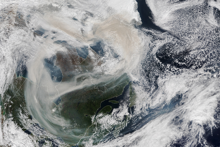
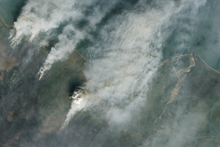
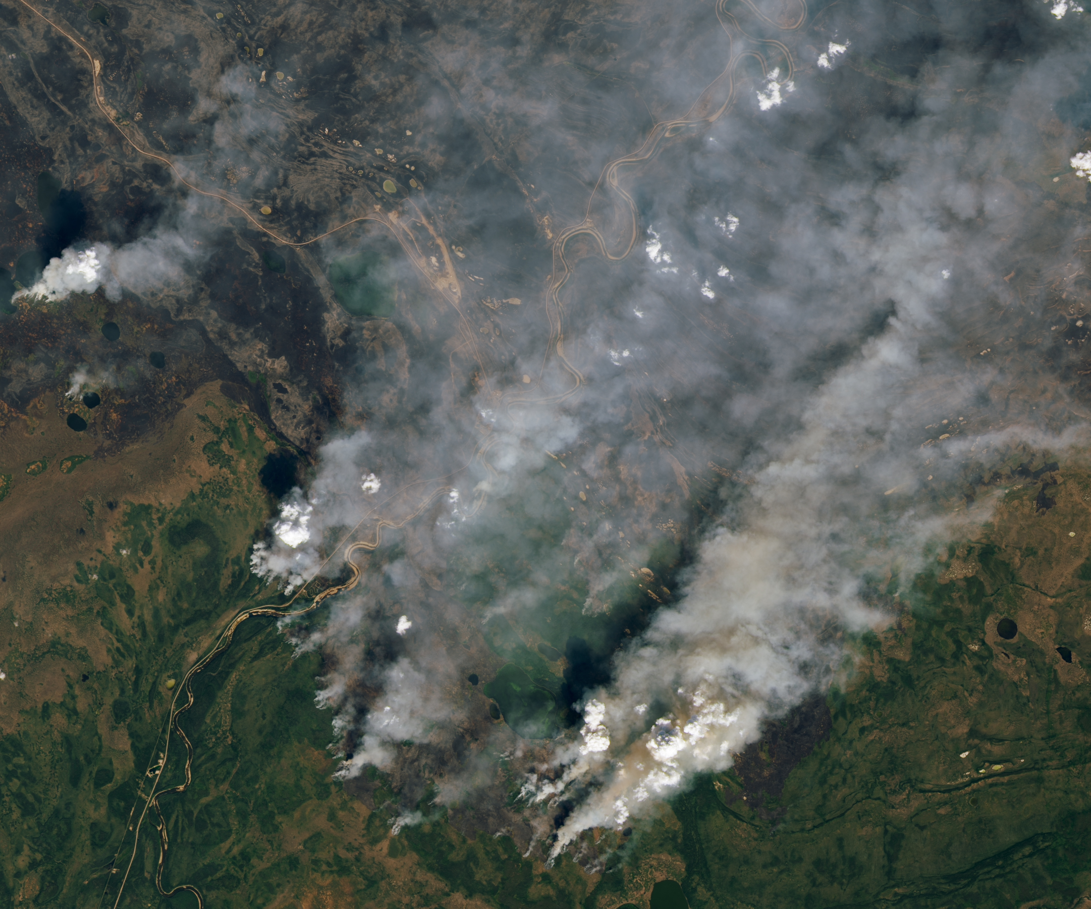
The Operational Land Imager (OLI) on Landsat 8 captured an image (top of the page) showing several fires burning near Yellowknife at about 18:50 Universal Time (12:50 p.m. local time) on August 16, 2023. The second image (below) is a more detailed view of a fire burning to the northeast. At the time, active fire fronts appeared to be within 20 kilometers (12 miles) of the city. Recently burned areas appear gray, and unburned forests are green. When the image was acquired, smoke streamed to the northeast.
“Residents living along the Ingraham Trail, in Dettah, Kam Lake, Grace Lake, and Engle Business District are currently at highest risk and should evacuate as soon as possible,” authorities said in a statement issued on August 16. “Other residents have until noon on Friday, August 18, 2023, to evacuate.”
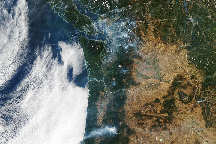
Another fire burning several hundred kilometers southwest of Yellowknife is visible in the third image (below), also acquired by Landsat 8 on August 16. This fire recently overran Enterprise, a small community of about 150 people on the south shore of Great Slave Lake. According to news reports, between 85 and 95 percent of the structures in the community were destroyed.
Canada is facing one of the worst fire years it has seen in decades, according to data published by the Canadian Interagency Forest Fire Centre. More than 13.7 million hectares (33.9 million acres) had burned as of August 17, seven times the 25-year average.
NASA Earth Observatory images by Lauren Dauphin, using Landsat data from the U.S. Geological Survey. Story by Adam Voiland.
alert message