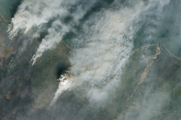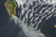
In the early hours of July 15, 2023, a wildfire broke out on La Palma, the most northwesterly of the Canary Islands.
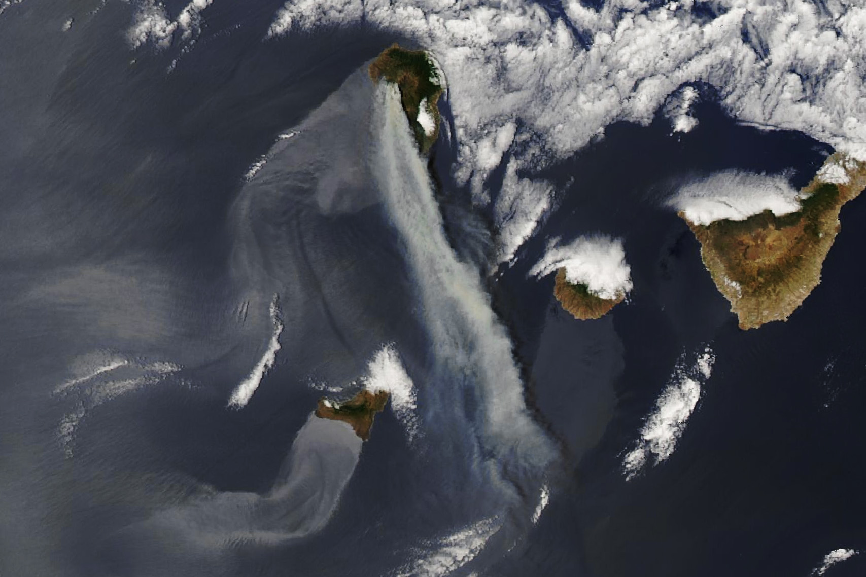
The Moderate Resolution Imaging Spectroradiometer (MODIS) on NASA’s Aqua satellite captured this image of smoke streaming south from the blaze that afternoon. The bright areas near islands south of La Palma resemble smoke, but they are actually the result of an optical phenomenon caused by sunglint.
The fire burned through pine forests west of a large caldera on the northern part of the island. At least 20 buildings were destroyed and 4,000 people evacuated their homes, according to Reuters. On July 16, authorities reported that the fire had charred at least 4,650 hectares (18 square miles).
Hot weather and strong winds accompanied the intense burning. The same heatwave scorched parts of southern Europe and North Africa. The Associated Press reported that more favorable weather conditions on July 16 helped firefighters slow the blaze. Satellite images collected on July 16, 17, and 18 showed much less smoke coming from the fire.
Fires on La Palma are common in summer due to the island’s dry climate. One analysis of tree rings suggests that intense fires burn the island’s forests roughly every 7 years on average, with less intense fires burning every 2-4 years.
In addition to fire, volcanic activity can also damage infrastructure and alter La Palma’s landscape. A slow-moving eruption destroyed 1,600 homes on the island in the latter part of 2021.
NASA Earth Observatory images by Wanmei Liang, using MODIS data from NASA EOSDIS LANCE and GIBS/Worldview. Story by Adam Voiland.